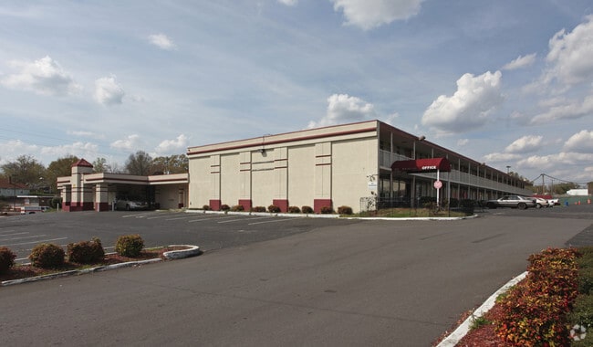
Property Record
800 W Franklin Blvd, , NC


Property Detail
800 W Franklin Blvd
301025
FUSE SITE PARCEL D PLAT BOOK 092 PAGE 013
Governmentalpublicusegeneral
GASTON
B and X Area of moderate flood hazard, usually the area between the limits of the 100-year and 500-year floods.
North Carolina
0
6.80 AC
2025
Gastonia/Lincolnton
0319004013
Charlotte
33,134 SF
Charlotte-Concord-Gastonia, NC-SC
NEARBY LISTINGS FOR SALE OR LEASE
-
-
View all listings for sale on LoopNet.com
DEMOGRAPHICS near 800 W Franklin Blvd
1 mile
3 mile
5 mile
2025 Total Population
10,268
50,578
102,863
2030 Population
10,856
53,188
108,000
Pop Growth 2025-2030
+ 5.73%
+ 5.16%
+ 4.99%
Average Age
39
39
39
2025 Total Households
4,077
20,135
40,936
HH Growth 2025-2030
+ 5.84%
+ 5.30%
+ 5.17%
Median Household Inc
$43,102
$49,370
$59,345
Avg Household Size
2.30
2.30
2.40
2025 Avg HH Vehicles
1.00
2.00
2.00
Median Home Value
$190,117
$221,120
$251,519
Median Year Built
1958
1969
1976
Nearby Places
Map Layers
Map Styles
 Street
 Aerial
Transit
 Traffic
 Biking
Places
Listings with unknown addresses are not visible on the map
- Restaurants
- Banks
- Shops
- Fitness
- Groceries
PUBLIC TRANSPORTATION
COMMUTER RAIL
Gastonia Amtrak Station (Crescent - Amtrak)
Drive
Walk
Distance
Gastonia Amtrak Station (Crescent - Amtrak)
4 min
2.2 mi
AIRPORT
Charlotte/Douglas International
Drive
Walk
Distance
Charlotte/Douglas International
31 min
17.8 mi
Concord-Padgett Regional
Drive
Walk
Distance
Concord-Padgett Regional
45 min
34.1 mi
Freight Ports
North Charleston Terminal
Drive
Walk
Distance
North Charleston Terminal
243 min
204.8 mi
Nearby Properties
Address
Land Use
TOTAL SIZE
Lot Size
Zoning
Address
Land Use
TOTAL SIZE
Lot Size
Zoning
56,000 SF
23.22 AC
GOV01
Address
Land Use
TOTAL SIZE
Lot Size
Zoning
68.71 AC
Address
Land Use
TOTAL SIZE
Lot Size
Zoning
4,519 SF
2.10 AC
Address
Land Use
TOTAL SIZE
Lot Size
Zoning
3,026 SF
32.14 AC
HCAR3
Address
Land Use
TOTAL SIZE
Lot Size
Zoning
159,263 SF
9.83 AC
GOV01
Address
Land Use
TOTAL SIZE
Lot Size
Zoning
Address
Land Use
TOTAL SIZE
Lot Size
Zoning
17.37 AC
Address
Land Use
TOTAL SIZE
Lot Size
Zoning
2,066 SF
16.10 AC
Address
Land Use
TOTAL SIZE
Lot Size
Zoning
312,465 SF
35.23 AC
Address
Land Use
TOTAL SIZE
Lot Size
Zoning
3,120 SF
15.05 AC
OFF01
Address
Land Use
TOTAL SIZE
Lot Size
Zoning
1,602 SF
14.02 AC
APT02
Address
Land Use
TOTAL SIZE
Lot Size
Zoning
9,792 SF
14.31 AC
APT01
Address
Land Use
TOTAL SIZE
Lot Size
Zoning
103,890 SF
8.81 AC
OFF04
Address
Land Use
TOTAL SIZE
Lot Size
Zoning
2,688 SF
22.48 AC
OFF01
Address
Land Use
TOTAL SIZE
Lot Size
Zoning
4,568 SF
24.69 AC
PUB01
Address
Land Use
TOTAL SIZE
Lot Size
Zoning
2,250 SF
27.79 AC
OFF01
Address
Land Use
TOTAL SIZE
Lot Size
Zoning
1,680 SF
19.08 AC
OFF01
Address
Land Use
TOTAL SIZE
Lot Size
Zoning
Address
Land Use
TOTAL SIZE
Lot Size
Zoning
1,868 SF
15.93 AC
OFF01
Address
Land Use
TOTAL SIZE
Lot Size
Zoning
539,988 SF
36.32 AC
STOR6
Address
Land Use
TOTAL SIZE
Lot Size
Zoning
192,978 SF
22.67 AC
RET05
Address
Land Use
TOTAL SIZE
Lot Size
Zoning
22.85 AC
Address
Land Use
TOTAL SIZE
Lot Size
Zoning
Address
Land Use
TOTAL SIZE
Lot Size
Zoning
123,948 SF
6.94 AC
GOV05
Address
Land Use
TOTAL SIZE
Lot Size
Zoning
0.79 AC
RET01
Address
Land Use
TOTAL SIZE
Lot Size
Zoning
411,076 SF
67.01 AC
INDS2
Address
Land Use
TOTAL SIZE
Lot Size
Zoning
53,260 SF
2.18 AC
HOTL1
Address
Land Use
TOTAL SIZE
Lot Size
Zoning
176,657 SF
16.19 AC
Address
Land Use
TOTAL SIZE
Lot Size
Zoning
112,513 SF
13.09 AC
PUB01
Address
Land Use
TOTAL SIZE
Lot Size
Zoning
1,721 SF
17.49 AC
OFF01
The World's #1 Commercial Real Estate Marketplace
Connect with us
© 2026 CoStar Group
The information above has been obtained from sources believed reliable. While we do not doubt its accuracy we have not verified it and make no guarantee, warranty or representation about it. It is your responsibility to independently confirm its accuracy and completeness. Any projections, opinions, assumptions, or estimates used are for example only and do not represent the current or future performance of the property. The value of this transaction to you depends on tax and other factors which should be evaluated by your tax, financial, and legal advisors. You and your advisors should conduct a careful, independent investigation of the property to determine to your satisfaction the suitability of the property for your needs.