Property Record
800 W Mitchell St, Kendallville, IN 46755

NEARBY LISTINGS FOR SALE OR LEASE
Property Detail
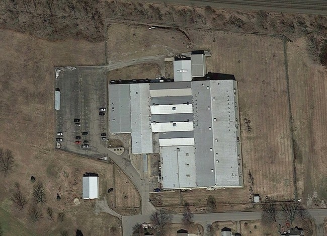
800 W Mitchell St
Manufacturinglight
E PT NW 1/4 SE 1/4 SEC 32 ( 200-243 ) 4.50A PT NW 1/4 EX E PT SE 1/4 SEC 32 8.03A (200-241) PT NE 1/4 SE 1/4 SEC 32 8.66A (20
AE
Noble
18113C0209D
Indiana
2024
21.19 AC
2024
Other Market Areas
971900
Kendallville, IN
97,797 SF
570732200243000020
DEMOGRAPHICS near 800 W Mitchell St
1 Mile
3 Mile
5 Mile
2024 Total Population
5,283
12,967
15,659
2029 Population
5,245
12,868
15,541
Pop Growth 2024-2029
(0.72%)
(0.76%)
(0.75%)
Average Age
38
40
40
2024 Total Households
2,087
5,178
6,248
HH Growth 2024-2029
(0.67%)
(0.79%)
(0.75%)
Median Household Inc
$55,226
$56,030
$58,234
Avg Household Size
2.40
2.40
2.40
2024 Avg HH Vehicles
2.00
2.00
2.00
Median Home Value
$129,981
$148,651
$156,080
Median Year Built
1950
1973
1973
Nearby Places
Map Layers
Map Styles
 Street
 Aerial
- Restaurants
- Banks
- Shops
- Fitness
- Groceries
PUBLIC TRANSPORTATION
AIRPORT
Fort Wayne International
DRIVE
WALK
Distance
Fort Wayne International
60 min
40.7 mi
SALE & LEASE HISTORY
LISTING DATE
SALE/LEASE

Sep 24, 2016
For Sale
Sep 24, 2016
For Sale
Nearby Properties
Address
Land Use
TOTAL SIZE
Lot Size
Zoning
Address
Land Use
TOTAL SIZE
Lot Size
Zoning
115,301 SF
54.70 AC
Address
Land Use
TOTAL SIZE
Lot Size
Zoning
182,855 SF
42.81 AC
Address
Land Use
TOTAL SIZE
Lot Size
Zoning
134,151 SF
2.56 AC
Address
Land Use
TOTAL SIZE
Lot Size
Zoning
182,042 SF
14.01 AC
Address
Land Use
TOTAL SIZE
Lot Size
Zoning
297,980 SF
32.35 AC
Address
Land Use
TOTAL SIZE
Lot Size
Zoning
287,015 SF
14.70 AC
Address
Land Use
TOTAL SIZE
Lot Size
Zoning
179,160 SF
15.27 AC
Address
Land Use
TOTAL SIZE
Lot Size
Zoning
87,442 SF
6.60 AC
Address
Land Use
TOTAL SIZE
Lot Size
Zoning
38,820 SF
5.71 AC
Address
Land Use
TOTAL SIZE
Lot Size
Zoning
3,456 SF
8.14 AC
Address
Land Use
TOTAL SIZE
Lot Size
Zoning
36,288 SF
4.25 AC
Address
Land Use
TOTAL SIZE
Lot Size
Zoning
75,000 SF
8.47 AC
Address
Land Use
TOTAL SIZE
Lot Size
Zoning
12,800 SF
50 AC
Address
Land Use
TOTAL SIZE
Lot Size
Zoning
58,092 SF
4.63 AC
Address
Land Use
TOTAL SIZE
Lot Size
Zoning
36,288 SF
3.75 AC
Address
Land Use
TOTAL SIZE
Lot Size
Zoning
92,689 SF
15.65 AC
Address
Land Use
TOTAL SIZE
Lot Size
Zoning
91,600 SF
11.70 AC
Address
Land Use
TOTAL SIZE
Lot Size
Zoning
169,944 SF
17.20 AC
Address
Land Use
TOTAL SIZE
Lot Size
Zoning
9,308 SF
10 AC
Address
Land Use
TOTAL SIZE
Lot Size
Zoning
60,760 SF
6.64 AC
Address
Land Use
TOTAL SIZE
Lot Size
Zoning
59,066 SF
5.04 AC
Address
Land Use
TOTAL SIZE
Lot Size
Zoning
56,875 SF
Address
Land Use
TOTAL SIZE
Lot Size
Zoning
11.43 AC
Address
Land Use
TOTAL SIZE
Lot Size
Zoning
92,771 SF
5.24 AC
Address
Land Use
TOTAL SIZE
Lot Size
Zoning
61,600 SF
18.57 AC
Address
Land Use
TOTAL SIZE
Lot Size
Zoning
20,052 SF
7.29 AC
Address
Land Use
TOTAL SIZE
Lot Size
Zoning
20,700 SF
33.87 AC
Address
Land Use
TOTAL SIZE
Lot Size
Zoning
2,752 SF
46.53 AC
Address
Land Use
TOTAL SIZE
Lot Size
Zoning
18,250 SF
9.42 AC
Address
Land Use
TOTAL SIZE
Lot Size
Zoning
254,634 SF
6.27 AC
The World's #1 Commercial Real Estate Marketplace
Connect with us
© 2026 CoStar Group
The information above has been obtained from sources believed reliable. While we do not doubt its accuracy we have not verified it and make no guarantee, warranty or representation about it. It is your responsibility to independently confirm its accuracy and completeness. Any projections, opinions, assumptions, or estimates used are for example only and do not represent the current or future performance of the property. The value of this transaction to you depends on tax and other factors which should be evaluated by your tax, financial, and legal advisors. You and your advisors should conduct a careful, independent investigation of the property to determine to your satisfaction the suitability of the property for your needs.