Property Record
800 Weldon Rd, Palmetto, GA 30268
Current Lease Availabilities
NEARBY LISTINGS FOR SALE OR LEASE
Property Detail
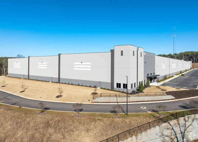
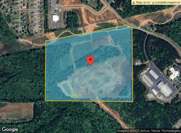
800 Weldon Rd
Atlanta-Sandy Springs-Roswell, GA
Shopland Palmetto Llc
129-7095-006
66.47 AC LL95 7TH LD
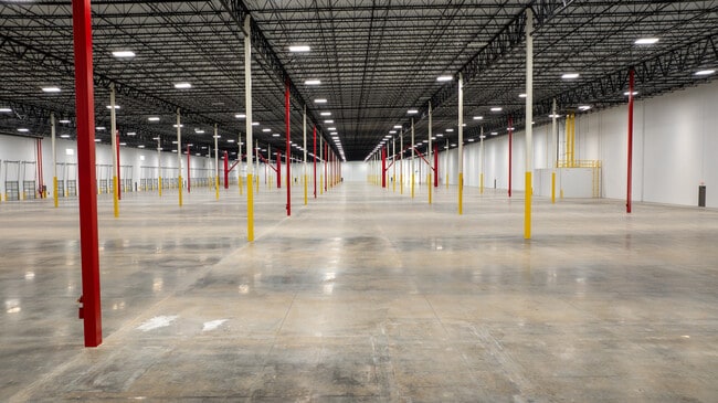
Warehouse
Coweta
X
Georgia
13121C0445F
95
2025
66.47 AC
2025
Fayette/Coweta County
170407
Atlanta
300,000 SF
DEMOGRAPHICS near 800 Weldon Rd
1 Mile
3 Mile
5 Mile
2024 Total Population
1,169
13,245
37,391
2029 Population
1,279
14,300
40,074
Pop Growth 2024-2029
+ 9.41%
+ 7.97%
+ 7.18%
Average Age
38
39
40
2024 Total Households
414
4,690
13,262
HH Growth 2024-2029
+ 9.42%
+ 7.97%
+ 7.06%
Median Household Inc
$46,428
$74,007
$81,400
Avg Household Size
2.80
2.80
2.80
2024 Avg HH Vehicles
2.00
2.00
2.00
Median Home Value
$154,838
$304,937
$320,076
Median Year Built
1984
1997
1998
Nearby Places
Map Layers
Map Styles
 Street
 Aerial
- Restaurants
- Banks
- Shops
- Fitness
- Groceries
PUBLIC TRANSPORTATION
AIRPORT
Hartsfield - Jackson Atlanta International
DRIVE
WALK
Distance
Hartsfield - Jackson Atlanta International
30 min
20.2 mi
Freight Ports
Georgia Ports - Savannah
DRIVE
WALK
Distance
Georgia Ports - Savannah
291 min
257.4 mi
Nearby Properties
Address
Land Use
TOTAL SIZE
Lot Size
Zoning
Address
Land Use
TOTAL SIZE
Lot Size
Zoning
1,000,200 SF
78.26 AC
R1
Address
Land Use
TOTAL SIZE
Lot Size
Zoning
79.51 AC
AG1
Address
Land Use
TOTAL SIZE
Lot Size
Zoning
374,881 SF
91.05 AC
M1
Address
Land Use
TOTAL SIZE
Lot Size
Zoning
1,094,400 SF
111.68 AC
M1
Address
Land Use
TOTAL SIZE
Lot Size
Zoning
981,874 SF
83.45 AC
AG1
Address
Land Use
TOTAL SIZE
Lot Size
Zoning
907,675 SF
73.12 AC
AG1
Address
Land Use
TOTAL SIZE
Lot Size
Zoning
1,351,440 SF
86.29 AC
M1
Address
Land Use
TOTAL SIZE
Lot Size
Zoning
1,054,500 SF
101.73 AC
M1
Address
Land Use
TOTAL SIZE
Lot Size
Zoning
1,064,460 SF
23.50 AC
M2
Address
Land Use
TOTAL SIZE
Lot Size
Zoning
293,156 SF
59.97 AC
R1
Address
Land Use
TOTAL SIZE
Lot Size
Zoning
685,260 SF
56.60 AC
M1
Address
Land Use
TOTAL SIZE
Lot Size
Zoning
48.74 AC
M1
Address
Land Use
TOTAL SIZE
Lot Size
Zoning
145,198 SF
52.44 AC
R1
Address
Land Use
TOTAL SIZE
Lot Size
Zoning
374,881 SF
34.73 AC
M1
Address
Land Use
TOTAL SIZE
Lot Size
Zoning
74.16 AC
R1
Address
Land Use
TOTAL SIZE
Lot Size
Zoning
139,164 SF
48.66 AC
R2
Address
Land Use
TOTAL SIZE
Lot Size
Zoning
201,600 SF
18 AC
M1
Address
Land Use
TOTAL SIZE
Lot Size
Zoning
255,000 SF
20.68 AC
M1
Address
Land Use
TOTAL SIZE
Lot Size
Zoning
39.33 AC
M2
Address
Land Use
TOTAL SIZE
Lot Size
Zoning
45,256 SF
20.15 AC
M
Address
Land Use
TOTAL SIZE
Lot Size
Zoning
75,847 SF
15.82 AC
R1
Address
Land Use
TOTAL SIZE
Lot Size
Zoning
Address
Land Use
TOTAL SIZE
Lot Size
Zoning
29,800 SF
16.70 AC
R2
Address
Land Use
TOTAL SIZE
Lot Size
Zoning
33,553 SF
274.48 AC
R1
Address
Land Use
TOTAL SIZE
Lot Size
Zoning
2,979 SF
132 AC
C3
Address
Land Use
TOTAL SIZE
Lot Size
Zoning
12,008 SF
12.19 AC
RL
Address
Land Use
TOTAL SIZE
Lot Size
Zoning
436,508 SF
16.03 AC
R7
Address
Land Use
TOTAL SIZE
Lot Size
Zoning
14.98 AC
AG1
Address
Land Use
TOTAL SIZE
Lot Size
Zoning
40,360 SF
12.29 AC
R2
The World's #1 Commercial Real Estate Marketplace
Connect with us
© 2025 CoStar Group
The information above has been obtained from sources believed reliable. While we do not doubt its accuracy we have not verified it and make no guarantee, warranty or representation about it. It is your responsibility to independently confirm its accuracy and completeness. Any projections, opinions, assumptions, or estimates used are for example only and do not represent the current or future performance of the property. The value of this transaction to you depends on tax and other factors which should be evaluated by your tax, financial, and legal advisors. You and your advisors should conduct a careful, independent investigation of the property to determine to your satisfaction the suitability of the property for your needs.