Property Record
8000 Blair Rd, Mint Hill, NC 28227

NEARBY LISTINGS FOR SALE OR LEASE
-
-
View all Mint Hill listings for sale on LoopNet.com
Property Detail
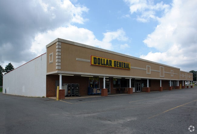
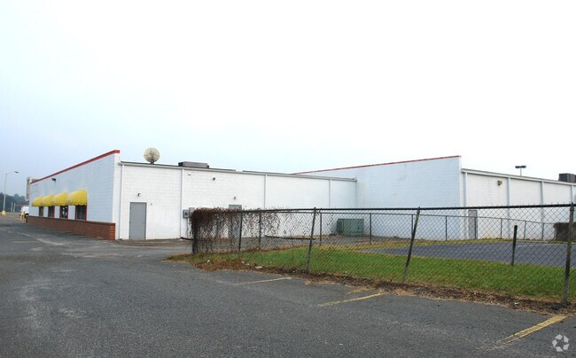
8000 Blair Rd
139-011-05
L1-4 &P5-17 BE M3-236
Commercialnec
Mecklenburg
X
North Carolina
3710550200K
1-4
2024
5.37 AC
2025
East
005714
Charlotte
28,720 SF
Charlotte-Concord-Gastonia, NC-SC
DEMOGRAPHICS near 8000 Blair Rd
1 Mile
3 Mile
5 Mile
2024 Total Population
2,842
30,145
110,252
2029 Population
3,049
32,135
117,543
Pop Growth 2024-2029
+ 7.28%
+ 6.60%
+ 6.61%
Average Age
43
41
39
2024 Total Households
1,012
10,693
39,750
HH Growth 2024-2029
+ 7.21%
+ 6.55%
+ 6.62%
Median Household Inc
$95,895
$87,806
$74,328
Avg Household Size
2.80
2.80
2.70
2024 Avg HH Vehicles
2.00
2.00
2.00
Median Home Value
$387,631
$353,027
$290,936
Median Year Built
1997
1993
1993
Nearby Places
Map Layers
Map Styles
 Street
 Aerial
- Restaurants
- Banks
- Shops
- Fitness
- Groceries
PUBLIC TRANSPORTATION
AIRPORT
Concord-Padgett Regional
DRIVE
WALK
Distance
Concord-Padgett Regional
24 min
18.2 mi
Charlotte/Douglas International
DRIVE
WALK
Distance
Charlotte/Douglas International
36 min
20.4 mi
Freight Ports
North Charleston Terminal
DRIVE
WALK
Distance
North Charleston Terminal
241 min
212.1 mi
Nearby Properties
Address
Land Use
TOTAL SIZE
Lot Size
Zoning
Address
Land Use
TOTAL SIZE
Lot Size
Zoning
261,708 SF
34.03 AC
Address
Land Use
TOTAL SIZE
Lot Size
Zoning
539,702 SF
83.70 AC
I
Address
Land Use
TOTAL SIZE
Lot Size
Zoning
187,371 SF
7.31 AC
Address
Land Use
TOTAL SIZE
Lot Size
Zoning
333,774 SF
64.04 AC
I
Address
Land Use
TOTAL SIZE
Lot Size
Zoning
96,071 SF
7.44 AC
Address
Land Use
TOTAL SIZE
Lot Size
Zoning
239,983 SF
21.41 AC
I-G(CD)
Address
Land Use
TOTAL SIZE
Lot Size
Zoning
78,372 SF
14.08 AC
IGCUD
Address
Land Use
TOTAL SIZE
Lot Size
Zoning
58,134 SF
5.08 AC
IGCUD
Address
Land Use
TOTAL SIZE
Lot Size
Zoning
86,432 SF
20.01 AC
I
Address
Land Use
TOTAL SIZE
Lot Size
Zoning
40,890 SF
2.92 AC
O-A DO-B(C
Address
Land Use
TOTAL SIZE
Lot Size
Zoning
80,888 SF
8.20 AC
Address
Land Use
TOTAL SIZE
Lot Size
Zoning
77,438 SF
4.26 AC
BD
Address
Land Use
TOTAL SIZE
Lot Size
Zoning
67,080 SF
7.99 AC
Address
Land Use
TOTAL SIZE
Lot Size
Zoning
62,619 SF
11.93 AC
I-G(CD)
Address
Land Use
TOTAL SIZE
Lot Size
Zoning
49,878 SF
6.11 AC
Address
Land Use
TOTAL SIZE
Lot Size
Zoning
77,876 SF
26.47 AC
R
Address
Land Use
TOTAL SIZE
Lot Size
Zoning
108,250 SF
10.07 AC
CC
Address
Land Use
TOTAL SIZE
Lot Size
Zoning
45,974 SF
9.85 AC
O-A DO-B(C
Address
Land Use
TOTAL SIZE
Lot Size
Zoning
73,255 SF
13.35 AC
R
Address
Land Use
TOTAL SIZE
Lot Size
Zoning
60,402 SF
10.46 AC
BP
Address
Land Use
TOTAL SIZE
Lot Size
Zoning
34,114 SF
8.50 AC
R(CD)
Address
Land Use
TOTAL SIZE
Lot Size
Zoning
18.70 AC
R
Address
Land Use
TOTAL SIZE
Lot Size
Zoning
54,876 SF
6.35 AC
R
Address
Land Use
TOTAL SIZE
Lot Size
Zoning
21,001 SF
20.22 AC
R
Address
Land Use
TOTAL SIZE
Lot Size
Zoning
54,308 SF
7.54 AC
BPCUD
Address
Land Use
TOTAL SIZE
Lot Size
Zoning
720 SF
35.60 AC
O-2(CD)
Address
Land Use
TOTAL SIZE
Lot Size
Zoning
20,808 SF
1.56 AC
B-D DO-B
Address
Land Use
TOTAL SIZE
Lot Size
Zoning
44,478 SF
5.41 AC
B-P(CD)
Address
Land Use
TOTAL SIZE
Lot Size
Zoning
20,470 SF
3.43 AC
B-P
Address
Land Use
TOTAL SIZE
Lot Size
Zoning
58,284 SF
4.01 AC
B-D
The World's #1 Commercial Real Estate Marketplace
Connect with us
© 2025 CoStar Group
The information above has been obtained from sources believed reliable. While we do not doubt its accuracy we have not verified it and make no guarantee, warranty or representation about it. It is your responsibility to independently confirm its accuracy and completeness. Any projections, opinions, assumptions, or estimates used are for example only and do not represent the current or future performance of the property. The value of this transaction to you depends on tax and other factors which should be evaluated by your tax, financial, and legal advisors. You and your advisors should conduct a careful, independent investigation of the property to determine to your satisfaction the suitability of the property for your needs.