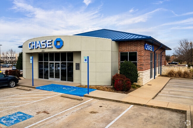
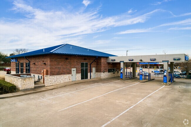
Property Record
8000 Independence Pkwy, Plano, TX 75025

Property Detail
8000 Independence Pkwy
R-1946-00A-002R-1
INDEPENDENCE CROSSING, BLK A, LOT 2R; REPLAT
Commercialnec
COLLIN
R
Texas
B and X Area of moderate flood hazard, usually the area between the limits of the 100-year and 500-year floods.
2r
2025
1.28 AC
2025
Central Plano
031641
Dallas/Ft Worth
4,282 SF
Dallas-Fort Worth-Arlington, TX
NEARBY LISTINGS FOR SALE OR LEASE
DEMOGRAPHICS near 8000 Independence Pkwy
1 mile
3 mile
5 mile
2025 Total Population
18,663
150,564
375,921
2030 Population
20,952
169,941
427,566
Pop Growth 2025-2030
+ 12.26%
+ 12.87%
+ 13.74%
Average Age
41
40
39
2025 Total Households
6,090
53,205
143,584
HH Growth 2025-2030
+ 12.45%
+ 13.06%
+ 14.05%
Median Household Inc
$176,856
$141,157
$120,713
Avg Household Size
3.00
2.80
2.60
2025 Avg HH Vehicles
2.00
2.00
2.00
Median Home Value
$612,793
$546,894
$538,463
Median Year Built
1995
1994
1997
Nearby Places
Map Layers
Map Styles
 Street
 Aerial
Transit
 Traffic
 Biking
Places
Listings with unknown addresses are not visible on the map
- Restaurants
- Banks
- Shops
- Fitness
- Groceries
PUBLIC TRANSPORTATION
AIRPORT
Dallas Love Field
Drive
Walk
Distance
Dallas Love Field
35 min
24.4 mi
Dallas-Fort Worth International
Drive
Walk
Distance
Dallas-Fort Worth International
34 min
28.4 mi
Freight Ports
Port of Shreveport
Drive
Walk
Distance
Port of Shreveport
235 min
213.2 mi
Nearby Properties
Address
Land Use
TOTAL SIZE
Lot Size
Zoning
Address
Land Use
TOTAL SIZE
Lot Size
Zoning
649,703 SF
31.92 AC
MF
Address
Land Use
TOTAL SIZE
Lot Size
Zoning
207,793 SF
12.48 AC
CE
Address
Land Use
TOTAL SIZE
Lot Size
Zoning
419,994 SF
19.83 AC
MF-M
Address
Land Use
TOTAL SIZE
Lot Size
Zoning
442,484 SF
APTS
Address
Land Use
TOTAL SIZE
Lot Size
Zoning
584,548 SF
33.76 AC
MF
Address
Land Use
TOTAL SIZE
Lot Size
Zoning
537,872 SF
36.28 AC
MF
Address
Land Use
TOTAL SIZE
Lot Size
Zoning
442,184 SF
11.65 AC
MF-E
Address
Land Use
TOTAL SIZE
Lot Size
Zoning
393,074 SF
24.03 AC
MFM
Address
Land Use
TOTAL SIZE
Lot Size
Zoning
294,229 SF
32.11 AC
Address
Land Use
TOTAL SIZE
Lot Size
Zoning
467,134 SF
24.13 AC
MF-M
Address
Land Use
TOTAL SIZE
Lot Size
Zoning
471,114 SF
26.05 AC
MF-M
Address
Land Use
TOTAL SIZE
Lot Size
Zoning
390,948 SF
21.95 AC
MF-M
Address
Land Use
TOTAL SIZE
Lot Size
Zoning
400,049 SF
34.67 AC
MF-L
Address
Land Use
TOTAL SIZE
Lot Size
Zoning
443,704 SF
18.87 AC
MFM
Address
Land Use
TOTAL SIZE
Lot Size
Zoning
300,347 SF
49.36 AC
SFR
Address
Land Use
TOTAL SIZE
Lot Size
Zoning
408,042 SF
18.47 AC
MF-M
Address
Land Use
TOTAL SIZE
Lot Size
Zoning
398,662 SF
21.42 AC
MF-M
Address
Land Use
TOTAL SIZE
Lot Size
Zoning
365,341 SF
15.26 AC
MF-M
Address
Land Use
TOTAL SIZE
Lot Size
Zoning
291,184 SF
21.03 AC
MF-M
Address
Land Use
TOTAL SIZE
Lot Size
Zoning
334,313 SF
22.10 AC
Address
Land Use
TOTAL SIZE
Lot Size
Zoning
283,040 SF
16 AC
MF-M
Address
Land Use
TOTAL SIZE
Lot Size
Zoning
332,500 SF
22.99 AC
MF-M
Address
Land Use
TOTAL SIZE
Lot Size
Zoning
260,679 SF
18.05 AC
MF-L
Address
Land Use
TOTAL SIZE
Lot Size
Zoning
196,064 SF
8.22 AC
MF-H
Address
Land Use
TOTAL SIZE
Lot Size
Zoning
246,610 SF
19.53 AC
MF-M
Address
Land Use
TOTAL SIZE
Lot Size
Zoning
366,350 SF
10.65 AC
PD-20
Address
Land Use
TOTAL SIZE
Lot Size
Zoning
213,680 SF
13.26 AC
MF-M
Address
Land Use
TOTAL SIZE
Lot Size
Zoning
289,502 SF
11.37 AC
MF
Address
Land Use
TOTAL SIZE
Lot Size
Zoning
249,571 SF
14.46 AC
MF-M
Address
Land Use
TOTAL SIZE
Lot Size
Zoning
280,335 SF
18.24 AC
MF-2
The World's #1 Commercial Real Estate Marketplace
Connect with us
© 2026 CoStar Group
The information above has been obtained from sources believed reliable. While we do not doubt its accuracy we have not verified it and make no guarantee, warranty or representation about it. It is your responsibility to independently confirm its accuracy and completeness. Any projections, opinions, assumptions, or estimates used are for example only and do not represent the current or future performance of the property. The value of this transaction to you depends on tax and other factors which should be evaluated by your tax, financial, and legal advisors. You and your advisors should conduct a careful, independent investigation of the property to determine to your satisfaction the suitability of the property for your needs.