Property Record
8000 Mediterranean Dr, Estero, FL 33928


Save to a Folder
{{folder.Name}}
{{folder.ListingIds.length}} Properties
{{folder.ListingIds.length}} Property
Create a New Folder
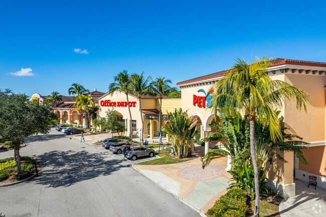
Property Detail
8000 Mediterranean Dr
04-47-25-E3-360SC.0020
COCONUT POINT AREA 2 DESC IN INST#2006-409925 TRACT SC-2
Regionalshoppingcenterormallwithanchorstore
Lee
MPD
Florida
AH Areas with a 1% annual chance of shallow flooding, usually in the form of a pond, withan average depth ranging from 1 to 3 feet. These areas have a 26% chance of flooding over the life of a 30-year mortgage.
8.30 AC
2025
Estero
2025
Southwest Florida
050316
Cape Coral-Fort Myers, FL
84,782 SF
NEARBY LISTINGS FOR SALE OR LEASE
DEMOGRAPHICS near 8000 Mediterranean Dr
1 mile
3 mile
5 mile
2025 Total Population
5,873
41,215
96,739
2030 Population
6,535
46,308
107,627
Pop Growth 2025-2030
+ 11.27%
+ 12.36%
+ 11.26%
Average Age
58
59
53
2025 Total Households
2,959
20,782
44,304
HH Growth 2025-2030
+ 10.75%
+ 11.81%
+ 11.05%
Median Household Inc
$109,158
$98,083
$92,294
Avg Household Size
1.90
1.90
2.10
2025 Avg HH Vehicles
2.00
2.00
2.00
Median Home Value
$589,891
$507,364
$498,866
Median Year Built
2001
2002
2000
Nearby Places
Map Layers
Map Styles
 Street
 Aerial
Layers
 Traffic
 Biking
Places
Listings with unknown addresses are not visible on the map
- Restaurants
- Banks
- Shops
- Fitness
- Groceries
PUBLIC TRANSPORTATION
AIRPORT
Southwest Florida International
Drive
Walk
Distance
Southwest Florida International
23 min
15.2 mi
Freight Ports
Port Manatee
Drive
Walk
Distance
Port Manatee
132 min
114.9 mi
Nearby Properties
Address
Land Use
TOTAL SIZE
Lot Size
Zoning
Address
Land Use
TOTAL SIZE
Lot Size
Zoning
785,522 SF
70.04 AC
MPD
Address
Land Use
TOTAL SIZE
Lot Size
Zoning
177,930 SF
20.74 AC
MPD
Address
Land Use
TOTAL SIZE
Lot Size
Zoning
687,668 SF
27.19 AC
CPD
Address
Land Use
TOTAL SIZE
Lot Size
Zoning
20.19 AC
MPD
Address
Land Use
TOTAL SIZE
Lot Size
Zoning
482,782 SF
27.98 AC
CPD
Address
Land Use
TOTAL SIZE
Lot Size
Zoning
540,648 SF
19.75 AC
MPD
Address
Land Use
TOTAL SIZE
Lot Size
Zoning
293,332 SF
7.03 AC
CPD
Address
Land Use
TOTAL SIZE
Lot Size
Zoning
245,356 SF
12.54 AC
MPD
Address
Land Use
TOTAL SIZE
Lot Size
Zoning
274,691 SF
6.62 AC
MPD
Address
Land Use
TOTAL SIZE
Lot Size
Zoning
348,757 SF
69.01 AC
CF-2
Address
Land Use
TOTAL SIZE
Lot Size
Zoning
69.37 AC
RPD
Address
Land Use
TOTAL SIZE
Lot Size
Zoning
5.39 AC
RPD
Address
Land Use
TOTAL SIZE
Lot Size
Zoning
236,456 SF
27.05 AC
MPD
Address
Land Use
TOTAL SIZE
Lot Size
Zoning
239.40 AC
Address
Land Use
TOTAL SIZE
Lot Size
Zoning
166,672 SF
8.58 AC
CPD
Address
Land Use
TOTAL SIZE
Lot Size
Zoning
139,174 SF
4.73 AC
CPD
Address
Land Use
TOTAL SIZE
Lot Size
Zoning
151,366 SF
15.47 AC
CPD
Address
Land Use
TOTAL SIZE
Lot Size
Zoning
48,538 SF
4.46 AC
CC
Address
Land Use
TOTAL SIZE
Lot Size
Zoning
97,916 SF
19.72 AC
CF-2
Address
Land Use
TOTAL SIZE
Lot Size
Zoning
181,680 SF
9.89 AC
MPD
Address
Land Use
TOTAL SIZE
Lot Size
Zoning
8.87 AC
CT
Address
Land Use
TOTAL SIZE
Lot Size
Zoning
103,495 SF
13.29 AC
CPD
Address
Land Use
TOTAL SIZE
Lot Size
Zoning
101,930 SF
6.60 AC
CPD
Address
Land Use
TOTAL SIZE
Lot Size
Zoning
206,959 SF
29.59 AC
MPD
Address
Land Use
TOTAL SIZE
Lot Size
Zoning
97,737 SF
10.67 AC
CPD
Address
Land Use
TOTAL SIZE
Lot Size
Zoning
269,023 SF
13.60 AC
CPD
Address
Land Use
TOTAL SIZE
Lot Size
Zoning
67,650 SF
2.27 AC
MPD
Address
Land Use
TOTAL SIZE
Lot Size
Zoning
73,370 SF
2.42 AC
MPD
Address
Land Use
TOTAL SIZE
Lot Size
Zoning
68,187 SF
2.47 AC
CPD
The World's #1 Commercial Real Estate Marketplace
Connect with us
© 2026 CoStar Group
The information above has been obtained from sources believed reliable. While we do not doubt its accuracy we have not verified it and make no guarantee, warranty or representation about it. It is your responsibility to independently confirm its accuracy and completeness. Any projections, opinions, assumptions, or estimates used are for example only and do not represent the current or future performance of the property. The value of this transaction to you depends on tax and other factors which should be evaluated by your tax, financial, and legal advisors. You and your advisors should conduct a careful, independent investigation of the property to determine to your satisfaction the suitability of the property for your needs.