Property Record
8002 Watts Rd, Madison, WI 53719
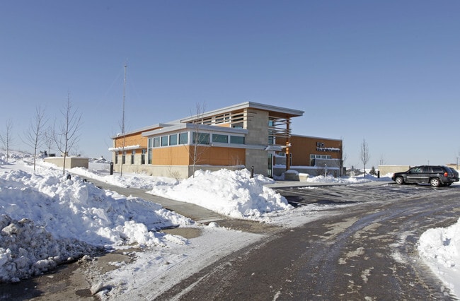

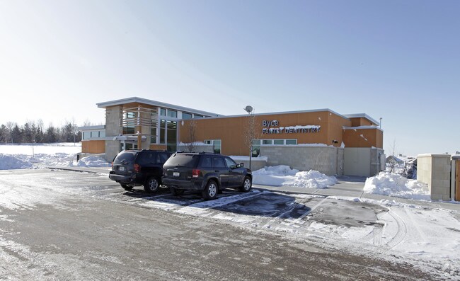
Property Detail
8002 Watts Rd
0708-262-0903-7
GANSER HEIGHTS, LOT 7.
Commercialnec
Dane
PD
Wisconsin
B and X Area of moderate flood hazard, usually the area between the limits of the 100-year and 500-year floods.
7
2025
1.09 AC
2025
Southwest Madison
000406
Milwaukee/Madison
5,810 SF
Madison, WI
NEARBY LISTINGS FOR SALE OR LEASE
DEMOGRAPHICS near 8002 Watts Rd
1 mile
3 mile
5 mile
2025 Total Population
8,548
74,412
154,246
2030 Population
8,963
77,631
160,646
Pop Growth 2025-2030
+ 4.85%
+ 4.33%
+ 4.15%
Average Age
38
40
39
2025 Total Households
4,584
33,868
68,434
HH Growth 2025-2030
+ 5.00%
+ 4.69%
+ 4.48%
Median Household Inc
$73,381
$94,472
$95,828
Avg Household Size
1.80
2.10
2.20
2025 Avg HH Vehicles
1.00
2.00
2.00
Median Home Value
$399,830
$434,624
$450,545
Median Year Built
1992
1992
1987
Nearby Places
Map Layers
Map Styles
 Street
 Aerial
Layers
 Traffic
 Biking
Places
Listings with unknown addresses are not visible on the map
- Restaurants
- Banks
- Shops
- Fitness
- Groceries
PUBLIC TRANSPORTATION
AIRPORT
Dane County Regional/Truax Field
Drive
Walk
Distance
Dane County Regional/Truax Field
28 min
17.1 mi
Freight Ports
Port Milwaukee
Drive
Walk
Distance
Port Milwaukee
110 min
90.5 mi
Nearby Properties
Address
Land Use
TOTAL SIZE
Lot Size
Zoning
Address
Land Use
TOTAL SIZE
Lot Size
Zoning
408,311 SF
9.26 AC
SE
Address
Land Use
TOTAL SIZE
Lot Size
Zoning
501,997 SF
26.90 AC
SE
Address
Land Use
TOTAL SIZE
Lot Size
Zoning
530,774 SF
37.40 AC
RMX
Address
Land Use
TOTAL SIZE
Lot Size
Zoning
526,685 SF
23.94 AC
SR-V2
Address
Land Use
TOTAL SIZE
Lot Size
Zoning
156,908 SF
23.87 AC
SE
Address
Land Use
TOTAL SIZE
Lot Size
Zoning
143,360 SF
10.27 AC
SEC
Address
Land Use
TOTAL SIZE
Lot Size
Zoning
235,052 SF
7.34 AC
WP-28
Address
Land Use
TOTAL SIZE
Lot Size
Zoning
217,664 SF
1.43 AC
TE
Address
Land Use
TOTAL SIZE
Lot Size
Zoning
217,544 SF
7.65 AC
TR-U2
Address
Land Use
TOTAL SIZE
Lot Size
Zoning
175,209 SF
12.60 AC
SEC
Address
Land Use
TOTAL SIZE
Lot Size
Zoning
169,563 SF
19.82 AC
SEC
Address
Land Use
TOTAL SIZE
Lot Size
Zoning
51,205 SF
9.32 AC
SE
Address
Land Use
TOTAL SIZE
Lot Size
Zoning
15.61 AC
Address
Land Use
TOTAL SIZE
Lot Size
Zoning
201,601 SF
10.08 AC
TR-U2
Address
Land Use
TOTAL SIZE
Lot Size
Zoning
5.95 AC
Address
Land Use
TOTAL SIZE
Lot Size
Zoning
222,210 SF
11.25 AC
PD
Address
Land Use
TOTAL SIZE
Lot Size
Zoning
169,975 SF
4.05 AC
CC-T
Address
Land Use
TOTAL SIZE
Lot Size
Zoning
167,555 SF
2.98 AC
TR-U2
Address
Land Use
TOTAL SIZE
Lot Size
Zoning
181,269 SF
4.58 AC
CC-T
Address
Land Use
TOTAL SIZE
Lot Size
Zoning
2.91 AC
CC-T
Address
Land Use
TOTAL SIZE
Lot Size
Zoning
204,228 SF
4.23 AC
PD
Address
Land Use
TOTAL SIZE
Lot Size
Zoning
237,562 SF
4.59 AC
PD
Address
Land Use
TOTAL SIZE
Lot Size
Zoning
248,319 SF
8.47 AC
PD
Address
Land Use
TOTAL SIZE
Lot Size
Zoning
243,290 SF
9.28 AC
SR-V2
Address
Land Use
TOTAL SIZE
Lot Size
Zoning
217,919 SF
11.97 AC
PD
Address
Land Use
TOTAL SIZE
Lot Size
Zoning
295,772 SF
7.35 AC
PD
Address
Land Use
TOTAL SIZE
Lot Size
Zoning
135,964 SF
6.57 AC
SR-V2
Address
Land Use
TOTAL SIZE
Lot Size
Zoning
Address
Land Use
TOTAL SIZE
Lot Size
Zoning
134,951 SF
7.39 AC
SEC
Address
Land Use
TOTAL SIZE
Lot Size
Zoning
11.09 AC
The World's #1 Commercial Real Estate Marketplace
Connect with us
© 2026 CoStar Group
The information above has been obtained from sources believed reliable. While we do not doubt its accuracy we have not verified it and make no guarantee, warranty or representation about it. It is your responsibility to independently confirm its accuracy and completeness. Any projections, opinions, assumptions, or estimates used are for example only and do not represent the current or future performance of the property. The value of this transaction to you depends on tax and other factors which should be evaluated by your tax, financial, and legal advisors. You and your advisors should conduct a careful, independent investigation of the property to determine to your satisfaction the suitability of the property for your needs.