Property Record
801 2Nd St, Perry, IA 50220
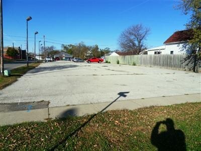
Property Detail
801 2Nd St
Des Moines
DALLAS
Des Moines-West Des Moines, IA
Iowa
02-10-362-010
0.18 AC
Commercialnec
Outlying Dallas County
B and X Area of moderate flood hazard, usually the area between the limits of the 100-year and 500-year floods.
NEARBY LISTINGS FOR SALE OR LEASE
DEMOGRAPHICS near 801 2Nd St
1 mile
3 mile
5 mile
2025 Total Population
6,583
9,320
9,980
2030 Population
7,351
10,382
11,077
Pop Growth 2025-2030
+ 11.67%
+ 11.39%
+ 10.99%
Average Age
38
39
39
2025 Total Households
2,449
3,483
3,730
HH Growth 2025-2030
+ 12.09%
+ 11.83%
+ 11.42%
Median Household Inc
$65,485
$65,454
$66,613
Avg Household Size
2.60
2.60
2.60
2025 Avg HH Vehicles
2.00
2.00
2.00
Median Home Value
$110,051
$124,059
$131,958
Median Year Built
1952
1957
1957
Nearby Places
Map Layers
Map Styles
 Street
 Aerial
Layers
 Traffic
 Biking
Places
Listings with unknown addresses are not visible on the map
- Restaurants
- Banks
- Shops
- Fitness
- Groceries
PUBLIC TRANSPORTATION
AIRPORT
Des Moines International
Drive
Walk
Distance
Des Moines International
57 min
40.6 mi
Nearby Properties
Address
Land Use
TOTAL SIZE
Lot Size
Zoning
Address
Land Use
TOTAL SIZE
Lot Size
Zoning
16 AC
Address
Land Use
TOTAL SIZE
Lot Size
Zoning
27,096 SF
4.31 AC
Address
Land Use
TOTAL SIZE
Lot Size
Zoning
24,240 SF
11.75 AC
Address
Land Use
TOTAL SIZE
Lot Size
Zoning
15,111 SF
6.54 AC
Address
Land Use
TOTAL SIZE
Lot Size
Zoning
30,672 SF
4.01 AC
Address
Land Use
TOTAL SIZE
Lot Size
Zoning
8,560 SF
1.07 AC
Address
Land Use
TOTAL SIZE
Lot Size
Zoning
43,710 SF
24.96 AC
Address
Land Use
TOTAL SIZE
Lot Size
Zoning
2,400 SF
5.55 AC
Address
Land Use
TOTAL SIZE
Lot Size
Zoning
9,512 SF
5.64 AC
Address
Land Use
TOTAL SIZE
Lot Size
Zoning
144,400 SF
38.52 AC
Address
Land Use
TOTAL SIZE
Lot Size
Zoning
33,666 SF
7.69 AC
Address
Land Use
TOTAL SIZE
Lot Size
Zoning
12,188 SF
0.50 AC
Address
Land Use
TOTAL SIZE
Lot Size
Zoning
13,746 SF
0.58 AC
Address
Land Use
TOTAL SIZE
Lot Size
Zoning
42,600 SF
5.20 AC
Address
Land Use
TOTAL SIZE
Lot Size
Zoning
10,877 SF
4.25 AC
Address
Land Use
TOTAL SIZE
Lot Size
Zoning
1,600 SF
5 AC
Address
Land Use
TOTAL SIZE
Lot Size
Zoning
12,982 SF
4.37 AC
Address
Land Use
TOTAL SIZE
Lot Size
Zoning
31,065 SF
5.50 AC
Address
Land Use
TOTAL SIZE
Lot Size
Zoning
42,364 SF
4.74 AC
Address
Land Use
TOTAL SIZE
Lot Size
Zoning
21,037 SF
3.61 AC
Address
Land Use
TOTAL SIZE
Lot Size
Zoning
67,761 SF
1.70 AC
Address
Land Use
TOTAL SIZE
Lot Size
Zoning
5,544 SF
0.19 AC
Address
Land Use
TOTAL SIZE
Lot Size
Zoning
1,890 SF
2.07 AC
Address
Land Use
TOTAL SIZE
Lot Size
Zoning
3.33 AC
Address
Land Use
TOTAL SIZE
Lot Size
Zoning
2,000 SF
17.54 AC
Address
Land Use
TOTAL SIZE
Lot Size
Zoning
34,924 SF
3.87 AC
Address
Land Use
TOTAL SIZE
Lot Size
Zoning
1,155 SF
4.95 AC
Address
Land Use
TOTAL SIZE
Lot Size
Zoning
7,988 SF
0.32 AC
Address
Land Use
TOTAL SIZE
Lot Size
Zoning
1,534 SF
3.75 AC
The World's #1 Commercial Real Estate Marketplace
Connect with us
© 2026 CoStar Group
The information above has been obtained from sources believed reliable. While we do not doubt its accuracy we have not verified it and make no guarantee, warranty or representation about it. It is your responsibility to independently confirm its accuracy and completeness. Any projections, opinions, assumptions, or estimates used are for example only and do not represent the current or future performance of the property. The value of this transaction to you depends on tax and other factors which should be evaluated by your tax, financial, and legal advisors. You and your advisors should conduct a careful, independent investigation of the property to determine to your satisfaction the suitability of the property for your needs.