Property Record
801 42Nd St, Springfield, OR 97478
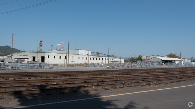
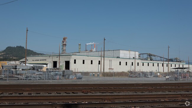
Property Detail
801 42Nd St
1851417
TL 02903-901
Industrialgeneral
Lane
E30
Oregon
AE The base floodplain where base flood elevations are provided. AE Zones are now used on new format FIRMs instead of A1-A30 Zones.
2903
2025
Lane County
2025
Portland
001903
Eugene-Springfield, OR
NEARBY LISTINGS FOR SALE OR LEASE
DEMOGRAPHICS near 801 42Nd St
1 mile
3 mile
5 mile
2025 Total Population
8,247
46,013
75,881
2030 Population
8,212
45,625
75,099
Pop Growth 2025-2030
(0.42%)
(0.84%)
(1.03%)
Average Age
37
40
41
2025 Total Households
3,054
17,684
30,311
HH Growth 2025-2030
(0.52%)
(0.93%)
(1.12%)
Median Household Inc
$71,147
$75,536
$71,808
Avg Household Size
2.60
2.50
2.40
2025 Avg HH Vehicles
2.00
2.00
2.00
Median Home Value
$322,093
$373,071
$381,159
Median Year Built
1975
1975
1974
Nearby Places
Map Layers
Map Styles
 Street
 Aerial
Layers
 Traffic
 Biking
Places
Listings with unknown addresses are not visible on the map
- Restaurants
- Banks
- Shops
- Fitness
- Groceries
PUBLIC TRANSPORTATION
COMMUTER RAIL
Eugene (Amtrak Cascades - Amtrak, Coast Starlight - Amtrak)
Drive
Walk
Distance
Eugene (Amtrak Cascades - Amtrak, Coast Starlight - Amtrak)
11 min
7.4 mi
AIRPORT
Mahlon Sweet Field
Drive
Walk
Distance
Mahlon Sweet Field
26 min
15.9 mi
Freight Ports
Port of Coos Bay, OR
Drive
Walk
Distance
Port of Coos Bay, OR
162 min
115.9 mi
Nearby Properties
Address
Land Use
TOTAL SIZE
Lot Size
Zoning
Address
Land Use
TOTAL SIZE
Lot Size
Zoning
9.57 AC
LD
Address
Land Use
TOTAL SIZE
Lot Size
Zoning
179 AC
E30
Address
Land Use
TOTAL SIZE
Lot Size
Zoning
33.20 AC
HI
Address
Land Use
TOTAL SIZE
Lot Size
Zoning
22.52 AC
LD
Address
Land Use
TOTAL SIZE
Lot Size
Zoning
Address
Land Use
TOTAL SIZE
Lot Size
Zoning
11.23 AC
Address
Land Use
TOTAL SIZE
Lot Size
Zoning
Address
Land Use
TOTAL SIZE
Lot Size
Zoning
50.28 AC
LD
Address
Land Use
TOTAL SIZE
Lot Size
Zoning
28.66 AC
LMI
Address
Land Use
TOTAL SIZE
Lot Size
Zoning
19.48 AC
LD
Address
Land Use
TOTAL SIZE
Lot Size
Zoning
35.91 AC
HI
Address
Land Use
TOTAL SIZE
Lot Size
Zoning
27.44 AC
LD
Address
Land Use
TOTAL SIZE
Lot Size
Zoning
Address
Land Use
TOTAL SIZE
Lot Size
Zoning
15.54 AC
HI
Address
Land Use
TOTAL SIZE
Lot Size
Zoning
15.15 AC
LD
Address
Land Use
TOTAL SIZE
Lot Size
Zoning
11.12 AC
HI
Address
Land Use
TOTAL SIZE
Lot Size
Zoning
10.70 AC
LD
Address
Land Use
TOTAL SIZE
Lot Size
Zoning
9.19 AC
E25
Address
Land Use
TOTAL SIZE
Lot Size
Zoning
9.40 AC
LD
Address
Land Use
TOTAL SIZE
Lot Size
Zoning
3.58 AC
HD
Address
Land Use
TOTAL SIZE
Lot Size
Zoning
13.84 AC
HD
Address
Land Use
TOTAL SIZE
Lot Size
Zoning
57.39 AC
CC
Address
Land Use
TOTAL SIZE
Lot Size
Zoning
9.23 AC
LD
Address
Land Use
TOTAL SIZE
Lot Size
Zoning
18.70 AC
E30
Address
Land Use
TOTAL SIZE
Lot Size
Zoning
Address
Land Use
TOTAL SIZE
Lot Size
Zoning
7.78 AC
LD
Address
Land Use
TOTAL SIZE
Lot Size
Zoning
5.88 AC
LD
Address
Land Use
TOTAL SIZE
Lot Size
Zoning
119.04 AC
E30
Address
Land Use
TOTAL SIZE
Lot Size
Zoning
5.14 AC
LD
The World's #1 Commercial Real Estate Marketplace
Connect with us
© 2026 CoStar Group
The information above has been obtained from sources believed reliable. While we do not doubt its accuracy we have not verified it and make no guarantee, warranty or representation about it. It is your responsibility to independently confirm its accuracy and completeness. Any projections, opinions, assumptions, or estimates used are for example only and do not represent the current or future performance of the property. The value of this transaction to you depends on tax and other factors which should be evaluated by your tax, financial, and legal advisors. You and your advisors should conduct a careful, independent investigation of the property to determine to your satisfaction the suitability of the property for your needs.