Property Record
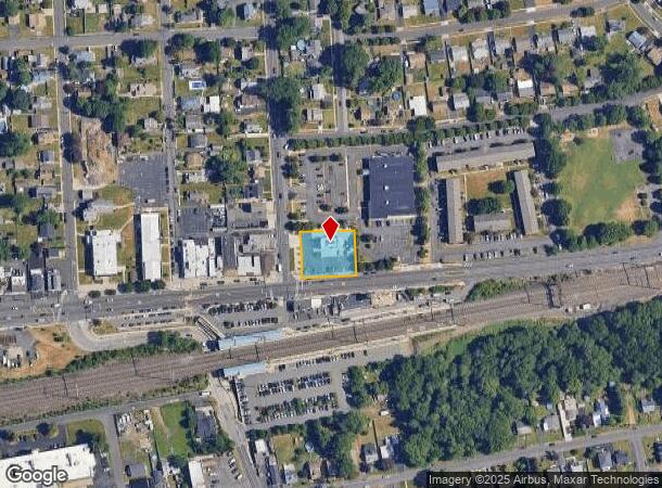
801 Bristol Pike, Bensalem, PA 19020

NEARBY LISTINGS FOR SALE OR LEASE
Property Detail
801 Bristol Pike
05-008-499
NE COR US13 APPL 72-453 125X150
Restaurantdrivein
Bucks
X
Pennsylvania
42017C0507K
0.43 AC
2024
Lower Bucks County
2025
Philadelphia
100103
Philadelphia-Camden-Wilmington, PA-NJ-DE-MD
1,334 SF
DEMOGRAPHICS near 801 Bristol Pike
1 Mile
3 Mile
5 Mile
2024 Total Population
11,874
81,757
251,588
2029 Population
11,825
82,017
250,562
Pop Growth 2024-2029
(0.41%)
+ 0.32%
(0.41%)
Average Age
41
41
41
2024 Total Households
4,445
31,581
95,349
HH Growth 2024-2029
(0.49%)
+ 0.33%
(0.48%)
Median Household Inc
$68,330
$72,120
$78,890
Avg Household Size
2.60
2.50
2.60
2024 Avg HH Vehicles
2.00
2.00
2.00
Median Home Value
$249,968
$265,588
$259,347
Median Year Built
1961
1968
1965
Nearby Places
Map Layers
Map Styles
 Street
 Aerial
- Restaurants
- Banks
- Shops
- Fitness
- Groceries
PUBLIC TRANSPORTATION
COMMUTER RAIL
Croydon (R7 - Southeastern Pennsylvania Transportation Authority Regional Rail (SEPTA Regional Rail))
DRIVE
WALK
Distance
Croydon (R7 - Southeastern Pennsylvania Transportation Authority Regional Rail (SEPTA Regional Rail))
0 min
1 min
0.1 mi
Eddington (R7 - Southeastern Pennsylvania Transportation Authority Regional Rail (SEPTA Regional Rail))
DRIVE
WALK
Distance
Eddington (R7 - Southeastern Pennsylvania Transportation Authority Regional Rail (SEPTA Regional Rail))
5 min
2.3 mi
AIRPORT
Trenton Mercer
DRIVE
WALK
Distance
Trenton Mercer
27 min
16.3 mi
Philadelphia International
DRIVE
WALK
Distance
Philadelphia International
43 min
28.1 mi
Freight Ports
Port of Philadelphia
DRIVE
WALK
Distance
Port of Philadelphia
23 min
14.4 mi
Nearby Properties
Address
Land Use
TOTAL SIZE
Lot Size
Zoning
Address
Land Use
TOTAL SIZE
Lot Size
Zoning
22,688 SF
32.55 AC
BLI1
Address
Land Use
TOTAL SIZE
Lot Size
Zoning
32.72 AC
Address
Land Use
TOTAL SIZE
Lot Size
Zoning
136,315 SF
11.38 AC
CA1
Address
Land Use
TOTAL SIZE
Lot Size
Zoning
253,500 SF
24.28 AC
BLI1
Address
Land Use
TOTAL SIZE
Lot Size
Zoning
1,325 SF
18.73 AC
Address
Land Use
TOTAL SIZE
Lot Size
Zoning
Address
Land Use
TOTAL SIZE
Lot Size
Zoning
372,324 SF
17 AC
Address
Land Use
TOTAL SIZE
Lot Size
Zoning
11 AC
TRN
Address
Land Use
TOTAL SIZE
Lot Size
Zoning
15.09 AC
I-1
Address
Land Use
TOTAL SIZE
Lot Size
Zoning
10.73 AC
BLI1
Address
Land Use
TOTAL SIZE
Lot Size
Zoning
8.96 AC
SPPOA
Address
Land Use
TOTAL SIZE
Lot Size
Zoning
Address
Land Use
TOTAL SIZE
Lot Size
Zoning
287,866 SF
47.54 AC
I-1
Address
Land Use
TOTAL SIZE
Lot Size
Zoning
1,997 SF
2.17 AC
Address
Land Use
TOTAL SIZE
Lot Size
Zoning
3.74 AC
Address
Land Use
TOTAL SIZE
Lot Size
Zoning
8.60 AC
R-1
Address
Land Use
TOTAL SIZE
Lot Size
Zoning
2.46 AC
W-1
Address
Land Use
TOTAL SIZE
Lot Size
Zoning
242 AC
OS-1
Address
Land Use
TOTAL SIZE
Lot Size
Zoning
8.40 AC
Address
Land Use
TOTAL SIZE
Lot Size
Zoning
4.01 AC
Address
Land Use
TOTAL SIZE
Lot Size
Zoning
4.41 AC
Address
Land Use
TOTAL SIZE
Lot Size
Zoning
9.15 AC
B2
Address
Land Use
TOTAL SIZE
Lot Size
Zoning
21,000 SF
3.42 AC
CA1
Address
Land Use
TOTAL SIZE
Lot Size
Zoning
38,590 SF
1.82 AC
TRN
Address
Land Use
TOTAL SIZE
Lot Size
Zoning
43,445 SF
5.96 AC
Address
Land Use
TOTAL SIZE
Lot Size
Zoning
1.67 AC
TRN
Address
Land Use
TOTAL SIZE
Lot Size
Zoning
Address
Land Use
TOTAL SIZE
Lot Size
Zoning
29,054 SF
12.95 AC
B2
Address
Land Use
TOTAL SIZE
Lot Size
Zoning
3,456 SF
4.88 AC
TRN
Address
Land Use
TOTAL SIZE
Lot Size
Zoning
27,580 SF
2.25 AC
R-2
The World's #1 Commercial Real Estate Marketplace
Connect with us
© 2025 CoStar Group
The information above has been obtained from sources believed reliable. While we do not doubt its accuracy we have not verified it and make no guarantee, warranty or representation about it. It is your responsibility to independently confirm its accuracy and completeness. Any projections, opinions, assumptions, or estimates used are for example only and do not represent the current or future performance of the property. The value of this transaction to you depends on tax and other factors which should be evaluated by your tax, financial, and legal advisors. You and your advisors should conduct a careful, independent investigation of the property to determine to your satisfaction the suitability of the property for your needs.