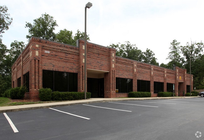
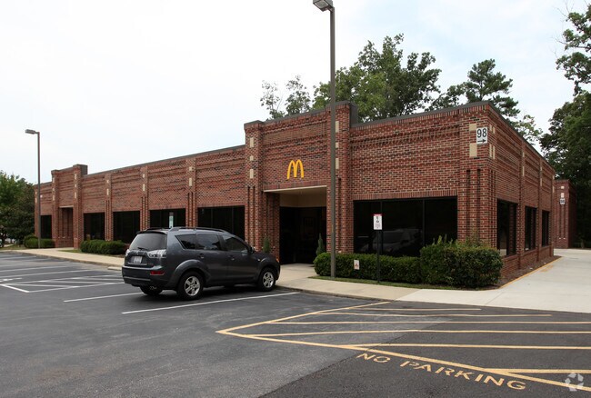
Property Record
501 Cascade Pointe Ln, Cary, NC 27513
NEARBY LISTINGS FOR SALE OR LEASE
Property Detail
501 Cascade Pointe Ln
Raleigh-Cary, NC
Westview A Weston Condos
0755.04-53-7528-000
LO2H MAS CD WESTVIEW A WESTON CONDOS TR6
Condominium
Wake
X
North Carolina
3720075500K
2h
0
11.20 AC
2025
Cary
053522
Raleigh/Durham
7,578 SF
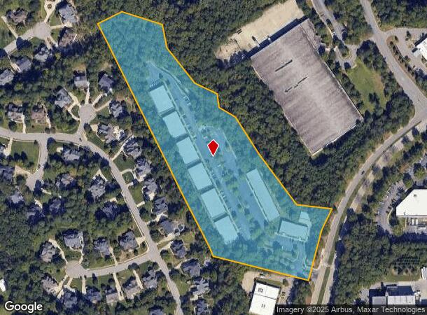
DEMOGRAPHICS near 501 Cascade Pointe Ln
1 mile
3 mile
5 mile
2024 Total Population
10,602
73,844
173,835
2029 Population
11,632
80,471
189,074
Pop Growth 2024-2029
+ 9.72%
+ 8.97%
+ 8.77%
Average Age
37
38
38
2024 Total Households
4,475
29,635
68,233
HH Growth 2024-2029
+ 9.77%
+ 8.86%
+ 8.76%
Median Household Inc
$104,823
$109,319
$109,112
Avg Household Size
2.30
2.50
2.50
2024 Avg HH Vehicles
2.00
2.00
2.00
Median Home Value
$461,764
$443,964
$426,120
Median Year Built
2003
1998
1999
Nearby Places
Map Layers
Map Styles
 Street
 Aerial
Transit
 Traffic
 Biking
Places
Listings with unknown addresses are not visible on the map
- Restaurants
- Banks
- Shops
- Fitness
- Groceries
PUBLIC TRANSPORTATION
COMMUTER RAIL
Cary Station (Piedmont - North Carolina by Train (NC Train))
Drive
Walk
Distance
Cary Station (Piedmont - North Carolina by Train (NC Train))
7 min
3.8 mi
AIRPORT
Raleigh-Durham International
Drive
Walk
Distance
Raleigh-Durham International
12 min
5.9 mi
Freight Ports
Port of Wilmington
Drive
Walk
Distance
Port of Wilmington
168 min
145.1 mi
Nearby Properties
Address
Land Use
TOTAL SIZE
Lot Size
Zoning
Address
Land Use
TOTAL SIZE
Lot Size
Zoning
517,812 SF
18.51 AC
RMFP
Address
Land Use
TOTAL SIZE
Lot Size
Zoning
237,537 SF
24.60 AC
C-BAC
Address
Land Use
TOTAL SIZE
Lot Size
Zoning
949,404 SF
26.71 AC
OIP
Address
Land Use
TOTAL SIZE
Lot Size
Zoning
534,604 SF
16.38 AC
RMFM
Address
Land Use
TOTAL SIZE
Lot Size
Zoning
429,107 SF
13.67 AC
RMFP
Address
Land Use
TOTAL SIZE
Lot Size
Zoning
375,689 SF
32.73 AC
HDR
Address
Land Use
TOTAL SIZE
Lot Size
Zoning
312,475 SF
21.74 AC
RMFP
Address
Land Use
TOTAL SIZE
Lot Size
Zoning
312,088 SF
12.53 AC
BAC-G
Address
Land Use
TOTAL SIZE
Lot Size
Zoning
453,970 SF
41.48 AC
RMF-C
Address
Land Use
TOTAL SIZE
Lot Size
Zoning
358,137 SF
22.39 AC
RMFP
Address
Land Use
TOTAL SIZE
Lot Size
Zoning
300,662 SF
12.68 AC
BAC-G
Address
Land Use
TOTAL SIZE
Lot Size
Zoning
414,214 SF
11.23 AC
OIP
Address
Land Use
TOTAL SIZE
Lot Size
Zoning
444,236 SF
8.51 AC
ORDP
Address
Land Use
TOTAL SIZE
Lot Size
Zoning
269,702 SF
14.66 AC
GCM
Address
Land Use
TOTAL SIZE
Lot Size
Zoning
368,195 SF
32.11 AC
HDR
Address
Land Use
TOTAL SIZE
Lot Size
Zoning
408,968 SF
32.58 AC
HDR
Address
Land Use
TOTAL SIZE
Lot Size
Zoning
394,181 SF
28.62 AC
HDR
Address
Land Use
TOTAL SIZE
Lot Size
Zoning
266,419 SF
77.78 AC
RA
Address
Land Use
TOTAL SIZE
Lot Size
Zoning
172,116 SF
56.06 AC
C-OI
Address
Land Use
TOTAL SIZE
Lot Size
Zoning
513,738 SF
35.66 AC
OIP
Address
Land Use
TOTAL SIZE
Lot Size
Zoning
261,061 SF
18.75 AC
HDR
Address
Land Use
TOTAL SIZE
Lot Size
Zoning
579,364 SF
32.23 AC
IM
Address
Land Use
TOTAL SIZE
Lot Size
Zoning
272,508 SF
15.49 AC
NAC
Address
Land Use
TOTAL SIZE
Lot Size
Zoning
328,572 SF
30.55 AC
HDR
Address
Land Use
TOTAL SIZE
Lot Size
Zoning
364,972 SF
35.18 AC
RMF-C
Address
Land Use
TOTAL SIZE
Lot Size
Zoning
242,305 SF
48.57 AC
R40
Address
Land Use
TOTAL SIZE
Lot Size
Zoning
282,961 SF
5.59 AC
GCP
Address
Land Use
TOTAL SIZE
Lot Size
Zoning
358,853 SF
16.94 AC
RMFP
Address
Land Use
TOTAL SIZE
Lot Size
Zoning
226,107 SF
18.72 AC
RMFP
Address
Land Use
TOTAL SIZE
Lot Size
Zoning
330,232 SF
18.45 AC
OIP
The World's #1 Commercial Real Estate Marketplace
Connect with us
© 2026 CoStar Group
The information above has been obtained from sources believed reliable. While we do not doubt its accuracy we have not verified it and make no guarantee, warranty or representation about it. It is your responsibility to independently confirm its accuracy and completeness. Any projections, opinions, assumptions, or estimates used are for example only and do not represent the current or future performance of the property. The value of this transaction to you depends on tax and other factors which should be evaluated by your tax, financial, and legal advisors. You and your advisors should conduct a careful, independent investigation of the property to determine to your satisfaction the suitability of the property for your needs.