Property Record
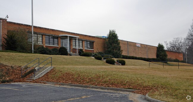
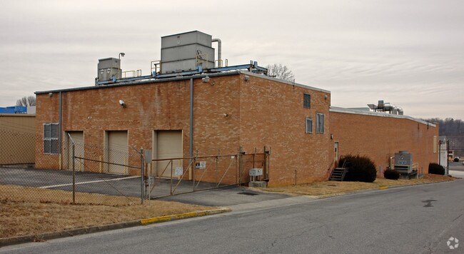
801 E Main St, Radford, VA 24142

Property Detail
801 E Main St
Blacksburg-Christiansburg-Radford, VA
BL CO 8.64 ACRE 3-(1)-1
3-1-1
RADFORD CITY
Taxexempt
Virginia
B and X Area of moderate flood hazard, usually the area between the limits of the 100-year and 500-year floods.
8.64 AC
0
Blacksburg & Wytheville
2025
Other Market Areas
010102
NEARBY LISTINGS FOR SALE OR LEASE
-
-
View all Radford listings for sale on LoopNet.com
DEMOGRAPHICS near 801 E Main St
1 mile
3 mile
5 mile
2025 Total Population
6,508
20,190
25,388
2030 Population
6,912
21,171
26,416
Pop Growth 2025-2030
+ 6.21%
+ 4.86%
+ 4.05%
Average Age
30
38
39
2025 Total Households
2,802
8,713
10,851
HH Growth 2025-2030
+ 6.03%
+ 4.67%
+ 3.94%
Median Household Inc
$40,158
$53,954
$57,737
Avg Household Size
2.00
2.20
2.20
2025 Avg HH Vehicles
2.00
2.00
2.00
Median Home Value
$315,082
$241,074
$243,447
Median Year Built
1982
1976
1978
Nearby Places
Map Layers
Map Styles
 Street
 Aerial
Layers
 Traffic
 Biking
Places
Listings with unknown addresses are not visible on the map
- Restaurants
- Banks
- Shops
- Fitness
- Groceries
Nearby Properties
Address
Land Use
TOTAL SIZE
Lot Size
Zoning
Address
Land Use
TOTAL SIZE
Lot Size
Zoning
45.01 AC
I1
Address
Land Use
TOTAL SIZE
Lot Size
Zoning
25.04 AC
A1
Address
Land Use
TOTAL SIZE
Lot Size
Zoning
2.75 AC
C1
Address
Land Use
TOTAL SIZE
Lot Size
Zoning
25.18 AC
R3
Address
Land Use
TOTAL SIZE
Lot Size
Zoning
13.84 AC
Address
Land Use
TOTAL SIZE
Lot Size
Zoning
17.95 AC
CM1
Address
Land Use
TOTAL SIZE
Lot Size
Zoning
7.57 AC
Address
Land Use
TOTAL SIZE
Lot Size
Zoning
14.32 AC
CM1
Address
Land Use
TOTAL SIZE
Lot Size
Zoning
8.63 AC
I0
Address
Land Use
TOTAL SIZE
Lot Size
Zoning
0.25 AC
Address
Land Use
TOTAL SIZE
Lot Size
Zoning
13.63 AC
Address
Land Use
TOTAL SIZE
Lot Size
Zoning
183.50 AC
PUD
Address
Land Use
TOTAL SIZE
Lot Size
Zoning
15.33 AC
CM1
Address
Land Use
TOTAL SIZE
Lot Size
Zoning
2.96 AC
Address
Land Use
TOTAL SIZE
Lot Size
Zoning
2.44 AC
Address
Land Use
TOTAL SIZE
Lot Size
Zoning
6.69 AC
Address
Land Use
TOTAL SIZE
Lot Size
Zoning
30.09 AC
Address
Land Use
TOTAL SIZE
Lot Size
Zoning
88.40 AC
I0
Address
Land Use
TOTAL SIZE
Lot Size
Zoning
1.66 AC
Address
Land Use
TOTAL SIZE
Lot Size
Zoning
15.52 AC
CM1
Address
Land Use
TOTAL SIZE
Lot Size
Zoning
37,107 SF
2.15 AC
GB
Address
Land Use
TOTAL SIZE
Lot Size
Zoning
1.75 AC
GB
Address
Land Use
TOTAL SIZE
Lot Size
Zoning
5.27 AC
R3
Address
Land Use
TOTAL SIZE
Lot Size
Zoning
50.83 AC
Address
Land Use
TOTAL SIZE
Lot Size
Zoning
3.74 AC
Address
Land Use
TOTAL SIZE
Lot Size
Zoning
1.23 AC
A1
Address
Land Use
TOTAL SIZE
Lot Size
Zoning
7.12 AC
Address
Land Use
TOTAL SIZE
Lot Size
Zoning
7.93 AC
Address
Land Use
TOTAL SIZE
Lot Size
Zoning
3.53 AC
Address
Land Use
TOTAL SIZE
Lot Size
Zoning
3.82 AC
CM1
The World's #1 Commercial Real Estate Marketplace
Connect with us
© 2026 CoStar Group
The information above has been obtained from sources believed reliable. While we do not doubt its accuracy we have not verified it and make no guarantee, warranty or representation about it. It is your responsibility to independently confirm its accuracy and completeness. Any projections, opinions, assumptions, or estimates used are for example only and do not represent the current or future performance of the property. The value of this transaction to you depends on tax and other factors which should be evaluated by your tax, financial, and legal advisors. You and your advisors should conduct a careful, independent investigation of the property to determine to your satisfaction the suitability of the property for your needs.