Property Record
801 E Nerge Rd, Roselle, IL 60172
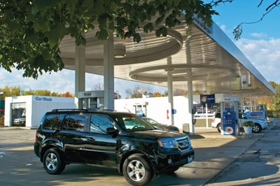


Property Detail
801 E Nerge Rd
07-35-400-008-0000
Cook
Commercialbuilding
Illinois
B and X Area of moderate flood hazard, usually the area between the limits of the 100-year and 500-year floods.
1
2023
0.52 AC
2025
North DuPage
804607
Chicago
4,873 SF
Chicago-Naperville-Elgin, IL-IN
NEARBY LISTINGS FOR SALE OR LEASE
DEMOGRAPHICS near 801 E Nerge Rd
1 mile
3 mile
5 mile
2025 Total Population
13,398
92,445
253,524
2030 Population
13,518
93,201
255,189
Pop Growth 2025-2030
+ 0.90%
+ 0.82%
+ 0.66%
Average Age
42
43
42
2025 Total Households
4,916
35,789
95,491
HH Growth 2025-2030
+ 0.71%
+ 0.63%
+ 0.50%
Median Household Inc
$116,327
$104,764
$97,270
Avg Household Size
2.60
2.50
2.60
2025 Avg HH Vehicles
2.00
2.00
2.00
Median Home Value
$392,608
$354,921
$330,212
Median Year Built
1978
1977
1976
Nearby Places
Map Layers
Map Styles
 Street
 Aerial
Layers
 Traffic
 Biking
Places
Listings with unknown addresses are not visible on the map
- Restaurants
- Banks
- Shops
- Fitness
- Groceries
PUBLIC TRANSPORTATION
COMMUTER RAIL
Roselle Station (Milwaukee District West Line - Northeast Illinois Regional Commuter Railroad (Metra))
Drive
Walk
Distance
Roselle Station (Milwaukee District West Line - Northeast Illinois Regional Commuter Railroad (Metra))
6 min
1.4 mi
Medinah Station (Milwaukee District West Line - Northeast Illinois Regional Commuter Railroad (Metra))
Drive
Walk
Distance
Medinah Station (Milwaukee District West Line - Northeast Illinois Regional Commuter Railroad (Metra))
6 min
2.3 mi
AIRPORT
Chicago O'Hare International
Drive
Walk
Distance
Chicago O'Hare International
27 min
18.0 mi
Chicago Midway International
Drive
Walk
Distance
Chicago Midway International
43 min
31.0 mi
SALE & LEASE HISTORY
LISTING DATE
SALE/LEASE

Sep 13, 2017
For Sale
Nearby Properties
Address
Land Use
TOTAL SIZE
Lot Size
Zoning
Address
Land Use
TOTAL SIZE
Lot Size
Zoning
3,464 SF
60.04 AC
Address
Land Use
TOTAL SIZE
Lot Size
Zoning
18.91 AC
Address
Land Use
TOTAL SIZE
Lot Size
Zoning
782,746 SF
12.44 AC
Address
Land Use
TOTAL SIZE
Lot Size
Zoning
457,762 SF
23 AC
M
Address
Land Use
TOTAL SIZE
Lot Size
Zoning
12.66 AC
Address
Land Use
TOTAL SIZE
Lot Size
Zoning
Address
Land Use
TOTAL SIZE
Lot Size
Zoning
525,422 SF
8.45 AC
C
Address
Land Use
TOTAL SIZE
Lot Size
Zoning
487,027 SF
8.36 AC
C
Address
Land Use
TOTAL SIZE
Lot Size
Zoning
450,614 SF
17.97 AC
C
Address
Land Use
TOTAL SIZE
Lot Size
Zoning
24.82 AC
Address
Land Use
TOTAL SIZE
Lot Size
Zoning
24.82 AC
Address
Land Use
TOTAL SIZE
Lot Size
Zoning
748,059 SF
7.36 AC
Address
Land Use
TOTAL SIZE
Lot Size
Zoning
24.82 AC
Address
Land Use
TOTAL SIZE
Lot Size
Zoning
489,153 SF
18.90 AC
I
Address
Land Use
TOTAL SIZE
Lot Size
Zoning
338,694 SF
12.18 AC
Address
Land Use
TOTAL SIZE
Lot Size
Zoning
288,000 SF
11.05 AC
C
Address
Land Use
TOTAL SIZE
Lot Size
Zoning
Address
Land Use
TOTAL SIZE
Lot Size
Zoning
345,881 SF
12.66 AC
I
Address
Land Use
TOTAL SIZE
Lot Size
Zoning
71,184 SF
22.49 AC
Address
Land Use
TOTAL SIZE
Lot Size
Zoning
290,000 SF
9.08 AC
Address
Land Use
TOTAL SIZE
Lot Size
Zoning
11.13 AC
Address
Land Use
TOTAL SIZE
Lot Size
Zoning
Address
Land Use
TOTAL SIZE
Lot Size
Zoning
101,282 SF
2.34 AC
Address
Land Use
TOTAL SIZE
Lot Size
Zoning
357,241 SF
25.69 AC
Address
Land Use
TOTAL SIZE
Lot Size
Zoning
249,266 SF
15.05 AC
I
Address
Land Use
TOTAL SIZE
Lot Size
Zoning
346,165 SF
3.15 AC
Address
Land Use
TOTAL SIZE
Lot Size
Zoning
66,774 SF
3.46 AC
Address
Land Use
TOTAL SIZE
Lot Size
Zoning
60,372 SF
8.99 AC
I
Address
Land Use
TOTAL SIZE
Lot Size
Zoning
155,610 SF
4.83 AC
C
Address
Land Use
TOTAL SIZE
Lot Size
Zoning
196,090 SF
5.47 AC
C
The World's #1 Commercial Real Estate Marketplace
Connect with us
© 2026 CoStar Group
The information above has been obtained from sources believed reliable. While we do not doubt its accuracy we have not verified it and make no guarantee, warranty or representation about it. It is your responsibility to independently confirm its accuracy and completeness. Any projections, opinions, assumptions, or estimates used are for example only and do not represent the current or future performance of the property. The value of this transaction to you depends on tax and other factors which should be evaluated by your tax, financial, and legal advisors. You and your advisors should conduct a careful, independent investigation of the property to determine to your satisfaction the suitability of the property for your needs.