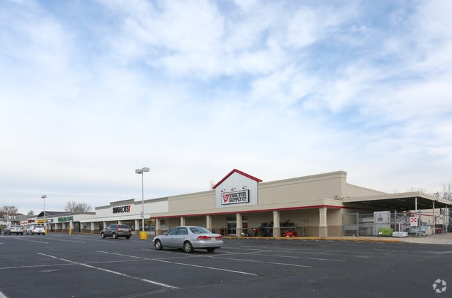
Property Record
801 E Philadelphia Ave, Boyertown, PA 19512

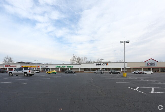

NEARBY LISTINGS FOR SALE OR LEASE
Property Detail
801 E Philadelphia Ave
32-00-05144-008
U 29-35
Regionalshoppingcenterormallwithanchorstore
Montgomery
X
Pennsylvania
42091C0078G
29
2024
11.34 AC
2025
West Montgomery County
208203
Philadelphia
83,400 SF
Philadelphia-Camden-Wilmington, PA-NJ-DE-MD
DEMOGRAPHICS near 801 E Philadelphia Ave
1 Mile
3 Mile
5 Mile
2024 Total Population
6,800
25,348
53,602
2029 Population
6,832
25,525
54,065
Pop Growth 2024-2029
+ 0.47%
+ 0.70%
+ 0.86%
Average Age
41
41
42
2024 Total Households
2,893
9,745
20,260
HH Growth 2024-2029
+ 0.41%
+ 0.61%
+ 0.80%
Median Household Inc
$67,106
$89,444
$93,930
Avg Household Size
2.30
2.60
2.60
2024 Avg HH Vehicles
2.00
2.00
2.00
Median Home Value
$223,832
$273,840
$274,393
Median Year Built
1957
1974
1974
Nearby Places
Map Layers
Map Styles
 Street
 Aerial
- Restaurants
- Banks
- Shops
- Fitness
- Groceries
PUBLIC TRANSPORTATION
AIRPORT
Lehigh Valley International
DRIVE
WALK
Distance
Lehigh Valley International
52 min
28.4 mi
Freight Ports
Port of Philadelphia
DRIVE
WALK
Distance
Port of Philadelphia
70 min
41.3 mi
SALE & LEASE HISTORY
LISTING DATE
SALE/LEASE

Sep 25, 2016
For Lease
Mar 11, 2025
For Lease
Nearby Properties
Address
Land Use
TOTAL SIZE
Lot Size
Zoning
Address
Land Use
TOTAL SIZE
Lot Size
Zoning
165,799 SF
68.37 AC
R50
Address
Land Use
TOTAL SIZE
Lot Size
Zoning
188,596 SF
24.21 AC
Address
Land Use
TOTAL SIZE
Lot Size
Zoning
5.98 AC
M1
Address
Land Use
TOTAL SIZE
Lot Size
Zoning
89,618 SF
11.02 AC
M1
Address
Land Use
TOTAL SIZE
Lot Size
Zoning
71,093 SF
2.64 AC
Address
Land Use
TOTAL SIZE
Lot Size
Zoning
88,494 SF
27.29 AC
IN
Address
Land Use
TOTAL SIZE
Lot Size
Zoning
199,496 SF
20.55 AC
M1
Address
Land Use
TOTAL SIZE
Lot Size
Zoning
47,136 SF
2.49 AC
Address
Land Use
TOTAL SIZE
Lot Size
Zoning
90,925 SF
9.33 AC
GC
Address
Land Use
TOTAL SIZE
Lot Size
Zoning
42,336 SF
4.28 AC
R4
Address
Land Use
TOTAL SIZE
Lot Size
Zoning
224,550 SF
21.20 AC
Address
Land Use
TOTAL SIZE
Lot Size
Zoning
90,648 SF
19.58 AC
R4
Address
Land Use
TOTAL SIZE
Lot Size
Zoning
113,341 SF
11.03 AC
Address
Land Use
TOTAL SIZE
Lot Size
Zoning
48,320 SF
5 AC
GC
Address
Land Use
TOTAL SIZE
Lot Size
Zoning
40,751 SF
12.78 AC
IN
Address
Land Use
TOTAL SIZE
Lot Size
Zoning
65,162 SF
9.05 AC
GC
Address
Land Use
TOTAL SIZE
Lot Size
Zoning
44,060 SF
24.54 AC
Address
Land Use
TOTAL SIZE
Lot Size
Zoning
78,000 SF
9.44 AC
M1
Address
Land Use
TOTAL SIZE
Lot Size
Zoning
236,153 SF
30.47 AC
M2
Address
Land Use
TOTAL SIZE
Lot Size
Zoning
20,460 SF
3.50 AC
R4
Address
Land Use
TOTAL SIZE
Lot Size
Zoning
264,545 SF
17.18 AC
Address
Land Use
TOTAL SIZE
Lot Size
Zoning
161,138 SF
160.99 AC
Address
Land Use
TOTAL SIZE
Lot Size
Zoning
73,397 SF
4.36 AC
M1
Address
Land Use
TOTAL SIZE
Lot Size
Zoning
19,632 SF
4.31 AC
IN
Address
Land Use
TOTAL SIZE
Lot Size
Zoning
27,733 SF
2 AC
IN
Address
Land Use
TOTAL SIZE
Lot Size
Zoning
15,296 SF
6.96 AC
IN
Address
Land Use
TOTAL SIZE
Lot Size
Zoning
23,300 SF
9.88 AC
R15
Address
Land Use
TOTAL SIZE
Lot Size
Zoning
64.55 AC
R15
Address
Land Use
TOTAL SIZE
Lot Size
Zoning
18,920 SF
6.17 AC
GC
The World's #1 Commercial Real Estate Marketplace
Connect with us
© 2026 CoStar Group
The information above has been obtained from sources believed reliable. While we do not doubt its accuracy we have not verified it and make no guarantee, warranty or representation about it. It is your responsibility to independently confirm its accuracy and completeness. Any projections, opinions, assumptions, or estimates used are for example only and do not represent the current or future performance of the property. The value of this transaction to you depends on tax and other factors which should be evaluated by your tax, financial, and legal advisors. You and your advisors should conduct a careful, independent investigation of the property to determine to your satisfaction the suitability of the property for your needs.