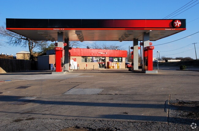
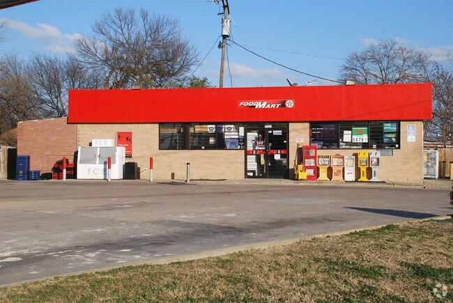
Property Record
801 E University Dr, Mckinney, TX 75069


Property Detail
801 E University Dr
R-0905-001-0020-1
MASSIE HEIGHTS ADDITION, BLK 1, LOT 2-7A
Commercialnec
COLLIN
ML
Texas
B and X Area of moderate flood hazard, usually the area between the limits of the 100-year and 500-year floods.
2
2025
0.52 AC
2025
McKinney
030901
Dallas/Ft Worth
1,152 SF
Dallas-Fort Worth-Arlington, TX
NEARBY LISTINGS FOR SALE OR LEASE
DEMOGRAPHICS near 801 E University Dr
1 mile
3 mile
5 mile
2025 Total Population
6,382
48,699
122,764
2030 Population
7,314
55,942
141,413
Pop Growth 2025-2030
+ 14.60%
+ 14.87%
+ 15.19%
Average Age
36
37
38
2025 Total Households
2,156
17,501
43,062
HH Growth 2025-2030
+ 14.94%
+ 15.04%
+ 15.43%
Median Household Inc
$85,183
$84,164
$104,487
Avg Household Size
2.80
2.70
2.70
2025 Avg HH Vehicles
2.00
2.00
2.00
Median Home Value
$392,288
$394,782
$475,838
Median Year Built
1994
1997
2004
Nearby Places
Map Layers
Map Styles
 Street
 Aerial
Transit
 Traffic
 Biking
Places
Listings with unknown addresses are not visible on the map
- Restaurants
- Banks
- Shops
- Fitness
- Groceries
PUBLIC TRANSPORTATION
AIRPORT
Dallas Love Field
Drive
Walk
Distance
Dallas Love Field
45 min
36.5 mi
Dallas-Fort Worth International
Drive
Walk
Distance
Dallas-Fort Worth International
45 min
37.8 mi
Nearby Properties
Address
Land Use
TOTAL SIZE
Lot Size
Zoning
Address
Land Use
TOTAL SIZE
Lot Size
Zoning
1,826,199 SF
117.79 AC
Address
Land Use
TOTAL SIZE
Lot Size
Zoning
1,532,548 SF
270.56 AC
Address
Land Use
TOTAL SIZE
Lot Size
Zoning
755,827 SF
52.76 AC
O
Address
Land Use
TOTAL SIZE
Lot Size
Zoning
582,987 SF
63.07 AC
Address
Land Use
TOTAL SIZE
Lot Size
Zoning
475,847 SF
16.34 AC
RG-18
Address
Land Use
TOTAL SIZE
Lot Size
Zoning
412,593 SF
17.24 AC
Address
Land Use
TOTAL SIZE
Lot Size
Zoning
879,029 SF
50.26 AC
ML
Address
Land Use
TOTAL SIZE
Lot Size
Zoning
727,459 SF
48.83 AC
Address
Land Use
TOTAL SIZE
Lot Size
Zoning
725,223 SF
46.60 AC
Address
Land Use
TOTAL SIZE
Lot Size
Zoning
360,057 SF
12.65 AC
C
Address
Land Use
TOTAL SIZE
Lot Size
Zoning
1,708,448 SF
85.24 AC
Address
Land Use
TOTAL SIZE
Lot Size
Zoning
697,149 SF
45.08 AC
Address
Land Use
TOTAL SIZE
Lot Size
Zoning
196,145 SF
18.05 AC
Address
Land Use
TOTAL SIZE
Lot Size
Zoning
201,484 SF
48.39 AC
PD/ML
Address
Land Use
TOTAL SIZE
Lot Size
Zoning
232,400 SF
13.32 AC
RG-18
Address
Land Use
TOTAL SIZE
Lot Size
Zoning
193,037 SF
12.35 AC
MF-M
Address
Land Use
TOTAL SIZE
Lot Size
Zoning
244,074 SF
13.97 AC
Address
Land Use
TOTAL SIZE
Lot Size
Zoning
131,417 SF
12 AC
AG
Address
Land Use
TOTAL SIZE
Lot Size
Zoning
151,317 SF
11.58 AC
Address
Land Use
TOTAL SIZE
Lot Size
Zoning
304,565 SF
19.09 AC
COMM
Address
Land Use
TOTAL SIZE
Lot Size
Zoning
298,992 SF
16.82 AC
LI
Address
Land Use
TOTAL SIZE
Lot Size
Zoning
174,624 SF
10.05 AC
Address
Land Use
TOTAL SIZE
Lot Size
Zoning
279,356 SF
16.24 AC
COMM
Address
Land Use
TOTAL SIZE
Lot Size
Zoning
96,408 SF
16.65 AC
Address
Land Use
TOTAL SIZE
Lot Size
Zoning
167,735 SF
5.08 AC
PD
Address
Land Use
TOTAL SIZE
Lot Size
Zoning
201,899 SF
9.77 AC
MF-M
Address
Land Use
TOTAL SIZE
Lot Size
Zoning
186,291 SF
11.13 AC
Address
Land Use
TOTAL SIZE
Lot Size
Zoning
195,589 SF
12.54 AC
RG-18
Address
Land Use
TOTAL SIZE
Lot Size
Zoning
144,545 SF
13.21 AC
COMM MULTI
Address
Land Use
TOTAL SIZE
Lot Size
Zoning
140,803 SF
25 AC
The World's #1 Commercial Real Estate Marketplace
Connect with us
© 2026 CoStar Group
The information above has been obtained from sources believed reliable. While we do not doubt its accuracy we have not verified it and make no guarantee, warranty or representation about it. It is your responsibility to independently confirm its accuracy and completeness. Any projections, opinions, assumptions, or estimates used are for example only and do not represent the current or future performance of the property. The value of this transaction to you depends on tax and other factors which should be evaluated by your tax, financial, and legal advisors. You and your advisors should conduct a careful, independent investigation of the property to determine to your satisfaction the suitability of the property for your needs.