Property Record
801 E Woodcroft Pky, Durham, NC 27713
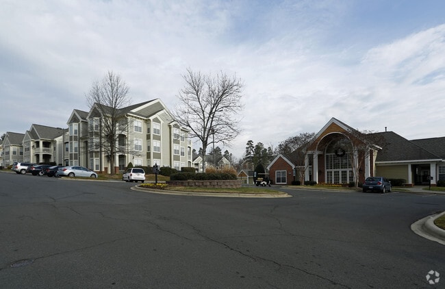

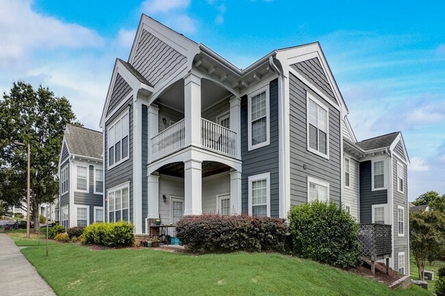

Property Detail
801 E Woodcroft Pky
154367
AUBURN/POD:01-02 DBA/SOUTH TERRACE AT AUBU PL:000145-000186
Gardenaptcourtapt5plusunits
Durham
PDR 5.370
North Carolina
B and X Area of moderate flood hazard, usually the area between the limits of the 100-year and 500-year floods.
25.34 AC
2025
Woodcroft
2025
Raleigh/Durham
002035
Durham-Chapel Hill, NC
7,241 SF
NEARBY LISTINGS FOR SALE OR LEASE
-
-
View all Durham listings for sale on LoopNet.com
DEMOGRAPHICS near 801 E Woodcroft Pky
1 mile
3 mile
5 mile
2025 Total Population
13,026
61,225
145,877
2030 Population
13,620
64,391
155,014
Pop Growth 2025-2030
+ 4.56%
+ 5.17%
+ 6.26%
Average Age
37
39
38
2025 Total Households
6,325
27,161
63,134
HH Growth 2025-2030
+ 4.73%
+ 5.33%
+ 6.48%
Median Household Inc
$95,553
$97,579
$90,774
Avg Household Size
2.00
2.20
2.20
2025 Avg HH Vehicles
2.00
2.00
2.00
Median Home Value
$401,698
$427,793
$448,411
Median Year Built
1999
1996
1997
Nearby Places
Map Layers
Map Styles
 Street
 Aerial
Layers
 Traffic
 Biking
Places
Listings with unknown addresses are not visible on the map
- Restaurants
- Banks
- Shops
- Fitness
- Groceries
PUBLIC TRANSPORTATION
COMMUTER RAIL
Durham Amtrak Station (Carolinian - Amtrak, Piedmont - Amtrak)
Drive
Walk
Distance
Durham Amtrak Station (Carolinian - Amtrak, Piedmont - Amtrak)
15 min
7.1 mi
AIRPORT
Raleigh-Durham International
Drive
Walk
Distance
Raleigh-Durham International
17 min
10.0 mi
Freight Ports
Port of Wilmington
Drive
Walk
Distance
Port of Wilmington
177 min
154.1 mi
Nearby Properties
Address
Land Use
TOTAL SIZE
Lot Size
Zoning
Address
Land Use
TOTAL SIZE
Lot Size
Zoning
778,433 SF
90.38 AC
CC(D)
Address
Land Use
TOTAL SIZE
Lot Size
Zoning
875,384 SF
111.74 AC
SRP
Address
Land Use
TOTAL SIZE
Lot Size
Zoning
1,378,965 SF
183.46 AC
SRP
Address
Land Use
TOTAL SIZE
Lot Size
Zoning
11,568 SF
39.56 AC
RS-M(D)
Address
Land Use
TOTAL SIZE
Lot Size
Zoning
444,254 SF
58.71 AC
SRP
Address
Land Use
TOTAL SIZE
Lot Size
Zoning
35.03 AC
RS-M(D)
Address
Land Use
TOTAL SIZE
Lot Size
Zoning
23,889 SF
50.95 AC
OI
Address
Land Use
TOTAL SIZE
Lot Size
Zoning
7,080 SF
30.67 AC
OI,RS-M
Address
Land Use
TOTAL SIZE
Lot Size
Zoning
6,948 SF
21.22 AC
RS-M(D)
Address
Land Use
TOTAL SIZE
Lot Size
Zoning
10,143 SF
46.78 AC
PDR 5.940
Address
Land Use
TOTAL SIZE
Lot Size
Zoning
8,199 SF
28.28 AC
PDR 12.000
Address
Land Use
TOTAL SIZE
Lot Size
Zoning
555,485 SF
34.84 AC
SRP
Address
Land Use
TOTAL SIZE
Lot Size
Zoning
4,744 SF
12.90 AC
MU(D)
Address
Land Use
TOTAL SIZE
Lot Size
Zoning
9,816 SF
26.57 AC
RS-M
Address
Land Use
TOTAL SIZE
Lot Size
Zoning
9,696 SF
20.94 AC
RS-M(D)
Address
Land Use
TOTAL SIZE
Lot Size
Zoning
13,634 SF
32.31 AC
RS-M
Address
Land Use
TOTAL SIZE
Lot Size
Zoning
12,864 SF
24.27 AC
RS-M
Address
Land Use
TOTAL SIZE
Lot Size
Zoning
240,537 SF
43.98 AC
IL
Address
Land Use
TOTAL SIZE
Lot Size
Zoning
217,507 SF
71.32 AC
CG(D)
Address
Land Use
TOTAL SIZE
Lot Size
Zoning
12,432 SF
26.15 AC
RS-M(D)
Address
Land Use
TOTAL SIZE
Lot Size
Zoning
373,374 SF
109.27 AC
RU-5
Address
Land Use
TOTAL SIZE
Lot Size
Zoning
411,834 SF
29.02 AC
IP(D)
Address
Land Use
TOTAL SIZE
Lot Size
Zoning
12,366 SF
46.02 AC
RS-M(D)
Address
Land Use
TOTAL SIZE
Lot Size
Zoning
12,150 SF
104.62 AC
SRP
Address
Land Use
TOTAL SIZE
Lot Size
Zoning
11,748 SF
35.02 AC
PDR 8.130
Address
Land Use
TOTAL SIZE
Lot Size
Zoning
1,846 SF
31.05 AC
PDR 3.650
Address
Land Use
TOTAL SIZE
Lot Size
Zoning
105.27 AC
SRP
Address
Land Use
TOTAL SIZE
Lot Size
Zoning
6,000 SF
27.57 AC
RS-M
Address
Land Use
TOTAL SIZE
Lot Size
Zoning
303,620 SF
150.86 AC
SRP
The World's #1 Commercial Real Estate Marketplace
Connect with us
© 2026 CoStar Group
The information above has been obtained from sources believed reliable. While we do not doubt its accuracy we have not verified it and make no guarantee, warranty or representation about it. It is your responsibility to independently confirm its accuracy and completeness. Any projections, opinions, assumptions, or estimates used are for example only and do not represent the current or future performance of the property. The value of this transaction to you depends on tax and other factors which should be evaluated by your tax, financial, and legal advisors. You and your advisors should conduct a careful, independent investigation of the property to determine to your satisfaction the suitability of the property for your needs.