Property Record
801 Jane St, Casper, WY 82601
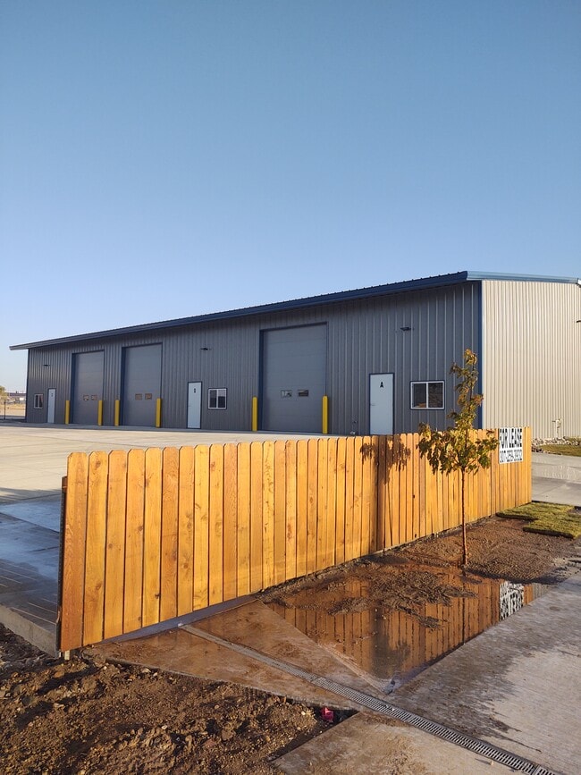

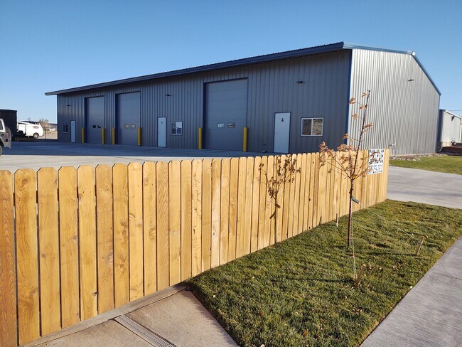
Property Detail
801 Jane St
Casper, WY
FLEMING LOT 1
33-79-03-1-0-200800
Natrona
Warehouse
Wyoming
C and X Area of minimal flood hazard, usually depicted on FIRMs as above the 500-year flood level.
1
2025
0.37 AC
2025
I-25 Corridor/Casper
000200
Other Market Areas
6,615 SF
NEARBY LISTINGS FOR SALE OR LEASE
DEMOGRAPHICS near 801 Jane St
1 mile
3 mile
5 mile
2025 Total Population
5,572
41,103
61,862
2030 Population
5,716
41,643
62,604
Pop Growth 2025-2030
+ 2.58%
+ 1.31%
+ 1.20%
Average Age
41
40
40
2025 Total Households
2,644
17,853
25,946
HH Growth 2025-2030
+ 2.69%
+ 1.37%
+ 1.26%
Median Household Inc
$50,597
$65,225
$69,826
Avg Household Size
2.00
2.20
2.30
2025 Avg HH Vehicles
2.00
2.00
2.00
Median Home Value
$164,121
$249,985
$260,481
Median Year Built
1953
1971
1974
Nearby Places
Map Layers
Map Styles
 Street
 Aerial
Layers
 Traffic
 Biking
Places
Listings with unknown addresses are not visible on the map
- Restaurants
- Banks
- Shops
- Fitness
- Groceries
SALE & LEASE HISTORY
LISTING DATE
SALE/LEASE

Oct 23, 2023
For Lease
May 30, 2020
For Lease
Feb 18, 2025
For Lease
Aug 28, 2025
For Lease
Nearby Properties
Address
Land Use
TOTAL SIZE
Lot Size
Zoning
Address
Land Use
TOTAL SIZE
Lot Size
Zoning
4,660 SF
13.18 AC
Address
Land Use
TOTAL SIZE
Lot Size
Zoning
12,674 SF
13.26 AC
Address
Land Use
TOTAL SIZE
Lot Size
Zoning
38,736 SF
8.91 AC
Address
Land Use
TOTAL SIZE
Lot Size
Zoning
4,384 SF
13.74 AC
Address
Land Use
TOTAL SIZE
Lot Size
Zoning
156,457 SF
5.74 AC
Address
Land Use
TOTAL SIZE
Lot Size
Zoning
102,996 SF
4.81 AC
Address
Land Use
TOTAL SIZE
Lot Size
Zoning
53,685 SF
4.28 AC
Address
Land Use
TOTAL SIZE
Lot Size
Zoning
16,924 SF
9.54 AC
Address
Land Use
TOTAL SIZE
Lot Size
Zoning
95,290 SF
0.57 AC
Address
Land Use
TOTAL SIZE
Lot Size
Zoning
99,524 SF
4.67 AC
Address
Land Use
TOTAL SIZE
Lot Size
Zoning
81,240 SF
5.86 AC
Address
Land Use
TOTAL SIZE
Lot Size
Zoning
585,921 SF
58.85 AC
Address
Land Use
TOTAL SIZE
Lot Size
Zoning
52,040 SF
13.51 AC
Address
Land Use
TOTAL SIZE
Lot Size
Zoning
166,099 SF
7.65 AC
Address
Land Use
TOTAL SIZE
Lot Size
Zoning
89,892 SF
2.75 AC
Address
Land Use
TOTAL SIZE
Lot Size
Zoning
10,928 SF
6.90 AC
Address
Land Use
TOTAL SIZE
Lot Size
Zoning
206,796 SF
18.06 AC
Address
Land Use
TOTAL SIZE
Lot Size
Zoning
89,995 SF
6.68 AC
Address
Land Use
TOTAL SIZE
Lot Size
Zoning
68,887 SF
8.02 AC
Address
Land Use
TOTAL SIZE
Lot Size
Zoning
54,112 SF
3.52 AC
Address
Land Use
TOTAL SIZE
Lot Size
Zoning
40,414 SF
0.03 AC
Address
Land Use
TOTAL SIZE
Lot Size
Zoning
36,379 SF
4.02 AC
Address
Land Use
TOTAL SIZE
Lot Size
Zoning
70,772 SF
11.68 AC
Address
Land Use
TOTAL SIZE
Lot Size
Zoning
110,360 SF
12.85 AC
Address
Land Use
TOTAL SIZE
Lot Size
Zoning
92,078 SF
5.52 AC
Address
Land Use
TOTAL SIZE
Lot Size
Zoning
68,174 SF
3.86 AC
Address
Land Use
TOTAL SIZE
Lot Size
Zoning
21,120 SF
16.73 AC
Address
Land Use
TOTAL SIZE
Lot Size
Zoning
29,040 SF
5.35 AC
Address
Land Use
TOTAL SIZE
Lot Size
Zoning
82,800 SF
5.94 AC
Address
Land Use
TOTAL SIZE
Lot Size
Zoning
119,046 SF
12.71 AC
The World's #1 Commercial Real Estate Marketplace
Connect with us
© 2026 CoStar Group
The information above has been obtained from sources believed reliable. While we do not doubt its accuracy we have not verified it and make no guarantee, warranty or representation about it. It is your responsibility to independently confirm its accuracy and completeness. Any projections, opinions, assumptions, or estimates used are for example only and do not represent the current or future performance of the property. The value of this transaction to you depends on tax and other factors which should be evaluated by your tax, financial, and legal advisors. You and your advisors should conduct a careful, independent investigation of the property to determine to your satisfaction the suitability of the property for your needs.