Property Record
801 Limona Rd, Brandon, FL 33510
NEARBY LISTINGS FOR SALE OR LEASE
-
-
View all Brandon listings for sale on LoopNet.com
Property Detail
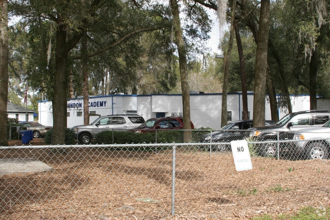
801 Limona Rd
Tampa-St. Petersburg-Clearwater, FL
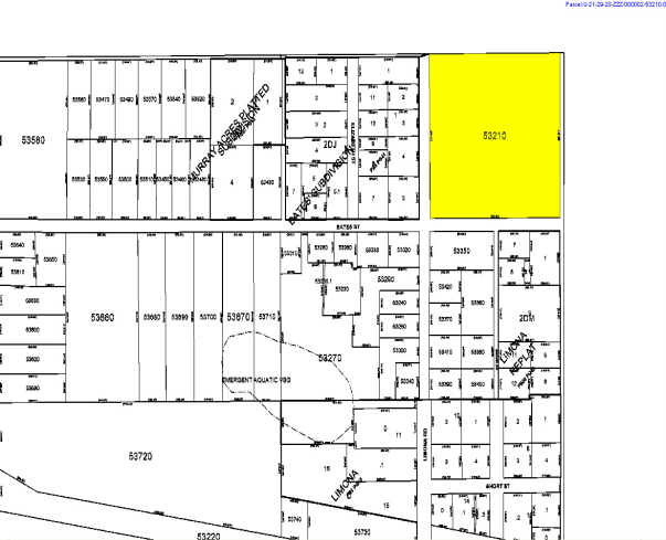
Unplatted
U-21-29-20-ZZZ-000002-53210.0
NE 1/4 OF NE 1/4 OF NE 1/4
Privateschool
Hillsborough
X
Florida
12057C0385H
53210
2024
8.91 AC
2025
East Tampa
012301
Tampa/St Petersburg
38,747 SF
DEMOGRAPHICS near 801 Limona Rd
1 mile
3 mile
5 mile
2024 Total Population
9,598
93,316
215,094
2029 Population
10,393
101,745
234,634
Pop Growth 2024-2029
+ 8.28%
+ 9.03%
+ 9.08%
Average Age
40
38
39
2024 Total Households
3,611
35,530
82,057
HH Growth 2024-2029
+ 8.50%
+ 9.56%
+ 9.48%
Median Household Inc
$70,388
$63,401
$65,094
Avg Household Size
2.50
2.50
2.50
2024 Avg HH Vehicles
2.00
2.00
2.00
Median Home Value
$271,859
$250,274
$261,200
Median Year Built
1986
1991
1993
Nearby Places
Map Layers
Map Styles
 Street
 Aerial
Transit
 Traffic
 Biking
Places
Listings with unknown addresses are not visible on the map
- Restaurants
- Banks
- Shops
- Fitness
- Groceries
PUBLIC TRANSPORTATION
AIRPORT
Tampa International
Drive
Walk
Distance
Tampa International
32 min
19.7 mi
St Pete-Clearwater International
Drive
Walk
Distance
St Pete-Clearwater International
49 min
28.9 mi
Freight Ports
Port of Tampa Bay
Drive
Walk
Distance
Port of Tampa Bay
21 min
11.8 mi
Nearby Properties
Address
Land Use
TOTAL SIZE
Lot Size
Zoning
Address
Land Use
TOTAL SIZE
Lot Size
Zoning
733,263 SF
72.88 AC
PD
Address
Land Use
TOTAL SIZE
Lot Size
Zoning
1,122,007 SF
181.48 AC
PD
Address
Land Use
TOTAL SIZE
Lot Size
Zoning
868,482 SF
60.83 AC
PD
Address
Land Use
TOTAL SIZE
Lot Size
Zoning
676,710 SF
64.79 AC
PD
Address
Land Use
TOTAL SIZE
Lot Size
Zoning
589,526 SF
18.06 AC
PD
Address
Land Use
TOTAL SIZE
Lot Size
Zoning
574,867 SF
31.07 AC
PD
Address
Land Use
TOTAL SIZE
Lot Size
Zoning
536,433 SF
18.23 AC
PD
Address
Land Use
TOTAL SIZE
Lot Size
Zoning
92,431 SF
175.42 AC
PD
Address
Land Use
TOTAL SIZE
Lot Size
Zoning
501,085 SF
41.18 AC
PD
Address
Land Use
TOTAL SIZE
Lot Size
Zoning
349,931 SF
19.43 AC
PD
Address
Land Use
TOTAL SIZE
Lot Size
Zoning
92,431 SF
161.99 AC
PD
Address
Land Use
TOTAL SIZE
Lot Size
Zoning
466,038 SF
26.75 AC
PD
Address
Land Use
TOTAL SIZE
Lot Size
Zoning
399,989 SF
25.63 AC
PD
Address
Land Use
TOTAL SIZE
Lot Size
Zoning
491,498 SF
35.60 AC
PD
Address
Land Use
TOTAL SIZE
Lot Size
Zoning
427,830 SF
23.95 AC
PD
Address
Land Use
TOTAL SIZE
Lot Size
Zoning
398,440 SF
48.63 AC
IPD-1
Address
Land Use
TOTAL SIZE
Lot Size
Zoning
317,413 SF
14.60 AC
PD
Address
Land Use
TOTAL SIZE
Lot Size
Zoning
343,903 SF
16.71 AC
PD
Address
Land Use
TOTAL SIZE
Lot Size
Zoning
358,987 SF
49.16 AC
PD
Address
Land Use
TOTAL SIZE
Lot Size
Zoning
402,388 SF
34.49 AC
PD
Address
Land Use
TOTAL SIZE
Lot Size
Zoning
105,896 SF
38.08 AC
PD
Address
Land Use
TOTAL SIZE
Lot Size
Zoning
378,173 SF
20.06 AC
PD
Address
Land Use
TOTAL SIZE
Lot Size
Zoning
337,223 SF
35.27 AC
PD
Address
Land Use
TOTAL SIZE
Lot Size
Zoning
328,279 SF
15.31 AC
PD
Address
Land Use
TOTAL SIZE
Lot Size
Zoning
391,668 SF
27.43 AC
PD
Address
Land Use
TOTAL SIZE
Lot Size
Zoning
273,935 SF
15.42 AC
PD
Address
Land Use
TOTAL SIZE
Lot Size
Zoning
340,192 SF
18.70 AC
PD
Address
Land Use
TOTAL SIZE
Lot Size
Zoning
283,777 SF
36.66 AC
PD
Address
Land Use
TOTAL SIZE
Lot Size
Zoning
135,692 SF
11.13 AC
PD
Address
Land Use
TOTAL SIZE
Lot Size
Zoning
138,310 SF
11.63 AC
PD
The World's #1 Commercial Real Estate Marketplace
Connect with us
© 2026 CoStar Group
The information above has been obtained from sources believed reliable. While we do not doubt its accuracy we have not verified it and make no guarantee, warranty or representation about it. It is your responsibility to independently confirm its accuracy and completeness. Any projections, opinions, assumptions, or estimates used are for example only and do not represent the current or future performance of the property. The value of this transaction to you depends on tax and other factors which should be evaluated by your tax, financial, and legal advisors. You and your advisors should conduct a careful, independent investigation of the property to determine to your satisfaction the suitability of the property for your needs.