Property Record
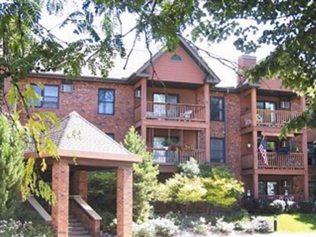
801 Main St, La Crosse, WI 54601


Property Detail
801 Main St
La Crosse-Onalaska, WI-MN
T BURNS G FARNUM & P BURNS ADDITION LOTS 1-6 & LOTS 10-12 & VAC ALLEY ADJ TO ABOVE LOTS BLOCK 4 & W1/2 VAC ALLEY ADJ ON E IN V1332 P19 EX PRT FOR RD SUBJ TO ESMT IN DOC NO. 1549536
017020166050
La Crosse
Commercialnec
Wisconsin
MZA
1-6,1
B and X Area of moderate flood hazard, usually the area between the limits of the 100-year and 500-year floods.
1.70 AC
2025
Downtown La Crosse
2025
Other Market Areas
000401
NEARBY LISTINGS FOR SALE OR LEASE
-
-
View all La Crosse listings for sale on LoopNet.com
DEMOGRAPHICS near 801 Main St
1 mile
3 mile
5 mile
2025 Total Population
17,724
50,737
73,358
2030 Population
17,738
51,505
73,902
Pop Growth 2025-2030
+ 0.08%
+ 1.51%
+ 0.74%
Average Age
31
37
39
2025 Total Households
6,502
21,807
31,904
HH Growth 2025-2030
+ 0.23%
+ 1.82%
+ 0.87%
Median Household Inc
$40,651
$52,469
$58,393
Avg Household Size
2.00
2.00
2.10
2025 Avg HH Vehicles
2.00
2.00
2.00
Median Home Value
$236,660
$211,717
$237,987
Median Year Built
1970
1966
1971
Nearby Places
Map Layers
Map Styles
 Street
 Aerial
Layers
 Traffic
 Biking
Places
Listings with unknown addresses are not visible on the map
- Restaurants
- Banks
- Shops
- Fitness
- Groceries
PUBLIC TRANSPORTATION
COMMUTER RAIL
La Crosse (Empire Builder - Amtrak)
Drive
Walk
Distance
La Crosse (Empire Builder - Amtrak)
6 min
2.1 mi
AIRPORT
La Crosse Regional
Drive
Walk
Distance
La Crosse Regional
17 min
6.6 mi
Freight Ports
Port Milwaukee
Drive
Walk
Distance
Port Milwaukee
237 min
211.5 mi
Nearby Properties
Address
Land Use
TOTAL SIZE
Lot Size
Zoning
Address
Land Use
TOTAL SIZE
Lot Size
Zoning
38,407 SF
3.12 AC
MZA
Address
Land Use
TOTAL SIZE
Lot Size
Zoning
4.65 AC
Address
Land Use
TOTAL SIZE
Lot Size
Zoning
12.60 AC
MZA
Address
Land Use
TOTAL SIZE
Lot Size
Zoning
54.26 AC
MZA
Address
Land Use
TOTAL SIZE
Lot Size
Zoning
131,552 SF
0.89 AC
Address
Land Use
TOTAL SIZE
Lot Size
Zoning
11.40 AC
MZA
Address
Land Use
TOTAL SIZE
Lot Size
Zoning
3.91 AC
Address
Land Use
TOTAL SIZE
Lot Size
Zoning
0.75 AC
MZA
Address
Land Use
TOTAL SIZE
Lot Size
Zoning
4.81 AC
Address
Land Use
TOTAL SIZE
Lot Size
Zoning
5.29 AC
MZA
Address
Land Use
TOTAL SIZE
Lot Size
Zoning
0.12 AC
Address
Land Use
TOTAL SIZE
Lot Size
Zoning
11.56 AC
Address
Land Use
TOTAL SIZE
Lot Size
Zoning
0.56 AC
MZA
Address
Land Use
TOTAL SIZE
Lot Size
Zoning
10.21 AC
MZA
Address
Land Use
TOTAL SIZE
Lot Size
Zoning
5.79 AC
MZA
Address
Land Use
TOTAL SIZE
Lot Size
Zoning
2.43 AC
Address
Land Use
TOTAL SIZE
Lot Size
Zoning
73,056 SF
0.62 AC
Address
Land Use
TOTAL SIZE
Lot Size
Zoning
15.48 AC
MZA
Address
Land Use
TOTAL SIZE
Lot Size
Zoning
81,664 SF
1.06 AC
MZA
Address
Land Use
TOTAL SIZE
Lot Size
Zoning
162,355 SF
13.90 AC
MZA
Address
Land Use
TOTAL SIZE
Lot Size
Zoning
2.10 AC
MZA
Address
Land Use
TOTAL SIZE
Lot Size
Zoning
8.98 AC
MZA
Address
Land Use
TOTAL SIZE
Lot Size
Zoning
7.88 AC
IND
Address
Land Use
TOTAL SIZE
Lot Size
Zoning
32,153 SF
3.16 AC
MZA
Address
Land Use
TOTAL SIZE
Lot Size
Zoning
64,480 SF
0.69 AC
MZA
Address
Land Use
TOTAL SIZE
Lot Size
Zoning
1.20 AC
MZA
Address
Land Use
TOTAL SIZE
Lot Size
Zoning
1.19 AC
Address
Land Use
TOTAL SIZE
Lot Size
Zoning
0.50 AC
Address
Land Use
TOTAL SIZE
Lot Size
Zoning
2.12 AC
MZA
Address
Land Use
TOTAL SIZE
Lot Size
Zoning
5.01 AC
MZA
The World's #1 Commercial Real Estate Marketplace
Connect with us
© 2026 CoStar Group
The information above has been obtained from sources believed reliable. While we do not doubt its accuracy we have not verified it and make no guarantee, warranty or representation about it. It is your responsibility to independently confirm its accuracy and completeness. Any projections, opinions, assumptions, or estimates used are for example only and do not represent the current or future performance of the property. The value of this transaction to you depends on tax and other factors which should be evaluated by your tax, financial, and legal advisors. You and your advisors should conduct a careful, independent investigation of the property to determine to your satisfaction the suitability of the property for your needs.