Property Record
801 S Glenstone Ave, Springfield, MO 65802


NEARBY LISTINGS FOR SALE OR LEASE
Property Detail
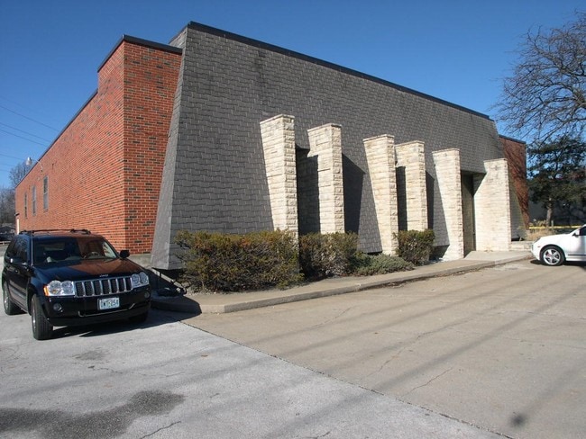
801 S Glenstone Ave
12-19-427-023
BEG NE COR SE1/4 SE1/4 19/29/21 S 117 FT W TO RR R/W NWLY AL G R/W TO E LNKENTWOOD DR E TO BEG 19/29/21
Officebuilding
Greene
X
Missouri
29077C0334E
0.61 AC
2025
Northeast
2025
Springfield
000900
Springfield, MO
10,028 SF
DEMOGRAPHICS near 801 S Glenstone Ave
1 Mile
3 Mile
5 Mile
2024 Total Population
9,630
87,277
173,273
2029 Population
9,976
90,797
180,199
Pop Growth 2024-2029
+ 3.59%
+ 4.03%
+ 4.00%
Average Age
36
37
39
2024 Total Households
4,890
38,452
77,259
HH Growth 2024-2029
+ 3.78%
+ 4.30%
+ 4.25%
Median Household Inc
$40,489
$43,128
$44,439
Avg Household Size
1.90
2.00
2.10
2024 Avg HH Vehicles
1.00
2.00
2.00
Median Home Value
$185,304
$153,682
$160,338
Median Year Built
1967
1969
1976
Nearby Places
Map Layers
Map Styles
 Street
 Aerial
- Restaurants
- Banks
- Shops
- Fitness
- Groceries
PUBLIC TRANSPORTATION
AIRPORT
Springfield-Branson Ntl
DRIVE
WALK
Distance
Springfield-Branson Ntl
26 min
14.6 mi
Freight Ports
Tulsa Port of Inola
DRIVE
WALK
Distance
Tulsa Port of Inola
198 min
173.8 mi
SALE & LEASE HISTORY
LISTING DATE
SALE/LEASE

Sep 15, 2021
For Sale
Oct 20, 2017
For Lease
Mar 20, 2017
For Lease
Mar 20, 2017
For Sale
Mar 01, 2017
For Sale
Apr 22, 2024
For Lease
Apr 22, 2024
For Sale
Nearby Properties
Address
Land Use
TOTAL SIZE
Lot Size
Zoning
Address
Land Use
TOTAL SIZE
Lot Size
Zoning
11.54 AC
Address
Land Use
TOTAL SIZE
Lot Size
Zoning
2,981,315 SF
76.43 AC
INC
Address
Land Use
TOTAL SIZE
Lot Size
Zoning
35.56 AC
INC
Address
Land Use
TOTAL SIZE
Lot Size
Zoning
343,758 SF
29.81 AC
INC
Address
Land Use
TOTAL SIZE
Lot Size
Zoning
297,760 SF
4.22 AC
INC
Address
Land Use
TOTAL SIZE
Lot Size
Zoning
299,725 SF
18.80 AC
INC
Address
Land Use
TOTAL SIZE
Lot Size
Zoning
233,445 SF
8.17 AC
INC
Address
Land Use
TOTAL SIZE
Lot Size
Zoning
1,728,457 SF
123.60 AC
INC
Address
Land Use
TOTAL SIZE
Lot Size
Zoning
12.35 AC
INC
Address
Land Use
TOTAL SIZE
Lot Size
Zoning
779,221 SF
45.03 AC
INC
Address
Land Use
TOTAL SIZE
Lot Size
Zoning
2.31 AC
INC
Address
Land Use
TOTAL SIZE
Lot Size
Zoning
18.35 AC
Address
Land Use
TOTAL SIZE
Lot Size
Zoning
224,730 SF
19.99 AC
INC
Address
Land Use
TOTAL SIZE
Lot Size
Zoning
355,759 SF
2.23 AC
INC
Address
Land Use
TOTAL SIZE
Lot Size
Zoning
2.76 AC
INC.
Address
Land Use
TOTAL SIZE
Lot Size
Zoning
10.29 AC
INC.
Address
Land Use
TOTAL SIZE
Lot Size
Zoning
805,370 SF
54.30 AC
INC
Address
Land Use
TOTAL SIZE
Lot Size
Zoning
13.88 AC
INC
Address
Land Use
TOTAL SIZE
Lot Size
Zoning
51.65 AC
INC
Address
Land Use
TOTAL SIZE
Lot Size
Zoning
1,825 SF
4.31 AC
INC
Address
Land Use
TOTAL SIZE
Lot Size
Zoning
211,041 SF
19.13 AC
INC
Address
Land Use
TOTAL SIZE
Lot Size
Zoning
25.51 AC
INC
Address
Land Use
TOTAL SIZE
Lot Size
Zoning
4.63 AC
O-2
Address
Land Use
TOTAL SIZE
Lot Size
Zoning
5.47 AC
INC
Address
Land Use
TOTAL SIZE
Lot Size
Zoning
1.99 AC
INC
Address
Land Use
TOTAL SIZE
Lot Size
Zoning
108,153 SF
7.37 AC
INC.
Address
Land Use
TOTAL SIZE
Lot Size
Zoning
324,341 SF
43 AC
INC
Address
Land Use
TOTAL SIZE
Lot Size
Zoning
20.11 AC
INC
Address
Land Use
TOTAL SIZE
Lot Size
Zoning
16.73 AC
Address
Land Use
TOTAL SIZE
Lot Size
Zoning
16.41 AC
INC
The World's #1 Commercial Real Estate Marketplace
Connect with us
© 2026 CoStar Group
The information above has been obtained from sources believed reliable. While we do not doubt its accuracy we have not verified it and make no guarantee, warranty or representation about it. It is your responsibility to independently confirm its accuracy and completeness. Any projections, opinions, assumptions, or estimates used are for example only and do not represent the current or future performance of the property. The value of this transaction to you depends on tax and other factors which should be evaluated by your tax, financial, and legal advisors. You and your advisors should conduct a careful, independent investigation of the property to determine to your satisfaction the suitability of the property for your needs.