Property Record
801 State Highway 284, Waconia, MN 55387
NEARBY LISTINGS FOR SALE OR LEASE
-
-
View all Waconia listings for sale on LoopNet.com
Property Detail
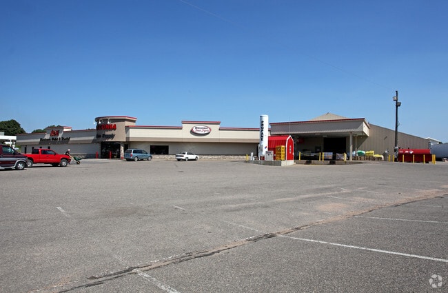
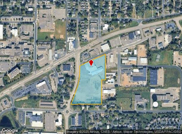
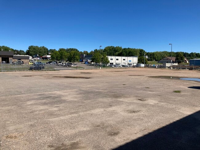
801 State Highway 284
75.0240100
5.50 AC IN SW1/4 NW1/4 ANNEX ORDER #159 2.76 ACRES IN SW1/4 NW1/4 TRACT D CRV #7662 & INC
Storebuilding
Carver
X
Minnesota
27019C0183D
9.15 AC
2025
Eden Prairie
2025
Minneapolis/St Paul
090302
Minneapolis-St. Paul-Bloomington, MN-WI
30,300 SF
DEMOGRAPHICS near 801 State Highway 284
1 Mile
3 Mile
5 Mile
2024 Total Population
7,923
15,309
22,435
2029 Population
8,559
16,573
23,942
Pop Growth 2024-2029
+ 8.03%
+ 8.26%
+ 6.72%
Average Age
40
39
39
2024 Total Households
2,987
5,493
7,833
HH Growth 2024-2029
+ 8.37%
+ 8.54%
+ 7.02%
Median Household Inc
$82,964
$95,206
$102,721
Avg Household Size
2.60
2.70
2.80
2024 Avg HH Vehicles
2.00
2.00
2.00
Median Home Value
$381,184
$394,129
$394,030
Median Year Built
1995
1999
1999
Nearby Places
Map Layers
Map Styles
 Street
 Aerial
- Restaurants
- Banks
- Shops
- Fitness
- Groceries
PUBLIC TRANSPORTATION
AIRPORT
Minneapolis-St Paul International/Wold-Chamberlain
DRIVE
WALK
Distance
Minneapolis-St Paul International/Wold-Chamberlain
44 min
30.5 mi
Freight Ports
Port Milwaukee
DRIVE
WALK
Distance
Port Milwaukee
413 min
367.6 mi
SALE & LEASE HISTORY
LISTING DATE
SALE/LEASE

Sep 08, 2020
For Sale
Nearby Properties
Address
Land Use
TOTAL SIZE
Lot Size
Zoning
Address
Land Use
TOTAL SIZE
Lot Size
Zoning
218,348 SF
12.89 AC
Address
Land Use
TOTAL SIZE
Lot Size
Zoning
50,530 SF
14.99 AC
Address
Land Use
TOTAL SIZE
Lot Size
Zoning
200,083 SF
58.28 AC
Address
Land Use
TOTAL SIZE
Lot Size
Zoning
10.72 AC
Address
Land Use
TOTAL SIZE
Lot Size
Zoning
23,645 SF
0.62 AC
Address
Land Use
TOTAL SIZE
Lot Size
Zoning
55,559 SF
55.16 AC
Address
Land Use
TOTAL SIZE
Lot Size
Zoning
16,876 SF
2.30 AC
Address
Land Use
TOTAL SIZE
Lot Size
Zoning
7.68 AC
Address
Land Use
TOTAL SIZE
Lot Size
Zoning
10.79 AC
Address
Land Use
TOTAL SIZE
Lot Size
Zoning
62,580 SF
10.19 AC
Address
Land Use
TOTAL SIZE
Lot Size
Zoning
3.13 AC
Address
Land Use
TOTAL SIZE
Lot Size
Zoning
6,392 SF
8.52 AC
Address
Land Use
TOTAL SIZE
Lot Size
Zoning
4.09 AC
Address
Land Use
TOTAL SIZE
Lot Size
Zoning
24,051 SF
4.17 AC
Address
Land Use
TOTAL SIZE
Lot Size
Zoning
132,018 SF
17.38 AC
Address
Land Use
TOTAL SIZE
Lot Size
Zoning
77,895 SF
11.45 AC
Address
Land Use
TOTAL SIZE
Lot Size
Zoning
41,970 SF
3.67 AC
Address
Land Use
TOTAL SIZE
Lot Size
Zoning
7,599 SF
0.78 AC
Address
Land Use
TOTAL SIZE
Lot Size
Zoning
16.62 AC
Address
Land Use
TOTAL SIZE
Lot Size
Zoning
2.68 AC
Address
Land Use
TOTAL SIZE
Lot Size
Zoning
9,450 SF
4.44 AC
Address
Land Use
TOTAL SIZE
Lot Size
Zoning
5.29 AC
Address
Land Use
TOTAL SIZE
Lot Size
Zoning
4.38 AC
Address
Land Use
TOTAL SIZE
Lot Size
Zoning
24,924 SF
3.03 AC
Address
Land Use
TOTAL SIZE
Lot Size
Zoning
73,840 SF
3.85 AC
Address
Land Use
TOTAL SIZE
Lot Size
Zoning
10,188 SF
4.48 AC
Address
Land Use
TOTAL SIZE
Lot Size
Zoning
20,336 SF
3.43 AC
Address
Land Use
TOTAL SIZE
Lot Size
Zoning
31.70 AC
Address
Land Use
TOTAL SIZE
Lot Size
Zoning
8,740 SF
0.76 AC
Address
Land Use
TOTAL SIZE
Lot Size
Zoning
15,700 SF
3.44 AC
The World's #1 Commercial Real Estate Marketplace
Connect with us
© 2025 CoStar Group
The information above has been obtained from sources believed reliable. While we do not doubt its accuracy we have not verified it and make no guarantee, warranty or representation about it. It is your responsibility to independently confirm its accuracy and completeness. Any projections, opinions, assumptions, or estimates used are for example only and do not represent the current or future performance of the property. The value of this transaction to you depends on tax and other factors which should be evaluated by your tax, financial, and legal advisors. You and your advisors should conduct a careful, independent investigation of the property to determine to your satisfaction the suitability of the property for your needs.