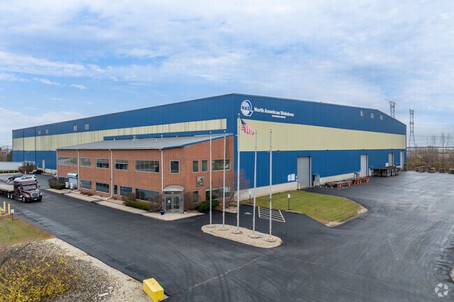
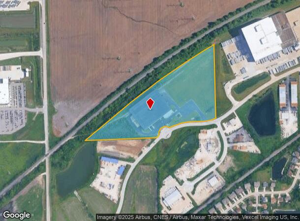
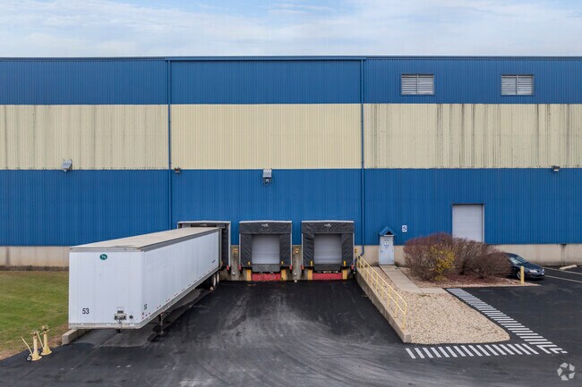
Property Record
801 Twin Rail Dr, Minooka, IL 60447
NEARBY LISTINGS FOR SALE OR LEASE
-
-
View all Minooka listings for sale on LoopNet.com
Property Detail
801 Twin Rail Dr
Chicago-Naperville-Elgin, IL-IN
Twin Rail Subdivision
03-02-377-001
TWIN RAIL SUB 2ND ADD LT 20 (EX E50') SEC 2-34-8 DOC 387151
Industrialgeneral
Grundy
X
Illinois
17093C0225H
20
2024
18.29 AC
2024
Grundy County
000102
Chicago
134,300 SF
DEMOGRAPHICS near 801 Twin Rail Dr
1 Mile
3 Mile
5 Mile
2024 Total Population
1,428
18,924
32,653
2029 Population
1,455
19,245
33,173
Pop Growth 2024-2029
+ 1.89%
+ 1.70%
+ 1.59%
Average Age
38
36
37
2024 Total Households
495
6,221
10,818
HH Growth 2024-2029
+ 2.02%
+ 1.56%
+ 1.53%
Median Household Inc
$76,480
$98,811
$105,296
Avg Household Size
2.80
3.00
3.00
2024 Avg HH Vehicles
3.00
2.00
2.00
Median Home Value
$239,130
$253,150
$267,086
Median Year Built
2002
2002
2001
Nearby Places
Map Layers
Map Styles
 Street
 Aerial
- Restaurants
- Banks
- Shops
- Fitness
- Groceries
Nearby Properties
Address
Land Use
TOTAL SIZE
Lot Size
Zoning
Address
Land Use
TOTAL SIZE
Lot Size
Zoning
1,920 SF
119.06 AC
Address
Land Use
TOTAL SIZE
Lot Size
Zoning
73.42 AC
Address
Land Use
TOTAL SIZE
Lot Size
Zoning
79.57 AC
Address
Land Use
TOTAL SIZE
Lot Size
Zoning
364 SF
48.93 AC
Address
Land Use
TOTAL SIZE
Lot Size
Zoning
19.57 AC
Address
Land Use
TOTAL SIZE
Lot Size
Zoning
1,034,100 SF
54.99 AC
Address
Land Use
TOTAL SIZE
Lot Size
Zoning
1,000,800 SF
24.66 AC
Address
Land Use
TOTAL SIZE
Lot Size
Zoning
15,600 SF
7.60 AC
Address
Land Use
TOTAL SIZE
Lot Size
Zoning
35.52 AC
Address
Land Use
TOTAL SIZE
Lot Size
Zoning
872,032 SF
43.10 AC
Address
Land Use
TOTAL SIZE
Lot Size
Zoning
598,380 SF
32.69 AC
Address
Land Use
TOTAL SIZE
Lot Size
Zoning
861,000 SF
47.22 AC
Address
Land Use
TOTAL SIZE
Lot Size
Zoning
306,240 SF
19.99 AC
Address
Land Use
TOTAL SIZE
Lot Size
Zoning
456,860 SF
35.47 AC
Address
Land Use
TOTAL SIZE
Lot Size
Zoning
107,428 SF
17.69 AC
Address
Land Use
TOTAL SIZE
Lot Size
Zoning
29.48 AC
Address
Land Use
TOTAL SIZE
Lot Size
Zoning
24.22 AC
Address
Land Use
TOTAL SIZE
Lot Size
Zoning
60,804 SF
7.29 AC
Address
Land Use
TOTAL SIZE
Lot Size
Zoning
77,000 SF
7.43 AC
Address
Land Use
TOTAL SIZE
Lot Size
Zoning
59,138 SF
3.19 AC
Address
Land Use
TOTAL SIZE
Lot Size
Zoning
22,925 SF
4.71 AC
Address
Land Use
TOTAL SIZE
Lot Size
Zoning
11,665 SF
10.79 AC
Address
Land Use
TOTAL SIZE
Lot Size
Zoning
4.31 AC
Address
Land Use
TOTAL SIZE
Lot Size
Zoning
50,820 SF
6 AC
Address
Land Use
TOTAL SIZE
Lot Size
Zoning
5,590 SF
5 AC
Address
Land Use
TOTAL SIZE
Lot Size
Zoning
8,880 SF
2.42 AC
The World's #1 Commercial Real Estate Marketplace
Connect with us
© 2026 CoStar Group
The information above has been obtained from sources believed reliable. While we do not doubt its accuracy we have not verified it and make no guarantee, warranty or representation about it. It is your responsibility to independently confirm its accuracy and completeness. Any projections, opinions, assumptions, or estimates used are for example only and do not represent the current or future performance of the property. The value of this transaction to you depends on tax and other factors which should be evaluated by your tax, financial, and legal advisors. You and your advisors should conduct a careful, independent investigation of the property to determine to your satisfaction the suitability of the property for your needs.