Property Record
801 W Main St, Jamestown, NC 27282
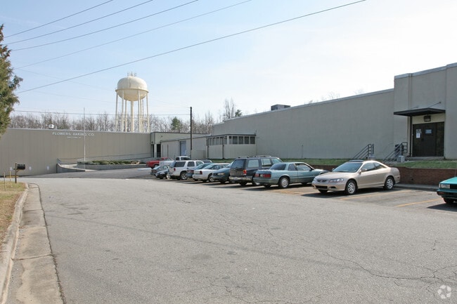

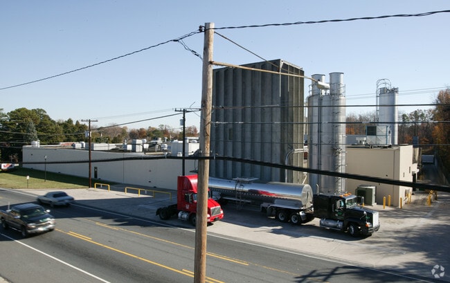
Property Detail
801 W Main St
0157741
1-6&51-56, 34-36 & REAR
Industrialgeneral
Guilford
IND
North Carolina
B and X Area of moderate flood hazard, usually the area between the limits of the 100-year and 500-year floods.
1-6,5
2024
5.55 AC
2025
High Point/SW Guilford Cty
014406
Greensboro/Winston-Salem
133,372 SF
Greensboro-High Point, NC
NEARBY LISTINGS FOR SALE OR LEASE
DEMOGRAPHICS near 801 W Main St
1 mile
3 mile
5 mile
2025 Total Population
4,480
50,776
130,232
2030 Population
4,676
52,537
134,760
Pop Growth 2025-2030
+ 4.38%
+ 3.47%
+ 3.48%
Average Age
44
39
40
2025 Total Households
1,811
18,707
51,609
HH Growth 2025-2030
+ 4.53%
+ 3.78%
+ 3.67%
Median Household Inc
$74,129
$57,914
$64,690
Avg Household Size
2.40
2.40
2.40
2025 Avg HH Vehicles
2.00
2.00
2.00
Median Home Value
$182,293
$218,383
$249,200
Median Year Built
1982
1983
1987
Nearby Places
Map Layers
Map Styles
 Street
 Aerial
Layers
 Traffic
 Biking
Places
Listings with unknown addresses are not visible on the map
- Restaurants
- Banks
- Shops
- Fitness
- Groceries
PUBLIC TRANSPORTATION
COMMUTER RAIL
High Point Station (Piedmont - North Carolina by Train (NC Train))
Drive
Walk
Distance
High Point Station (Piedmont - North Carolina by Train (NC Train))
9 min
4.8 mi
AIRPORT
Piedmont Triad International
Drive
Walk
Distance
Piedmont Triad International
23 min
11.2 mi
Freight Ports
Port of Wilmington
Drive
Walk
Distance
Port of Wilmington
251 min
213.4 mi
Nearby Properties
Address
Land Use
TOTAL SIZE
Lot Size
Zoning
Address
Land Use
TOTAL SIZE
Lot Size
Zoning
264,860 SF
62.75 AC
PI
Address
Land Use
TOTAL SIZE
Lot Size
Zoning
236,597 SF
13.83 AC
CU-PI
Address
Land Use
TOTAL SIZE
Lot Size
Zoning
341,210 SF
13.43 AC
PUD
Address
Land Use
TOTAL SIZE
Lot Size
Zoning
419,281 SF
25.12 AC
CIV
Address
Land Use
TOTAL SIZE
Lot Size
Zoning
805,958 SF
61.42 AC
LI
Address
Land Use
TOTAL SIZE
Lot Size
Zoning
1,259,149 SF
46.12 AC
HB
Address
Land Use
TOTAL SIZE
Lot Size
Zoning
291,895 SF
21.52 AC
RM-26
Address
Land Use
TOTAL SIZE
Lot Size
Zoning
136,202 SF
30.02 AC
CZ-I
Address
Land Use
TOTAL SIZE
Lot Size
Zoning
363,308 SF
29.41 AC
RM-16
Address
Land Use
TOTAL SIZE
Lot Size
Zoning
231,597 SF
8.46 AC
PD-R
Address
Land Use
TOTAL SIZE
Lot Size
Zoning
30,322 SF
964.25 AC
PNR
Address
Land Use
TOTAL SIZE
Lot Size
Zoning
269,956 SF
19.44 AC
OI
Address
Land Use
TOTAL SIZE
Lot Size
Zoning
299,349 SF
21.76 AC
RM-16
Address
Land Use
TOTAL SIZE
Lot Size
Zoning
1.32 AC
PNR
Address
Land Use
TOTAL SIZE
Lot Size
Zoning
403,590 SF
72.06 AC
CIV
Address
Land Use
TOTAL SIZE
Lot Size
Zoning
185,320 SF
15.08 AC
PI
Address
Land Use
TOTAL SIZE
Lot Size
Zoning
144,746 SF
8.17 AC
AG
Address
Land Use
TOTAL SIZE
Lot Size
Zoning
90,060 SF
3.15 AC
CZ-I
Address
Land Use
TOTAL SIZE
Lot Size
Zoning
250,573 SF
48.53 AC
R-5
Address
Land Use
TOTAL SIZE
Lot Size
Zoning
324,986 SF
24.19 AC
LI
Address
Land Use
TOTAL SIZE
Lot Size
Zoning
473,040 SF
63.60 AC
AG
Address
Land Use
TOTAL SIZE
Lot Size
Zoning
181,106 SF
16.23 AC
RM-16
Address
Land Use
TOTAL SIZE
Lot Size
Zoning
272,917 SF
33.57 AC
MS
Address
Land Use
TOTAL SIZE
Lot Size
Zoning
145,571 SF
11.01 AC
RC
Address
Land Use
TOTAL SIZE
Lot Size
Zoning
33,771 SF
196.93 AC
PI
Address
Land Use
TOTAL SIZE
Lot Size
Zoning
72,851 SF
9.13 AC
IND
Address
Land Use
TOTAL SIZE
Lot Size
Zoning
113,866 SF
11.53 AC
LI
Address
Land Use
TOTAL SIZE
Lot Size
Zoning
101,625 SF
4.97 AC
CZ-I
Address
Land Use
TOTAL SIZE
Lot Size
Zoning
79,740 SF
24.38 AC
R-5
Address
Land Use
TOTAL SIZE
Lot Size
Zoning
79,022 SF
6.52 AC
CIV
The World's #1 Commercial Real Estate Marketplace
Connect with us
© 2026 CoStar Group
The information above has been obtained from sources believed reliable. While we do not doubt its accuracy we have not verified it and make no guarantee, warranty or representation about it. It is your responsibility to independently confirm its accuracy and completeness. Any projections, opinions, assumptions, or estimates used are for example only and do not represent the current or future performance of the property. The value of this transaction to you depends on tax and other factors which should be evaluated by your tax, financial, and legal advisors. You and your advisors should conduct a careful, independent investigation of the property to determine to your satisfaction the suitability of the property for your needs.