Property Record
801 Walmart Dr, Murray, KY 42071
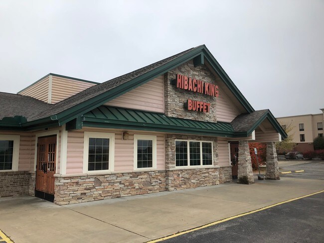

Property Detail
801 Walmart Dr
041-0-0120-N
801 WALMART DRIVE
Restaurantbuilding
Calloway
B and X Area of moderate flood hazard, usually the area between the limits of the 100-year and 500-year floods.
Kentucky
2025
2.33 AC
2025
Kentucky West Area
010303
Other Market Areas
10,694 SF
Murray, KY
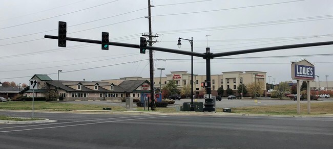
NEARBY LISTINGS FOR SALE OR LEASE
DEMOGRAPHICS near 801 Walmart Dr
1 mile
3 mile
5 mile
2025 Total Population
8,473
20,122
25,331
2030 Population
8,699
20,565
25,886
Pop Growth 2025-2030
+ 2.67%
+ 2.20%
+ 2.19%
Average Age
30
36
37
2025 Total Households
2,614
7,711
9,887
HH Growth 2025-2030
+ 3.37%
+ 2.37%
+ 2.36%
Median Household Inc
$35,801
$43,610
$47,587
Avg Household Size
1.90
2.10
2.10
2025 Avg HH Vehicles
2.00
2.00
2.00
Median Home Value
$180,308
$207,100
$212,827
Median Year Built
1991
1983
1985
Nearby Places
Map Layers
Map Styles
 Street
 Aerial
Layers
 Traffic
 Biking
Places
Listings with unknown addresses are not visible on the map
- Restaurants
- Banks
- Shops
- Fitness
- Groceries
SALE & LEASE HISTORY
LISTING DATE
SALE/LEASE

Jan 04, 2018
For Lease
Aug 22, 2018
For Sale
Nearby Properties
Address
Land Use
TOTAL SIZE
Lot Size
Zoning
Address
Land Use
TOTAL SIZE
Lot Size
Zoning
Address
Land Use
TOTAL SIZE
Lot Size
Zoning
3,650 SF
46 AC
Address
Land Use
TOTAL SIZE
Lot Size
Zoning
23.69 AC
Address
Land Use
TOTAL SIZE
Lot Size
Zoning
Address
Land Use
TOTAL SIZE
Lot Size
Zoning
Address
Land Use
TOTAL SIZE
Lot Size
Zoning
Address
Land Use
TOTAL SIZE
Lot Size
Zoning
1.65 AC
Address
Land Use
TOTAL SIZE
Lot Size
Zoning
871,000 SF
93.59 AC
Address
Land Use
TOTAL SIZE
Lot Size
Zoning
50.15 AC
Address
Land Use
TOTAL SIZE
Lot Size
Zoning
26,000 SF
2.94 AC
Address
Land Use
TOTAL SIZE
Lot Size
Zoning
13,928 SF
0.63 AC
Address
Land Use
TOTAL SIZE
Lot Size
Zoning
Address
Land Use
TOTAL SIZE
Lot Size
Zoning
76,000 SF
4.97 AC
Address
Land Use
TOTAL SIZE
Lot Size
Zoning
34,679 SF
7.11 AC
Address
Land Use
TOTAL SIZE
Lot Size
Zoning
13,150 SF
0.27 AC
Address
Land Use
TOTAL SIZE
Lot Size
Zoning
101,000 SF
14.04 AC
Address
Land Use
TOTAL SIZE
Lot Size
Zoning
5,000 SF
0.45 AC
Address
Land Use
TOTAL SIZE
Lot Size
Zoning
40,000 SF
21 AC
Address
Land Use
TOTAL SIZE
Lot Size
Zoning
50,565 SF
1.30 AC
Address
Land Use
TOTAL SIZE
Lot Size
Zoning
1,701 SF
35 AC
Address
Land Use
TOTAL SIZE
Lot Size
Zoning
17.19 AC
Address
Land Use
TOTAL SIZE
Lot Size
Zoning
4,200 SF
0.84 AC
Address
Land Use
TOTAL SIZE
Lot Size
Zoning
1,800 SF
5.77 AC
Address
Land Use
TOTAL SIZE
Lot Size
Zoning
2,116 SF
1.31 AC
Address
Land Use
TOTAL SIZE
Lot Size
Zoning
50,400 SF
9.56 AC
Address
Land Use
TOTAL SIZE
Lot Size
Zoning
34,364 SF
5.80 AC
Address
Land Use
TOTAL SIZE
Lot Size
Zoning
11,264 SF
0.10 AC
The World's #1 Commercial Real Estate Marketplace
Connect with us
© 2026 CoStar Group
The information above has been obtained from sources believed reliable. While we do not doubt its accuracy we have not verified it and make no guarantee, warranty or representation about it. It is your responsibility to independently confirm its accuracy and completeness. Any projections, opinions, assumptions, or estimates used are for example only and do not represent the current or future performance of the property. The value of this transaction to you depends on tax and other factors which should be evaluated by your tax, financial, and legal advisors. You and your advisors should conduct a careful, independent investigation of the property to determine to your satisfaction the suitability of the property for your needs.