Property Record
801 Woodsdale Rd, Elwood, KS 66024
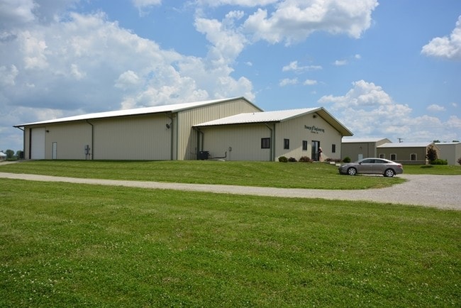
This Property Is For Sale
NEARBY LISTINGS FOR SALE OR LEASE
Property Detail
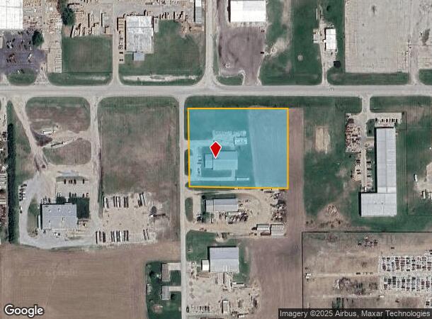
801 Woodsdale Rd
0973604001001030
2000 Elwood Addition
Warehouse
2000 ELWOOD ADDITION, S36, T03, R22E, COM E4/C, W 1454.82', S 119 .78' TO S'LY R/W ROSEPORT RD & E'LY R/W WOODSDALE RD TO
X
Doniphan
20043C0310D
Kansas
2024
3.19 AC
2025
St Joseph
020300
Kansas City
8,500 SF
St. Joseph, MO-KS
DEMOGRAPHICS near 801 Woodsdale Rd
1 Mile
3 Mile
5 Mile
2024 Total Population
472
15,795
52,550
2029 Population
446
15,653
51,555
Pop Growth 2024-2029
(5.51%)
(0.90%)
(1.89%)
Average Age
39
38
39
2024 Total Households
188
6,469
21,310
HH Growth 2024-2029
(5.32%)
(0.88%)
(1.92%)
Median Household Inc
$42,500
$36,470
$43,006
Avg Household Size
2.40
2.30
2.30
2024 Avg HH Vehicles
2.00
2.00
2.00
Median Home Value
$68,965
$82,582
$121,838
Median Year Built
1980
1950
1952
Nearby Places
Map Layers
Map Styles
 Street
 Aerial
- Restaurants
- Banks
- Shops
- Fitness
- Groceries
Nearby Properties
Address
Land Use
TOTAL SIZE
Lot Size
Zoning
Address
Land Use
TOTAL SIZE
Lot Size
Zoning
146,880 SF
0.77 AC
Address
Land Use
TOTAL SIZE
Lot Size
Zoning
39,440 SF
0.33 AC
CITY
Address
Land Use
TOTAL SIZE
Lot Size
Zoning
45.95 AC
CITY
Address
Land Use
TOTAL SIZE
Lot Size
Zoning
519,410 SF
37.46 AC
CITY
Address
Land Use
TOTAL SIZE
Lot Size
Zoning
83,529 SF
15.74 AC
CITY
Address
Land Use
TOTAL SIZE
Lot Size
Zoning
Address
Land Use
TOTAL SIZE
Lot Size
Zoning
102,962 SF
Address
Land Use
TOTAL SIZE
Lot Size
Zoning
54,000 SF
Address
Land Use
TOTAL SIZE
Lot Size
Zoning
85,436 SF
1.40 AC
CITY
Address
Land Use
TOTAL SIZE
Lot Size
Zoning
63,996 SF
1.70 AC
CITY
Address
Land Use
TOTAL SIZE
Lot Size
Zoning
56,750 SF
1.70 AC
CITY
Address
Land Use
TOTAL SIZE
Lot Size
Zoning
54,704 SF
1.40 AC
CITY
Address
Land Use
TOTAL SIZE
Lot Size
Zoning
9,000 SF
632.95 AC
ZA
Address
Land Use
TOTAL SIZE
Lot Size
Zoning
108,284 SF
1.70 AC
CITY
Address
Land Use
TOTAL SIZE
Lot Size
Zoning
Address
Land Use
TOTAL SIZE
Lot Size
Zoning
11.74 AC
CITY
Address
Land Use
TOTAL SIZE
Lot Size
Zoning
14,443 SF
23.84 AC
CITY
Address
Land Use
TOTAL SIZE
Lot Size
Zoning
215,306 SF
29.45 AC
Address
Land Use
TOTAL SIZE
Lot Size
Zoning
20,270 SF
0.95 AC
CITY
Address
Land Use
TOTAL SIZE
Lot Size
Zoning
30,086 SF
39.35 AC
CITY
Address
Land Use
TOTAL SIZE
Lot Size
Zoning
333,260 SF
19.90 AC
CITY
Address
Land Use
TOTAL SIZE
Lot Size
Zoning
Address
Land Use
TOTAL SIZE
Lot Size
Zoning
0.77 AC
CITY
Address
Land Use
TOTAL SIZE
Lot Size
Zoning
47,005 SF
9.60 AC
CITY
Address
Land Use
TOTAL SIZE
Lot Size
Zoning
487.99 AC
Address
Land Use
TOTAL SIZE
Lot Size
Zoning
20,740 SF
209.42 AC
ZA
Address
Land Use
TOTAL SIZE
Lot Size
Zoning
48,462 SF
4.60 AC
Address
Land Use
TOTAL SIZE
Lot Size
Zoning
19,333 SF
0.82 AC
CITY
Address
Land Use
TOTAL SIZE
Lot Size
Zoning
53,500 SF
Address
Land Use
TOTAL SIZE
Lot Size
Zoning
19,308 SF
1.70 AC
CITY
The World's #1 Commercial Real Estate Marketplace
Connect with us
© 2025 CoStar Group
The information above has been obtained from sources believed reliable. While we do not doubt its accuracy we have not verified it and make no guarantee, warranty or representation about it. It is your responsibility to independently confirm its accuracy and completeness. Any projections, opinions, assumptions, or estimates used are for example only and do not represent the current or future performance of the property. The value of this transaction to you depends on tax and other factors which should be evaluated by your tax, financial, and legal advisors. You and your advisors should conduct a careful, independent investigation of the property to determine to your satisfaction the suitability of the property for your needs.