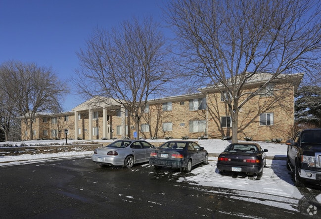
Property Record
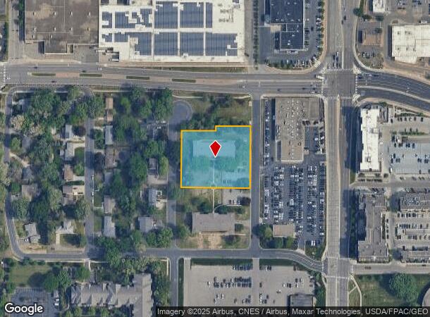
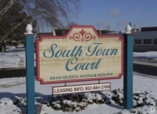
8010 Queen Ave S, Minneapolis, MN 55431
NEARBY LISTINGS FOR SALE OR LEASE
Property Detail
8010 Queen Ave S
05-027-24-14-0004
Unplatted 05 027 24
Apartment
UNPLATTED 05 027 24 COM AT A PT IN E LINE OF W 1/2 OF NE 1/4 OF SE 1/4 OF NE 1/4 DIS 149 32/100 FT S FROM NE COR THEREOF TH W 164 18/100 FT TH S 19 32/100 FT TH W T IRREGULAR
X
Hennepin
27053C0456F
Minnesota
2024
1.45 AC
2024
Bloomington West
025603
Minneapolis/St Paul
10,559 SF
Minneapolis-St. Paul-Bloomington, MN-WI
DEMOGRAPHICS near 8010 Queen Ave S
1 Mile
3 Mile
5 Mile
2024 Total Population
12,411
107,642
231,129
2029 Population
12,147
106,077
227,289
Pop Growth 2024-2029
(2.13%)
(1.45%)
(1.66%)
Average Age
44
42
42
2024 Total Households
6,187
46,840
96,197
HH Growth 2024-2029
(2.26%)
(1.47%)
(1.71%)
Median Household Inc
$70,797
$79,394
$96,922
Avg Household Size
1.90
2.20
2.30
2024 Avg HH Vehicles
1.00
2.00
2.00
Median Home Value
$272,368
$311,936
$371,424
Median Year Built
1970
1965
1962
Nearby Places
Map Layers
Map Styles
 Street
 Aerial
- Restaurants
- Banks
- Shops
- Fitness
- Groceries
PUBLIC TRANSPORTATION
AIRPORT
Minneapolis-St Paul International/Wold-Chamberlain
DRIVE
WALK
Distance
Minneapolis-St Paul International/Wold-Chamberlain
11 min
6.0 mi
Nearby Properties
Address
Land Use
TOTAL SIZE
Lot Size
Zoning
Address
Land Use
TOTAL SIZE
Lot Size
Zoning
364,730 SF
13.40 AC
PCD3
Address
Land Use
TOTAL SIZE
Lot Size
Zoning
18,088 SF
5.44 AC
MDD6
Address
Land Use
TOTAL SIZE
Lot Size
Zoning
21.50 AC
Address
Land Use
TOTAL SIZE
Lot Size
Zoning
12,308 SF
1.25 AC
PCD3
Address
Land Use
TOTAL SIZE
Lot Size
Zoning
22,654 SF
5.22 AC
Address
Land Use
TOTAL SIZE
Lot Size
Zoning
45.77 AC
Address
Land Use
TOTAL SIZE
Lot Size
Zoning
79,717 SF
4.62 AC
Address
Land Use
TOTAL SIZE
Lot Size
Zoning
461,748 SF
5.87 AC
Address
Land Use
TOTAL SIZE
Lot Size
Zoning
35.28 AC
Address
Land Use
TOTAL SIZE
Lot Size
Zoning
3.51 AC
Address
Land Use
TOTAL SIZE
Lot Size
Zoning
50,484 SF
5.12 AC
Address
Land Use
TOTAL SIZE
Lot Size
Zoning
8.55 AC
Address
Land Use
TOTAL SIZE
Lot Size
Zoning
25,780 SF
5.24 AC
Address
Land Use
TOTAL SIZE
Lot Size
Zoning
435,796 SF
36.44 AC
Address
Land Use
TOTAL SIZE
Lot Size
Zoning
31,646 SF
5.85 AC
Address
Land Use
TOTAL SIZE
Lot Size
Zoning
129,658 SF
13.52 AC
Address
Land Use
TOTAL SIZE
Lot Size
Zoning
Address
Land Use
TOTAL SIZE
Lot Size
Zoning
7,614 SF
2.01 AC
PCD3
Address
Land Use
TOTAL SIZE
Lot Size
Zoning
98,676 SF
8.77 AC
Address
Land Use
TOTAL SIZE
Lot Size
Zoning
25,909 SF
6.09 AC
Address
Land Use
TOTAL SIZE
Lot Size
Zoning
94,827 SF
5.86 AC
RMD
Address
Land Use
TOTAL SIZE
Lot Size
Zoning
22,119 SF
4.02 AC
Address
Land Use
TOTAL SIZE
Lot Size
Zoning
8.80 AC
Address
Land Use
TOTAL SIZE
Lot Size
Zoning
Address
Land Use
TOTAL SIZE
Lot Size
Zoning
21.69 AC
Address
Land Use
TOTAL SIZE
Lot Size
Zoning
122,021 SF
21.74 AC
Address
Land Use
TOTAL SIZE
Lot Size
Zoning
60,320 SF
11.50 AC
Address
Land Use
TOTAL SIZE
Lot Size
Zoning
Address
Land Use
TOTAL SIZE
Lot Size
Zoning
2.23 AC
Address
Land Use
TOTAL SIZE
Lot Size
Zoning
39,118 SF
3.48 AC
The World's #1 Commercial Real Estate Marketplace
Connect with us
© 2025 CoStar Group
The information above has been obtained from sources believed reliable. While we do not doubt its accuracy we have not verified it and make no guarantee, warranty or representation about it. It is your responsibility to independently confirm its accuracy and completeness. Any projections, opinions, assumptions, or estimates used are for example only and do not represent the current or future performance of the property. The value of this transaction to you depends on tax and other factors which should be evaluated by your tax, financial, and legal advisors. You and your advisors should conduct a careful, independent investigation of the property to determine to your satisfaction the suitability of the property for your needs.