Property Record
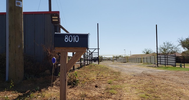
8010 Rendon Bloodworth Rd, Mansfield, TX 76063


Save to a Folder
{{folder.Name}}
{{folder.ListingIds.length}} Properties
{{folder.ListingIds.length}} Property
Create a New Folder
Property Detail
8010 Rendon Bloodworth Rd
Dallas-Fort Worth-Arlington, TX
HAMMER, WILLIAM SURVEY ABSTRACT 650 TRACT 1A01 LESS HS
05947901
TARRANT
Timberlandforesttreesagricultural
Texas
AE The base floodplain where base flood elevations are provided. AE Zones are now used on new format FIRMs instead of A1-A30 Zones.
9 AC
2025
Southeast Ft Worth
2025
Dallas/Ft Worth
111306
NEARBY LISTINGS FOR SALE OR LEASE
DEMOGRAPHICS near 8010 Rendon Bloodworth Rd
1 mile
3 mile
5 mile
2025 Total Population
1,571
27,501
97,781
2030 Population
1,683
29,443
104,350
Pop Growth 2025-2030
+ 7.13%
+ 7.06%
+ 6.72%
Average Age
38
38
39
2025 Total Households
511
9,466
33,211
HH Growth 2025-2030
+ 7.24%
+ 7.30%
+ 6.86%
Median Household Inc
$100,974
$89,315
$105,321
Avg Household Size
3.10
2.80
2.90
2025 Avg HH Vehicles
2.00
2.00
2.00
Median Home Value
$386,169
$410,630
$391,600
Median Year Built
2002
2003
1999
Nearby Places
Map Layers
Map Styles
 Street
 Aerial
Layers
 Traffic
 Biking
Places
Listings with unknown addresses are not visible on the map
- Restaurants
- Banks
- Shops
- Fitness
- Groceries
PUBLIC TRANSPORTATION
AIRPORT
Dallas-Fort Worth International
Drive
Walk
Distance
Dallas-Fort Worth International
44 min
29.3 mi
Dallas Love Field
Drive
Walk
Distance
Dallas Love Field
54 min
37.9 mi
SALE & LEASE HISTORY
LISTING DATE
SALE/LEASE

Oct 08, 2019
For Lease
Mar 13, 2025
For Lease
Aug 31, 2021
For Lease
Nearby Properties
Address
Land Use
TOTAL SIZE
Lot Size
Zoning
Address
Land Use
TOTAL SIZE
Lot Size
Zoning
348,951 SF
18.66 AC
Address
Land Use
TOTAL SIZE
Lot Size
Zoning
317,142 SF
11.40 AC
Address
Land Use
TOTAL SIZE
Lot Size
Zoning
160,000 SF
26.90 AC
Address
Land Use
TOTAL SIZE
Lot Size
Zoning
413,000 SF
19.16 AC
Address
Land Use
TOTAL SIZE
Lot Size
Zoning
298,988 SF
7.16 AC
Address
Land Use
TOTAL SIZE
Lot Size
Zoning
276,467 SF
7.61 AC
Address
Land Use
TOTAL SIZE
Lot Size
Zoning
249,922 SF
17.26 AC
Address
Land Use
TOTAL SIZE
Lot Size
Zoning
170,082 SF
36.49 AC
Address
Land Use
TOTAL SIZE
Lot Size
Zoning
724,286 SF
48.41 AC
Address
Land Use
TOTAL SIZE
Lot Size
Zoning
231,551 SF
25.69 AC
Address
Land Use
TOTAL SIZE
Lot Size
Zoning
234,580 SF
65.82 AC
Address
Land Use
TOTAL SIZE
Lot Size
Zoning
229,168 SF
6.13 AC
Address
Land Use
TOTAL SIZE
Lot Size
Zoning
149,494 SF
3.73 AC
Address
Land Use
TOTAL SIZE
Lot Size
Zoning
79,070 SF
11.98 AC
Address
Land Use
TOTAL SIZE
Lot Size
Zoning
275,337 SF
14 AC
Address
Land Use
TOTAL SIZE
Lot Size
Zoning
85,000 SF
13.03 AC
Address
Land Use
TOTAL SIZE
Lot Size
Zoning
158,103 SF
13.27 AC
Address
Land Use
TOTAL SIZE
Lot Size
Zoning
85,786 SF
9.43 AC
Address
Land Use
TOTAL SIZE
Lot Size
Zoning
44,669 SF
9.05 AC
Address
Land Use
TOTAL SIZE
Lot Size
Zoning
22.84 AC
Address
Land Use
TOTAL SIZE
Lot Size
Zoning
156,103 SF
4.42 AC
Address
Land Use
TOTAL SIZE
Lot Size
Zoning
41,960 SF
13.70 AC
Address
Land Use
TOTAL SIZE
Lot Size
Zoning
36,962 SF
3.69 AC
Address
Land Use
TOTAL SIZE
Lot Size
Zoning
143,210 SF
9.78 AC
Address
Land Use
TOTAL SIZE
Lot Size
Zoning
76,715 SF
7.98 AC
Address
Land Use
TOTAL SIZE
Lot Size
Zoning
73,323 SF
11.87 AC
Address
Land Use
TOTAL SIZE
Lot Size
Zoning
1,008 SF
20.48 AC
Address
Land Use
TOTAL SIZE
Lot Size
Zoning
123,530 SF
27.29 AC
Address
Land Use
TOTAL SIZE
Lot Size
Zoning
107,723 SF
9.06 AC
Address
Land Use
TOTAL SIZE
Lot Size
Zoning
166,434 SF
9.20 AC
The World's #1 Commercial Real Estate Marketplace
Connect with us
© 2026 CoStar Group
The information above has been obtained from sources believed reliable. While we do not doubt its accuracy we have not verified it and make no guarantee, warranty or representation about it. It is your responsibility to independently confirm its accuracy and completeness. Any projections, opinions, assumptions, or estimates used are for example only and do not represent the current or future performance of the property. The value of this transaction to you depends on tax and other factors which should be evaluated by your tax, financial, and legal advisors. You and your advisors should conduct a careful, independent investigation of the property to determine to your satisfaction the suitability of the property for your needs.