Property Record
8010 Timber Trl, Sanderson, FL 32087
Property Detail
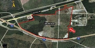
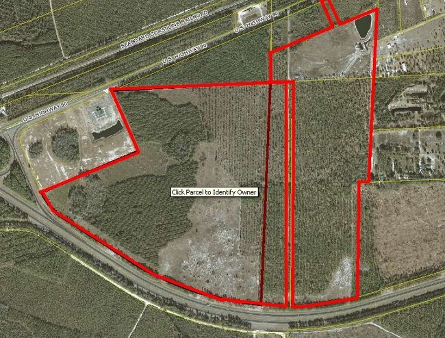
8010 Timber Trl
14-3S-20-0000-0000-0040
LEG 005613 ACRES PART OF SW 1/4 OF SW 1/4 OF SEC 11-3S-20E DESC IN OR 2022-4450 & ESMNT TO FPL IN OR 2014 -3638 (LESS OR 2024-2797) POM 89C
Agriculturalland
BAKER
B and X Area of moderate flood hazard, usually the area between the limits of the 100-year and 500-year floods.
Florida
2025
26.61 AC
2025
Baker County
040201
Jacksonville (Florida)
2,387 SF
Jacksonville, FL
NEARBY LISTINGS FOR SALE OR LEASE
-
-
View all Sanderson listings for sale on LoopNet.com
DEMOGRAPHICS near 8010 Timber Trl
1 mile
3 mile
5 mile
2025 Total Population
34
1,293
3,657
2030 Population
37
1,388
3,899
Pop Growth 2025-2030
+ 8.82%
+ 7.35%
+ 6.62%
Average Age
37
38
39
2025 Total Households
12
425
1,137
HH Growth 2025-2030
0.00%
+ 7.29%
+ 7.39%
Median Household Inc
$59,999
$60,500
$65,534
Avg Household Size
2.50
2.80
2.70
2025 Avg HH Vehicles
2.00
2.00
2.00
Median Home Value
$133,333
$147,938
$201,154
Median Year Built
1992
1992
1992
Nearby Places
Map Layers
Map Styles
 Street
 Aerial
Layers
 Traffic
 Biking
Places
Listings with unknown addresses are not visible on the map
- Restaurants
- Banks
- Shops
- Fitness
- Groceries
Nearby Properties
Address
Land Use
TOTAL SIZE
Lot Size
Zoning
Address
Land Use
TOTAL SIZE
Lot Size
Zoning
113,546 SF
15.41 AC
Address
Land Use
TOTAL SIZE
Lot Size
Zoning
123,547 SF
46.96 AC
Address
Land Use
TOTAL SIZE
Lot Size
Zoning
228.10 AC
Address
Land Use
TOTAL SIZE
Lot Size
Zoning
153,022 SF
18.68 AC
Address
Land Use
TOTAL SIZE
Lot Size
Zoning
725.38 AC
Address
Land Use
TOTAL SIZE
Lot Size
Zoning
15,089 SF
9.09 AC
Address
Land Use
TOTAL SIZE
Lot Size
Zoning
9,360 SF
1.68 AC
Address
Land Use
TOTAL SIZE
Lot Size
Zoning
7,704 SF
4.89 AC
Address
Land Use
TOTAL SIZE
Lot Size
Zoning
196.36 AC
Address
Land Use
TOTAL SIZE
Lot Size
Zoning
5,400 SF
25 AC
Address
Land Use
TOTAL SIZE
Lot Size
Zoning
8,368 SF
10.19 AC
Address
Land Use
TOTAL SIZE
Lot Size
Zoning
2,629 SF
26.72 AC
Address
Land Use
TOTAL SIZE
Lot Size
Zoning
1,485 SF
113.01 AC
Address
Land Use
TOTAL SIZE
Lot Size
Zoning
4,872 SF
9.16 AC
Address
Land Use
TOTAL SIZE
Lot Size
Zoning
2,744 SF
37.84 AC
Address
Land Use
TOTAL SIZE
Lot Size
Zoning
5,180 SF
164.17 AC
Address
Land Use
TOTAL SIZE
Lot Size
Zoning
2,673 SF
17.51 AC
Address
Land Use
TOTAL SIZE
Lot Size
Zoning
10.45 AC
Address
Land Use
TOTAL SIZE
Lot Size
Zoning
4,260 SF
1.90 AC
Address
Land Use
TOTAL SIZE
Lot Size
Zoning
2,280 SF
7.50 AC
Address
Land Use
TOTAL SIZE
Lot Size
Zoning
1,152 SF
187.19 AC
Address
Land Use
TOTAL SIZE
Lot Size
Zoning
3,148 SF
8.45 AC
Address
Land Use
TOTAL SIZE
Lot Size
Zoning
636 AC
Address
Land Use
TOTAL SIZE
Lot Size
Zoning
4,070 SF
7.14 AC
Address
Land Use
TOTAL SIZE
Lot Size
Zoning
64.32 AC
Address
Land Use
TOTAL SIZE
Lot Size
Zoning
4,155 SF
35.76 AC
Address
Land Use
TOTAL SIZE
Lot Size
Zoning
638 AC
Address
Land Use
TOTAL SIZE
Lot Size
Zoning
2,280 SF
5.01 AC
Address
Land Use
TOTAL SIZE
Lot Size
Zoning
29.94 AC
Address
Land Use
TOTAL SIZE
Lot Size
Zoning
636 AC
The World's #1 Commercial Real Estate Marketplace
Connect with us
© 2026 CoStar Group
The information above has been obtained from sources believed reliable. While we do not doubt its accuracy we have not verified it and make no guarantee, warranty or representation about it. It is your responsibility to independently confirm its accuracy and completeness. Any projections, opinions, assumptions, or estimates used are for example only and do not represent the current or future performance of the property. The value of this transaction to you depends on tax and other factors which should be evaluated by your tax, financial, and legal advisors. You and your advisors should conduct a careful, independent investigation of the property to determine to your satisfaction the suitability of the property for your needs.