Property Record
8010 Us Highway 98 N, Lakeland, FL 33809


NEARBY LISTINGS FOR SALE OR LEASE
Property Detail
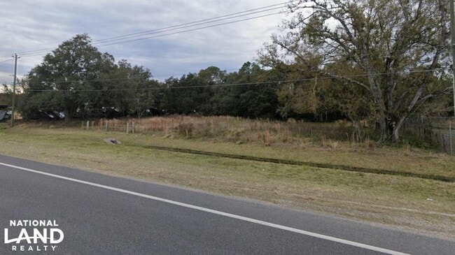
8010 Us Highway 98 N
23-27-11-000000-022010
Alameda Heights
Commercialacreage
S 420PT3 FT OF E 413PT17 FT OF NE1/4 OF SE1/4 OF SE1/4 LESS N 200 FT OF E 250 FT & LESS R/W FOR US 98
X
Polk
12105C0163G
Florida
2024
2.48 AC
2025
Polk County
012128
Tampa/St Petersburg
1,056 SF
Lakeland-Winter Haven, FL
DEMOGRAPHICS near 8010 Us Highway 98 N
1 Mile
3 Mile
5 Mile
2024 Total Population
5,738
53,802
96,332
2029 Population
6,894
64,018
114,946
Pop Growth 2024-2029
+ 20.15%
+ 18.99%
+ 19.32%
Average Age
38
42
41
2024 Total Households
2,011
21,248
37,087
HH Growth 2024-2029
+ 19.94%
+ 18.95%
+ 19.26%
Median Household Inc
$53,305
$63,106
$59,360
Avg Household Size
2.80
2.50
2.50
2024 Avg HH Vehicles
2.00
2.00
2.00
Median Home Value
$217,182
$224,615
$211,384
Median Year Built
1999
1993
1993
Nearby Places
Map Layers
Map Styles
 Street
 Aerial
- Restaurants
- Banks
- Shops
- Fitness
- Groceries
PUBLIC TRANSPORTATION
COMMUTER RAIL
DRIVE
WALK
Distance
14 min
7.7 mi
AIRPORT
Tampa International
DRIVE
WALK
Distance
Tampa International
56 min
44.7 mi
Freight Ports
Port of Tampa Bay
DRIVE
WALK
Distance
Port of Tampa Bay
49 min
38.1 mi
SALE & LEASE HISTORY
LISTING DATE
SALE/LEASE

Sep 09, 2020
For Sale
Nearby Properties
Address
Land Use
TOTAL SIZE
Lot Size
Zoning
Address
Land Use
TOTAL SIZE
Lot Size
Zoning
1,091,160 SF
133.41 AC
PUD
Address
Land Use
TOTAL SIZE
Lot Size
Zoning
361,669 SF
12.73 AC
Address
Land Use
TOTAL SIZE
Lot Size
Zoning
762,259 SF
24.95 AC
PUD
Address
Land Use
TOTAL SIZE
Lot Size
Zoning
169,546 SF
14.40 AC
PUD
Address
Land Use
TOTAL SIZE
Lot Size
Zoning
142,936 SF
26.38 AC
Address
Land Use
TOTAL SIZE
Lot Size
Zoning
226,634 SF
27.21 AC
C3
Address
Land Use
TOTAL SIZE
Lot Size
Zoning
206,724 SF
66.04 AC
RC
Address
Land Use
TOTAL SIZE
Lot Size
Zoning
118,250 SF
23.12 AC
Address
Land Use
TOTAL SIZE
Lot Size
Zoning
96,768 SF
13.49 AC
C4
Address
Land Use
TOTAL SIZE
Lot Size
Zoning
129,358 SF
8.84 AC
Address
Land Use
TOTAL SIZE
Lot Size
Zoning
42,557 SF
26.12 AC
Address
Land Use
TOTAL SIZE
Lot Size
Zoning
86,578 SF
9.84 AC
C2
Address
Land Use
TOTAL SIZE
Lot Size
Zoning
101,160 SF
27.71 AC
RC
Address
Land Use
TOTAL SIZE
Lot Size
Zoning
84,684 SF
7.07 AC
C2
Address
Land Use
TOTAL SIZE
Lot Size
Zoning
57,481 SF
12.46 AC
RE1
Address
Land Use
TOTAL SIZE
Lot Size
Zoning
61,272 SF
3.81 AC
Address
Land Use
TOTAL SIZE
Lot Size
Zoning
102,260 SF
6.78 AC
C3
Address
Land Use
TOTAL SIZE
Lot Size
Zoning
77,845 SF
9.44 AC
C3
Address
Land Use
TOTAL SIZE
Lot Size
Zoning
42,213 SF
26.89 AC
RC
Address
Land Use
TOTAL SIZE
Lot Size
Zoning
38,640 SF
3.95 AC
C3
Address
Land Use
TOTAL SIZE
Lot Size
Zoning
83,640 SF
13.55 AC
R2
Address
Land Use
TOTAL SIZE
Lot Size
Zoning
75,572 SF
12.51 AC
C3
Address
Land Use
TOTAL SIZE
Lot Size
Zoning
30,429 SF
5.95 AC
Address
Land Use
TOTAL SIZE
Lot Size
Zoning
49,600 SF
5 AC
Address
Land Use
TOTAL SIZE
Lot Size
Zoning
90,100 SF
8.97 AC
Address
Land Use
TOTAL SIZE
Lot Size
Zoning
54,796 SF
7.16 AC
PUD
Address
Land Use
TOTAL SIZE
Lot Size
Zoning
29,855 SF
5.35 AC
RC
Address
Land Use
TOTAL SIZE
Lot Size
Zoning
98,518 SF
8.80 AC
Address
Land Use
TOTAL SIZE
Lot Size
Zoning
128,017 SF
80.37 AC
RC
Address
Land Use
TOTAL SIZE
Lot Size
Zoning
38,718 SF
9.18 AC
C3
The World's #1 Commercial Real Estate Marketplace
Connect with us
© 2026 CoStar Group
The information above has been obtained from sources believed reliable. While we do not doubt its accuracy we have not verified it and make no guarantee, warranty or representation about it. It is your responsibility to independently confirm its accuracy and completeness. Any projections, opinions, assumptions, or estimates used are for example only and do not represent the current or future performance of the property. The value of this transaction to you depends on tax and other factors which should be evaluated by your tax, financial, and legal advisors. You and your advisors should conduct a careful, independent investigation of the property to determine to your satisfaction the suitability of the property for your needs.