Property Record
8012 State Line Rd, Prairie Village, KS 66208
Current Lease Availabilities
NEARBY LISTINGS FOR SALE OR LEASE
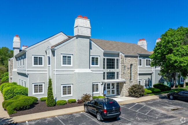
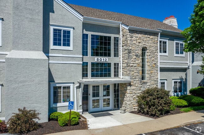
Property Detail
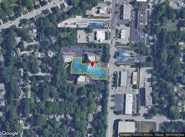
8012 State Line Rd
Kansas City, MO-KS
Nel-Aro
HP88000000-0005A
NEL-ARO PT LTS 5 & 6 BG AT PT ON E/L BRYMAR ADDITION & 175 S N/L LT 4 E 500 S 229.72 TOTRUE POB W 75 N 50 W 38.69 N .67 W 8 N 3 W 7.90 S 3.50 W 8 S .25 W 108.69 N 64.50 W 90 S 40 SW 42.43 S90 E 155.97 SE 91.47 E 135N 107.32 TO POB
Officebuilding
Johnson
X
Kansas
29095C0376G
5,6
2024
1.07 AC
2024
Ward Parkway
051600
Kansas City
7,528 SF
DEMOGRAPHICS near 8012 State Line Rd
1 Mile
3 Mile
5 Mile
2024 Total Population
10,815
98,010
251,942
2029 Population
10,964
99,947
258,041
Pop Growth 2024-2029
+ 1.38%
+ 1.98%
+ 2.42%
Average Age
40
41
40
2024 Total Households
4,976
42,846
115,550
HH Growth 2024-2029
+ 1.09%
+ 1.88%
+ 2.44%
Median Household Inc
$90,540
$88,326
$74,141
Avg Household Size
2.10
2.20
2.10
2024 Avg HH Vehicles
2.00
2.00
2.00
Median Home Value
$311,567
$337,357
$291,097
Median Year Built
1953
1955
1960
Nearby Places
- Restaurants
- Banks
- Shops
- Fitness
- Groceries
PUBLIC TRANSPORTATION
COMMUTER RAIL
DRIVE
WALK
Distance
19 min
8.0 mi
AIRPORT
Kansas City International
DRIVE
WALK
Distance
Kansas City International
45 min
31.6 mi
Nearby Properties
Address
Land Use
TOTAL SIZE
Lot Size
Zoning
Address
Land Use
TOTAL SIZE
Lot Size
Zoning
183,684 SF
36.94 AC
R-1A
Address
Land Use
TOTAL SIZE
Lot Size
Zoning
616,742 SF
13.59 AC
Address
Land Use
TOTAL SIZE
Lot Size
Zoning
188,248 SF
4.78 AC
C-2
Address
Land Use
TOTAL SIZE
Lot Size
Zoning
73,383 SF
9.53 AC
R-1
Address
Land Use
TOTAL SIZE
Lot Size
Zoning
552,475 SF
Address
Land Use
TOTAL SIZE
Lot Size
Zoning
73,793 SF
9.21 AC
R-1A
Address
Land Use
TOTAL SIZE
Lot Size
Zoning
465,394 SF
16.63 AC
Address
Land Use
TOTAL SIZE
Lot Size
Zoning
69,958 SF
10.93 AC
R-1
Address
Land Use
TOTAL SIZE
Lot Size
Zoning
99,812 SF
3.85 AC
R-1A
Address
Land Use
TOTAL SIZE
Lot Size
Zoning
120,225 SF
9.13 AC
R-1
Address
Land Use
TOTAL SIZE
Lot Size
Zoning
387,197 SF
Address
Land Use
TOTAL SIZE
Lot Size
Zoning
124,249 SF
6.13 AC
R-1B
Address
Land Use
TOTAL SIZE
Lot Size
Zoning
106,648 SF
16.93 AC
R-1A
Address
Land Use
TOTAL SIZE
Lot Size
Zoning
457,500 SF
Address
Land Use
TOTAL SIZE
Lot Size
Zoning
109,553 SF
3.08 AC
Address
Land Use
TOTAL SIZE
Lot Size
Zoning
67,981 SF
7.12 AC
R-1A
Address
Land Use
TOTAL SIZE
Lot Size
Zoning
36,769 SF
17.41 AC
R-1
Address
Land Use
TOTAL SIZE
Lot Size
Zoning
77,648 SF
6.90 AC
R-1
Address
Land Use
TOTAL SIZE
Lot Size
Zoning
151,831 SF
12.93 AC
Address
Land Use
TOTAL SIZE
Lot Size
Zoning
405,226 SF
6.87 AC
MXD
Address
Land Use
TOTAL SIZE
Lot Size
Zoning
36,324 SF
16.55 AC
R-1A
Address
Land Use
TOTAL SIZE
Lot Size
Zoning
66,378 SF
3.22 AC
R-1
Address
Land Use
TOTAL SIZE
Lot Size
Zoning
213,409 SF
5.20 AC
R-1A
Address
Land Use
TOTAL SIZE
Lot Size
Zoning
257,979 SF
14.35 AC
C-2
Address
Land Use
TOTAL SIZE
Lot Size
Zoning
68,004 SF
7.75 AC
R-1B
Address
Land Use
TOTAL SIZE
Lot Size
Zoning
262,727 SF
16.81 AC
C-2
Address
Land Use
TOTAL SIZE
Lot Size
Zoning
53,797 SF
5.47 AC
R-1
Address
Land Use
TOTAL SIZE
Lot Size
Zoning
194,371 SF
12.94 AC
R2A
Address
Land Use
TOTAL SIZE
Lot Size
Zoning
244,478 SF
26.69 AC
Address
Land Use
TOTAL SIZE
Lot Size
Zoning
62,625 SF
10.23 AC
R-1A
The World's #1 Commercial Real Estate Marketplace
Connect with us
© 2025 CoStar Group
The information above has been obtained from sources believed reliable. While we do not doubt its accuracy we have not verified it and make no guarantee, warranty or representation about it. It is your responsibility to independently confirm its accuracy and completeness. Any projections, opinions, assumptions, or estimates used are for example only and do not represent the current or future performance of the property. The value of this transaction to you depends on tax and other factors which should be evaluated by your tax, financial, and legal advisors. You and your advisors should conduct a careful, independent investigation of the property to determine to your satisfaction the suitability of the property for your needs.