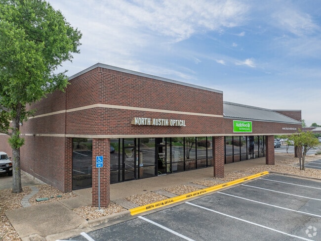
Property Record
8015 Shoal Creek Blvd, Austin, TX 78757


NEARBY LISTINGS FOR SALE OR LEASE
Property Detail
8015 Shoal Creek Blvd
Austin-Round Rock, TX
Shoal Creek Terrace Resub Lt 1
773055
LOT 1A SHOAL CREEK TERRACE RESUB LT 1
Stripcommercialcenter
Travis
AE
Texas
48453C0455J
1a,1
2024
6.38 AC
2025
Central
040400
Austin
56,901 SF
DEMOGRAPHICS near 8015 Shoal Creek Blvd
1 Mile
3 Mile
5 Mile
2024 Total Population
15,661
132,572
306,406
2029 Population
16,981
143,468
331,493
Pop Growth 2024-2029
+ 8.43%
+ 8.22%
+ 8.19%
Average Age
40
38
38
2024 Total Households
7,985
61,496
138,202
HH Growth 2024-2029
+ 9.20%
+ 9.07%
+ 8.97%
Median Household Inc
$67,736
$72,579
$75,035
Avg Household Size
1.90
2.10
2.10
2024 Avg HH Vehicles
1.00
2.00
2.00
Median Home Value
$603,803
$625,406
$584,533
Median Year Built
1973
1981
1984
Nearby Places
Map Layers
Map Styles
 Street
 Aerial
- Restaurants
- Banks
- Shops
- Fitness
- Groceries
PUBLIC TRANSPORTATION
COMMUTER RAIL
Austin (Texas Eagle - Amtrak)
DRIVE
WALK
Distance
Austin (Texas Eagle - Amtrak)
13 min
8.0 mi
AIRPORT
Austin-Bergstrom International
DRIVE
WALK
Distance
Austin-Bergstrom International
31 min
19.5 mi
Freight Ports
Calhoun Port
DRIVE
WALK
Distance
Calhoun Port
197 min
163.0 mi
SALE & LEASE HISTORY
LISTING DATE
SALE/LEASE

Oct 16, 2017
For Lease
Nov 23, 2020
For Lease
Aug 13, 2024
For Lease
Aug 07, 2019
For Lease
Nearby Properties
Address
Land Use
TOTAL SIZE
Lot Size
Zoning
Address
Land Use
TOTAL SIZE
Lot Size
Zoning
230.30 AC
Address
Land Use
TOTAL SIZE
Lot Size
Zoning
1,234 SF
96.75 AC
Address
Land Use
TOTAL SIZE
Lot Size
Zoning
702,590 SF
48.64 AC
Address
Land Use
TOTAL SIZE
Lot Size
Zoning
1,145,461 SF
34.05 AC
Address
Land Use
TOTAL SIZE
Lot Size
Zoning
371,269 SF
27.63 AC
Address
Land Use
TOTAL SIZE
Lot Size
Zoning
326,626 SF
2.54 AC
Address
Land Use
TOTAL SIZE
Lot Size
Zoning
320,104 SF
3.27 AC
Address
Land Use
TOTAL SIZE
Lot Size
Zoning
323,406 SF
2.36 AC
Address
Land Use
TOTAL SIZE
Lot Size
Zoning
456,682 SF
7.34 AC
Address
Land Use
TOTAL SIZE
Lot Size
Zoning
316,888 SF
3.79 AC
Address
Land Use
TOTAL SIZE
Lot Size
Zoning
352,386 SF
33.65 AC
Address
Land Use
TOTAL SIZE
Lot Size
Zoning
354,008 SF
39.99 AC
Address
Land Use
TOTAL SIZE
Lot Size
Zoning
340,785 SF
1.89 AC
Address
Land Use
TOTAL SIZE
Lot Size
Zoning
340,000 SF
1.54 AC
Address
Land Use
TOTAL SIZE
Lot Size
Zoning
300,616 SF
3.95 AC
Address
Land Use
TOTAL SIZE
Lot Size
Zoning
172,307 SF
11.95 AC
Address
Land Use
TOTAL SIZE
Lot Size
Zoning
311,025 SF
4.99 AC
Address
Land Use
TOTAL SIZE
Lot Size
Zoning
233,091 SF
5.61 AC
Address
Land Use
TOTAL SIZE
Lot Size
Zoning
351,012 SF
16.40 AC
Address
Land Use
TOTAL SIZE
Lot Size
Zoning
364,130 SF
42.45 AC
Address
Land Use
TOTAL SIZE
Lot Size
Zoning
314,319 SF
5.97 AC
Address
Land Use
TOTAL SIZE
Lot Size
Zoning
45.78 AC
Address
Land Use
TOTAL SIZE
Lot Size
Zoning
409,082 SF
14.42 AC
Address
Land Use
TOTAL SIZE
Lot Size
Zoning
293,217 SF
22.34 AC
Address
Land Use
TOTAL SIZE
Lot Size
Zoning
286,276 SF
4.53 AC
Address
Land Use
TOTAL SIZE
Lot Size
Zoning
365,130 SF
18.15 AC
Address
Land Use
TOTAL SIZE
Lot Size
Zoning
274,228 SF
4.95 AC
Address
Land Use
TOTAL SIZE
Lot Size
Zoning
276,772 SF
4.68 AC
Address
Land Use
TOTAL SIZE
Lot Size
Zoning
32.82 AC
Address
Land Use
TOTAL SIZE
Lot Size
Zoning
221,888 SF
4.17 AC
The World's #1 Commercial Real Estate Marketplace
Connect with us
© 2025 CoStar Group
The information above has been obtained from sources believed reliable. While we do not doubt its accuracy we have not verified it and make no guarantee, warranty or representation about it. It is your responsibility to independently confirm its accuracy and completeness. Any projections, opinions, assumptions, or estimates used are for example only and do not represent the current or future performance of the property. The value of this transaction to you depends on tax and other factors which should be evaluated by your tax, financial, and legal advisors. You and your advisors should conduct a careful, independent investigation of the property to determine to your satisfaction the suitability of the property for your needs.