Property Record
8015 Woodbridge Pkwy, Sachse, TX 75048
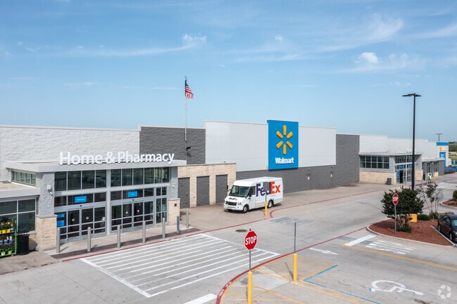


Property Detail
8015 Woodbridge Pkwy
Dallas-Fort Worth-Arlington, TX
WOODBRIDGE COMMONS PHASE TWO, BLK A, LOT 1R
R-10152-00A-001R-1
COLLIN
Commercialnec
Texas
B and X Area of moderate flood hazard, usually the area between the limits of the 100-year and 500-year floods.
1r
2025
16.34 AC
2025
Sachse/Rowlett
031336
Dallas/Ft Worth
145,268 SF
NEARBY LISTINGS FOR SALE OR LEASE
DEMOGRAPHICS near 8015 Woodbridge Pkwy
1 mile
3 mile
5 mile
2025 Total Population
10,613
90,233
207,471
2030 Population
12,049
100,429
228,362
Pop Growth 2025-2030
+ 13.53%
+ 11.30%
+ 10.07%
Average Age
38
38
38
2025 Total Households
3,687
28,698
66,938
HH Growth 2025-2030
+ 13.81%
+ 11.39%
+ 10.01%
Median Household Inc
$145,219
$123,915
$122,222
Avg Household Size
2.90
3.10
3.10
2025 Avg HH Vehicles
2.00
2.00
2.00
Median Home Value
$549,674
$444,934
$446,156
Median Year Built
2008
2004
2003
Nearby Places
Map Layers
Map Styles
 Street
 Aerial
Layers
 Traffic
 Biking
Places
Listings with unknown addresses are not visible on the map
- Restaurants
- Banks
- Shops
- Fitness
- Groceries
PUBLIC TRANSPORTATION
AIRPORT
Dallas Love Field
Drive
Walk
Distance
Dallas Love Field
42 min
29.9 mi
Dallas-Fort Worth International
Drive
Walk
Distance
Dallas-Fort Worth International
47 min
38.0 mi
Nearby Properties
Address
Land Use
TOTAL SIZE
Lot Size
Zoning
Address
Land Use
TOTAL SIZE
Lot Size
Zoning
339,663 SF
95.04 AC
Address
Land Use
TOTAL SIZE
Lot Size
Zoning
350,553 SF
18.71 AC
MF-M
Address
Land Use
TOTAL SIZE
Lot Size
Zoning
328,843 SF
11.70 AC
Z239
Address
Land Use
TOTAL SIZE
Lot Size
Zoning
361,965 SF
11.12 AC
Z06
Address
Land Use
TOTAL SIZE
Lot Size
Zoning
367,458 SF
13.42 AC
Address
Land Use
TOTAL SIZE
Lot Size
Zoning
320,801 SF
10.14 AC
Z236
Address
Land Use
TOTAL SIZE
Lot Size
Zoning
285,392 SF
19.44 AC
MF-M
Address
Land Use
TOTAL SIZE
Lot Size
Zoning
423,253 SF
30.26 AC
Z239
Address
Land Use
TOTAL SIZE
Lot Size
Zoning
441,356 SF
74.94 AC
Address
Land Use
TOTAL SIZE
Lot Size
Zoning
385,735 SF
13.13 AC
Address
Land Use
TOTAL SIZE
Lot Size
Zoning
266,957 SF
11.34 AC
MFR
Address
Land Use
TOTAL SIZE
Lot Size
Zoning
366,600 SF
8.09 AC
Z06
Address
Land Use
TOTAL SIZE
Lot Size
Zoning
393,054 SF
55.95 AC
Address
Land Use
TOTAL SIZE
Lot Size
Zoning
257,718 SF
13.10 AC
RESIDENTIA
Address
Land Use
TOTAL SIZE
Lot Size
Zoning
286,659 SF
9.94 AC
Z236
Address
Land Use
TOTAL SIZE
Lot Size
Zoning
228,536 SF
10.54 AC
MF-M
Address
Land Use
TOTAL SIZE
Lot Size
Zoning
231,434 SF
11.27 AC
Z06
Address
Land Use
TOTAL SIZE
Lot Size
Zoning
274,329 SF
44.89 AC
Address
Land Use
TOTAL SIZE
Lot Size
Zoning
114,945 SF
19.71 AC
TC
Address
Land Use
TOTAL SIZE
Lot Size
Zoning
223,052 SF
5.81 AC
Z236
Address
Land Use
TOTAL SIZE
Lot Size
Zoning
746 SF
115.14 AC
Address
Land Use
TOTAL SIZE
Lot Size
Zoning
85,793 SF
6.90 AC
Address
Land Use
TOTAL SIZE
Lot Size
Zoning
83,564 SF
10.81 AC
Address
Land Use
TOTAL SIZE
Lot Size
Zoning
140,130 SF
19.67 AC
Address
Land Use
TOTAL SIZE
Lot Size
Zoning
42,555 SF
21.32 AC
Z239
Address
Land Use
TOTAL SIZE
Lot Size
Zoning
132,306 SF
7.85 AC
MF
Address
Land Use
TOTAL SIZE
Lot Size
Zoning
78,708 SF
9.55 AC
Address
Land Use
TOTAL SIZE
Lot Size
Zoning
102,786 SF
28.88 AC
Address
Land Use
TOTAL SIZE
Lot Size
Zoning
77,225 SF
9.59 AC
Address
Land Use
TOTAL SIZE
Lot Size
Zoning
191,200 SF
20.69 AC
TC
The World's #1 Commercial Real Estate Marketplace
Connect with us
© 2026 CoStar Group
The information above has been obtained from sources believed reliable. While we do not doubt its accuracy we have not verified it and make no guarantee, warranty or representation about it. It is your responsibility to independently confirm its accuracy and completeness. Any projections, opinions, assumptions, or estimates used are for example only and do not represent the current or future performance of the property. The value of this transaction to you depends on tax and other factors which should be evaluated by your tax, financial, and legal advisors. You and your advisors should conduct a careful, independent investigation of the property to determine to your satisfaction the suitability of the property for your needs.