Property Record
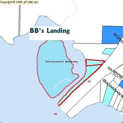
8017 Highway 79, Panama City Beach, FL 32413

Property Detail
8017 Highway 79
32555-000-000
21 2S 16W -10- 34C M & B IN LOT 13 ORIG & IN SW1/4 OF SW1/4 AS PER DB 68 P 45 & DB 90 P 291 & DB 126 P 333 LESS RD R/W ORB 274 P 385 ORB 3700 P 638 SUBJ TO GP ESMT ORB 3612 P1792
Storesoffices
BAY
BC05
Florida
AE The base floodplain where base flood elevations are provided. AE Zones are now used on new format FIRMs instead of A1-A30 Zones.
13
2024
10.47 AC
2025
Panama City
002706
Other Market Areas
320 SF
Panama City-Panama City Beach, FL
NEARBY LISTINGS FOR SALE OR LEASE
-
-
View all Panama City Beach listings for sale on LoopNet.com
DEMOGRAPHICS near 8017 Highway 79
1 mile
3 mile
5 mile
2025 Total Population
734
4,010
5,959
2030 Population
863
4,739
6,946
Pop Growth 2025-2030
+ 17.57%
+ 18.18%
+ 16.56%
Average Age
41
40
41
2025 Total Households
265
1,426
2,240
HH Growth 2025-2030
+ 17.74%
+ 18.37%
+ 16.70%
Median Household Inc
$84,659
$71,729
$81,994
Avg Household Size
2.80
2.80
2.60
2025 Avg HH Vehicles
2.00
2.00
2.00
Median Home Value
$333,333
$276,100
$344,791
Median Year Built
2010
2010
2007
Nearby Places
Map Layers
Map Styles
 Street
 Aerial
Layers
 Traffic
 Biking
Places
Listings with unknown addresses are not visible on the map
- Restaurants
- Banks
- Shops
- Fitness
- Groceries
PUBLIC TRANSPORTATION
AIRPORT
Northwest Florida Beaches International
Drive
Walk
Distance
Northwest Florida Beaches International
12 min
7.0 mi
Freight Ports
Port of Panama City
Drive
Walk
Distance
Port of Panama City
27 min
16.0 mi
Nearby Properties
Address
Land Use
TOTAL SIZE
Lot Size
Zoning
Address
Land Use
TOTAL SIZE
Lot Size
Zoning
4,964 SF
84.18 AC
BC08
Address
Land Use
TOTAL SIZE
Lot Size
Zoning
66,556 SF
5 AC
BC14
Address
Land Use
TOTAL SIZE
Lot Size
Zoning
9,554 SF
6 AC
Address
Land Use
TOTAL SIZE
Lot Size
Zoning
3,364 SF
21.97 AC
BC16
Address
Land Use
TOTAL SIZE
Lot Size
Zoning
73.10 AC
BC08
Address
Land Use
TOTAL SIZE
Lot Size
Zoning
6,579 SF
5.60 AC
BC16
Address
Land Use
TOTAL SIZE
Lot Size
Zoning
8,940 SF
1.36 AC
BC08
Address
Land Use
TOTAL SIZE
Lot Size
Zoning
9,882 SF
0.93 AC
CSVH
Address
Land Use
TOTAL SIZE
Lot Size
Zoning
1,800 SF
95.85 AC
BC13
Address
Land Use
TOTAL SIZE
Lot Size
Zoning
4,094 SF
1.33 AC
BC08
Address
Land Use
TOTAL SIZE
Lot Size
Zoning
10,512 SF
1.37 AC
BC08
Address
Land Use
TOTAL SIZE
Lot Size
Zoning
8,188 SF
1.16 AC
BC17
Address
Land Use
TOTAL SIZE
Lot Size
Zoning
8,010 SF
1.55 AC
CSVH
Address
Land Use
TOTAL SIZE
Lot Size
Zoning
6,254 SF
0.63 AC
CSVH
Address
Land Use
TOTAL SIZE
Lot Size
Zoning
7,526 SF
0.90 AC
CSVH
Address
Land Use
TOTAL SIZE
Lot Size
Zoning
3,398 SF
0.19 AC
Address
Land Use
TOTAL SIZE
Lot Size
Zoning
3,361 SF
0.18 AC
Address
Land Use
TOTAL SIZE
Lot Size
Zoning
3,178 SF
0.18 AC
Address
Land Use
TOTAL SIZE
Lot Size
Zoning
4,187 SF
0.17 AC
BC02
Address
Land Use
TOTAL SIZE
Lot Size
Zoning
3,398 SF
0.18 AC
Address
Land Use
TOTAL SIZE
Lot Size
Zoning
3,415 SF
0.18 AC
Address
Land Use
TOTAL SIZE
Lot Size
Zoning
3,361 SF
0.19 AC
Address
Land Use
TOTAL SIZE
Lot Size
Zoning
3,415 SF
0.18 AC
Address
Land Use
TOTAL SIZE
Lot Size
Zoning
3,398 SF
0.18 AC
Address
Land Use
TOTAL SIZE
Lot Size
Zoning
3,398 SF
0.20 AC
Address
Land Use
TOTAL SIZE
Lot Size
Zoning
3,178 SF
0.20 AC
Address
Land Use
TOTAL SIZE
Lot Size
Zoning
3,415 SF
0.20 AC
Address
Land Use
TOTAL SIZE
Lot Size
Zoning
3,415 SF
0.20 AC
Address
Land Use
TOTAL SIZE
Lot Size
Zoning
3,178 SF
0.18 AC
The World's #1 Commercial Real Estate Marketplace
Connect with us
© 2026 CoStar Group
The information above has been obtained from sources believed reliable. While we do not doubt its accuracy we have not verified it and make no guarantee, warranty or representation about it. It is your responsibility to independently confirm its accuracy and completeness. Any projections, opinions, assumptions, or estimates used are for example only and do not represent the current or future performance of the property. The value of this transaction to you depends on tax and other factors which should be evaluated by your tax, financial, and legal advisors. You and your advisors should conduct a careful, independent investigation of the property to determine to your satisfaction the suitability of the property for your needs.