Property Record
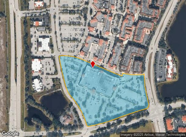
8017 Via Sardinia Way, Estero, FL 33928


NEARBY LISTINGS FOR SALE OR LEASE
Property Detail
8017 Via Sardinia Way
09-47-25-E2-360SC.0040
Coconut Point
Departmentstore
COCONUT POINT AREA 2 DESC IN INST#2006-409925 TRACT SC-4
X
Lee
12071C0593H
Florida
2024
11.77 AC
2025
Estero
050318
Southwest Florida
189,784 SF
Cape Coral-Fort Myers, FL
DEMOGRAPHICS near 8017 Via Sardinia Way
1 Mile
3 Mile
5 Mile
2024 Total Population
6,180
36,173
97,430
2029 Population
7,445
43,674
117,055
Pop Growth 2024-2029
+ 20.47%
+ 20.74%
+ 20.14%
Average Age
61
60
53
2024 Total Households
3,203
18,262
45,237
HH Growth 2024-2029
+ 20.17%
+ 20.44%
+ 20.08%
Median Household Inc
$94,284
$91,155
$83,119
Avg Household Size
1.90
1.90
2.10
2024 Avg HH Vehicles
2.00
2.00
2.00
Median Home Value
$407,555
$414,917
$373,341
Median Year Built
2002
2001
1999
Nearby Places
Map Layers
Map Styles
 Street
 Aerial
- Restaurants
- Banks
- Shops
- Fitness
- Groceries
PUBLIC TRANSPORTATION
AIRPORT
Southwest Florida International
DRIVE
WALK
Distance
Southwest Florida International
24 min
15.7 mi
Freight Ports
Port Manatee
DRIVE
WALK
Distance
Port Manatee
133 min
115.5 mi
Nearby Properties
Address
Land Use
TOTAL SIZE
Lot Size
Zoning
Address
Land Use
TOTAL SIZE
Lot Size
Zoning
785,522 SF
70.04 AC
MPD
Address
Land Use
TOTAL SIZE
Lot Size
Zoning
177,930 SF
20.74 AC
MPD
Address
Land Use
TOTAL SIZE
Lot Size
Zoning
687,668 SF
27.19 AC
CPD
Address
Land Use
TOTAL SIZE
Lot Size
Zoning
20.19 AC
MPD
Address
Land Use
TOTAL SIZE
Lot Size
Zoning
540,648 SF
19.75 AC
MPD
Address
Land Use
TOTAL SIZE
Lot Size
Zoning
293,332 SF
7.03 AC
CPD
Address
Land Use
TOTAL SIZE
Lot Size
Zoning
274,691 SF
6.62 AC
MPD
Address
Land Use
TOTAL SIZE
Lot Size
Zoning
348,757 SF
69.01 AC
CF-2
Address
Land Use
TOTAL SIZE
Lot Size
Zoning
69.37 AC
RPD
Address
Land Use
TOTAL SIZE
Lot Size
Zoning
5.39 AC
RPD
Address
Land Use
TOTAL SIZE
Lot Size
Zoning
239.40 AC
Address
Land Use
TOTAL SIZE
Lot Size
Zoning
166,672 SF
8.58 AC
CPD
Address
Land Use
TOTAL SIZE
Lot Size
Zoning
139,174 SF
4.73 AC
CPD
Address
Land Use
TOTAL SIZE
Lot Size
Zoning
48,538 SF
4.46 AC
CC
Address
Land Use
TOTAL SIZE
Lot Size
Zoning
97,916 SF
19.72 AC
CF-2
Address
Land Use
TOTAL SIZE
Lot Size
Zoning
181,680 SF
9.89 AC
MPD
Address
Land Use
TOTAL SIZE
Lot Size
Zoning
8.87 AC
CT
Address
Land Use
TOTAL SIZE
Lot Size
Zoning
35,085 SF
1.70 AC
TFC2
Address
Land Use
TOTAL SIZE
Lot Size
Zoning
103,495 SF
13.29 AC
CPD
Address
Land Use
TOTAL SIZE
Lot Size
Zoning
97,737 SF
10.67 AC
CPD
Address
Land Use
TOTAL SIZE
Lot Size
Zoning
154.77 AC
RPD
Address
Land Use
TOTAL SIZE
Lot Size
Zoning
87,430 SF
7.30 AC
IPD
Address
Land Use
TOTAL SIZE
Lot Size
Zoning
67,650 SF
2.27 AC
MPD
Address
Land Use
TOTAL SIZE
Lot Size
Zoning
73,370 SF
2.42 AC
MPD
Address
Land Use
TOTAL SIZE
Lot Size
Zoning
68,187 SF
2.47 AC
CPD
Address
Land Use
TOTAL SIZE
Lot Size
Zoning
84,782 SF
8.30 AC
MPD
Address
Land Use
TOTAL SIZE
Lot Size
Zoning
Address
Land Use
TOTAL SIZE
Lot Size
Zoning
112,563 SF
13.05 AC
CC-1
Address
Land Use
TOTAL SIZE
Lot Size
Zoning
94,995 SF
8.67 AC
CPD
Address
Land Use
TOTAL SIZE
Lot Size
Zoning
122,309 SF
1.95 AC
MPD
The World's #1 Commercial Real Estate Marketplace
Connect with us
© 2025 CoStar Group
The information above has been obtained from sources believed reliable. While we do not doubt its accuracy we have not verified it and make no guarantee, warranty or representation about it. It is your responsibility to independently confirm its accuracy and completeness. Any projections, opinions, assumptions, or estimates used are for example only and do not represent the current or future performance of the property. The value of this transaction to you depends on tax and other factors which should be evaluated by your tax, financial, and legal advisors. You and your advisors should conduct a careful, independent investigation of the property to determine to your satisfaction the suitability of the property for your needs.