Property Record
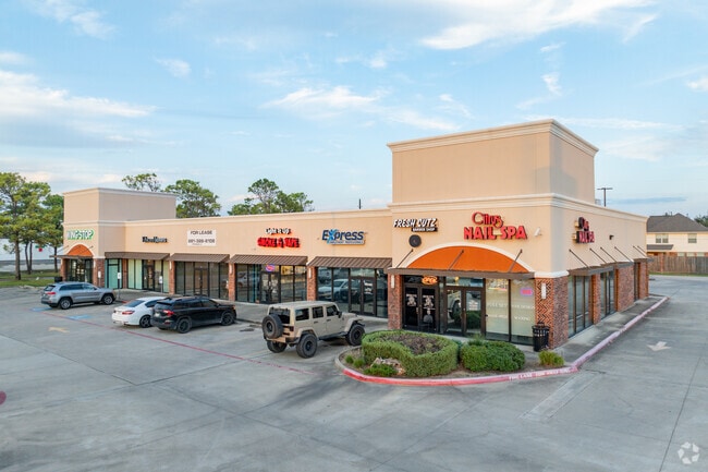
8018 N Highway 146, Baytown, TX 77523


NEARBY LISTINGS FOR SALE OR LEASE
Property Detail
8018 N Highway 146
Houston-The Woodlands-Sugar Land, TX
Country Meadows
22442-22440-00200-000000
LOT 2 REPLAT OF RES B COUNTRY MEADOWS SEC 5 BAYTOWN VILLAGE SQUARE
Commercialnec
Chambers
X
Texas
48201C0770N
2
2025
1.36 AC
2025
Chambers Cnty/Baytown
710201
Houston
10,766 SF
DEMOGRAPHICS near 8018 N Highway 146
1 Mile
3 Mile
5 Mile
2024 Total Population
7,612
18,675
63,041
2029 Population
9,764
22,674
73,472
Pop Growth 2024-2029
+ 28.27%
+ 21.41%
+ 16.55%
Average Age
34
36
35
2024 Total Households
2,400
6,037
20,511
HH Growth 2024-2029
+ 28.21%
+ 21.27%
+ 16.39%
Median Household Inc
$127,581
$99,584
$86,770
Avg Household Size
3.20
3.10
3.00
2024 Avg HH Vehicles
2.00
2.00
2.00
Median Home Value
$204,857
$232,782
$253,657
Median Year Built
2008
2003
2004
Nearby Places
Map Layers
Map Styles
 Street
 Aerial
- Restaurants
- Banks
- Shops
- Fitness
- Groceries
PUBLIC TRANSPORTATION
AIRPORT
William P Hobby
DRIVE
WALK
Distance
William P Hobby
52 min
34.6 mi
George Bush Intcntl/Houston
DRIVE
WALK
Distance
George Bush Intcntl/Houston
49 min
39.7 mi
Freight Ports
Port of Houston
DRIVE
WALK
Distance
Port of Houston
39 min
27.5 mi
SALE & LEASE HISTORY
LISTING DATE
SALE/LEASE

Sep 25, 2016
For Lease
Mar 25, 2021
For Sale
Nearby Properties
Address
Land Use
TOTAL SIZE
Lot Size
Zoning
Address
Land Use
TOTAL SIZE
Lot Size
Zoning
0.58 AC
Address
Land Use
TOTAL SIZE
Lot Size
Zoning
63,224 SF
738.31 AC
Address
Land Use
TOTAL SIZE
Lot Size
Zoning
738.47 AC
Address
Land Use
TOTAL SIZE
Lot Size
Zoning
463.62 AC
Address
Land Use
TOTAL SIZE
Lot Size
Zoning
738.31 AC
Address
Land Use
TOTAL SIZE
Lot Size
Zoning
Address
Land Use
TOTAL SIZE
Lot Size
Zoning
Address
Land Use
TOTAL SIZE
Lot Size
Zoning
738.47 AC
Address
Land Use
TOTAL SIZE
Lot Size
Zoning
504,680 SF
29.61 AC
Address
Land Use
TOTAL SIZE
Lot Size
Zoning
133,873 SF
12.26 AC
Address
Land Use
TOTAL SIZE
Lot Size
Zoning
22,375 SF
12.13 AC
Address
Land Use
TOTAL SIZE
Lot Size
Zoning
58,493 SF
18.49 AC
Address
Land Use
TOTAL SIZE
Lot Size
Zoning
738.47 AC
Address
Land Use
TOTAL SIZE
Lot Size
Zoning
187,383 SF
18.95 AC
Address
Land Use
TOTAL SIZE
Lot Size
Zoning
46.88 AC
Address
Land Use
TOTAL SIZE
Lot Size
Zoning
21,000 SF
51.28 AC
Address
Land Use
TOTAL SIZE
Lot Size
Zoning
24.90 AC
Address
Land Use
TOTAL SIZE
Lot Size
Zoning
111,906 SF
15.67 AC
Address
Land Use
TOTAL SIZE
Lot Size
Zoning
27.91 AC
Address
Land Use
TOTAL SIZE
Lot Size
Zoning
49.36 AC
Address
Land Use
TOTAL SIZE
Lot Size
Zoning
45.60 AC
Address
Land Use
TOTAL SIZE
Lot Size
Zoning
49,600 SF
5.20 AC
Address
Land Use
TOTAL SIZE
Lot Size
Zoning
6,771 SF
28.08 AC
Address
Land Use
TOTAL SIZE
Lot Size
Zoning
7,768 SF
10.46 AC
Address
Land Use
TOTAL SIZE
Lot Size
Zoning
174.54 AC
Address
Land Use
TOTAL SIZE
Lot Size
Zoning
51.32 AC
The World's #1 Commercial Real Estate Marketplace
Connect with us
© 2025 CoStar Group
The information above has been obtained from sources believed reliable. While we do not doubt its accuracy we have not verified it and make no guarantee, warranty or representation about it. It is your responsibility to independently confirm its accuracy and completeness. Any projections, opinions, assumptions, or estimates used are for example only and do not represent the current or future performance of the property. The value of this transaction to you depends on tax and other factors which should be evaluated by your tax, financial, and legal advisors. You and your advisors should conduct a careful, independent investigation of the property to determine to your satisfaction the suitability of the property for your needs.