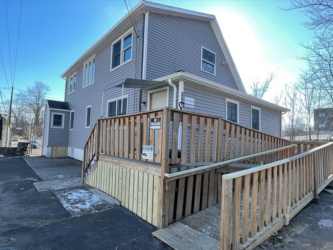
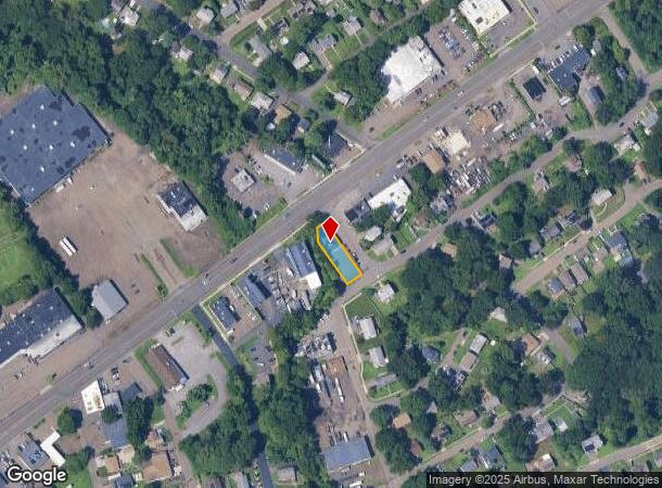
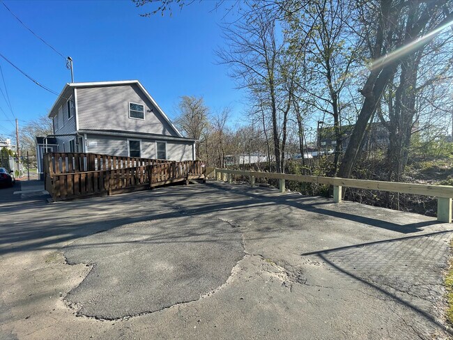
Property Record
802 Boston Post Rd, West Haven, CT 06516
NEARBY LISTINGS FOR SALE OR LEASE
Property Detail
802 Boston Post Rd
Officebuilding
New Haven
AE
Connecticut
09009C0436H
0.17 AC
2025
West Haven
2025
Westchester/So Connecticut
361500
New Haven, CT
1,699 SF
WHAV-000053-000414
DEMOGRAPHICS near 802 Boston Post Rd
1 Mile
3 Mile
5 Mile
2024 Total Population
17,054
107,367
222,653
2029 Population
16,969
106,336
220,299
Pop Growth 2024-2029
(0.50%)
(0.96%)
(1.06%)
Average Age
35
37
38
2024 Total Households
5,484
41,441
85,751
HH Growth 2024-2029
(0.91%)
(0.92%)
(1.06%)
Median Household Inc
$63,165
$59,897
$64,405
Avg Household Size
2.50
2.30
2.30
2024 Avg HH Vehicles
2.00
1.00
1.00
Median Home Value
$207,784
$244,494
$267,927
Median Year Built
1969
1955
1955
Nearby Places
Map Layers
Map Styles
 Street
 Aerial
- Restaurants
- Banks
- Shops
- Fitness
- Groceries
PUBLIC TRANSPORTATION
COMMUTER RAIL
DRIVE
WALK
Distance
4 min
2.1 mi
DRIVE
WALK
Distance
5 min
2.8 mi
AIRPORT
Tweed/New Haven
DRIVE
WALK
Distance
Tweed/New Haven
15 min
7.7 mi
Long Island MacArthur
DRIVE
WALK
Distance
Long Island MacArthur
130 min
49.3 mi
SALE & LEASE HISTORY
LISTING DATE
SALE/LEASE

Jan 26, 2022
For Lease
Nearby Properties
Address
Land Use
TOTAL SIZE
Lot Size
Zoning
Address
Land Use
TOTAL SIZE
Lot Size
Zoning
289,886 SF
2.21 AC
BD2
Address
Land Use
TOTAL SIZE
Lot Size
Zoning
56,359 SF
17.09 AC
RCPD
Address
Land Use
TOTAL SIZE
Lot Size
Zoning
347,604 SF
6.37 AC
RM2
Address
Land Use
TOTAL SIZE
Lot Size
Zoning
49,582 SF
1.62 AC
RH2
Address
Land Use
TOTAL SIZE
Lot Size
Zoning
50.14 AC
PRD
Address
Land Use
TOTAL SIZE
Lot Size
Zoning
81,870 SF
3.86 AC
RM2
Address
Land Use
TOTAL SIZE
Lot Size
Zoning
132,345 SF
3.48 AC
RH2
Address
Land Use
TOTAL SIZE
Lot Size
Zoning
302,262 SF
10.40 AC
RM1
Address
Land Use
TOTAL SIZE
Lot Size
Zoning
446,320 SF
BD1
Address
Land Use
TOTAL SIZE
Lot Size
Zoning
217,040 SF
2.20 AC
RH2
Address
Land Use
TOTAL SIZE
Lot Size
Zoning
133,767 SF
1.25 AC
BD2
Address
Land Use
TOTAL SIZE
Lot Size
Zoning
486,703 SF
2.12 AC
BD
Address
Land Use
TOTAL SIZE
Lot Size
Zoning
72,708 SF
1.91 AC
PDU 87
Address
Land Use
TOTAL SIZE
Lot Size
Zoning
117,902 SF
1.41 AC
BD
Address
Land Use
TOTAL SIZE
Lot Size
Zoning
318,210 SF
2.73 AC
BA
Address
Land Use
TOTAL SIZE
Lot Size
Zoning
102,115 SF
0.77 AC
RH2
Address
Land Use
TOTAL SIZE
Lot Size
Zoning
57,339 SF
3.46 AC
RM2
Address
Land Use
TOTAL SIZE
Lot Size
Zoning
123,166 SF
2.33 AC
RH2
Address
Land Use
TOTAL SIZE
Lot Size
Zoning
75,139 SF
3.54 AC
RM1
Address
Land Use
TOTAL SIZE
Lot Size
Zoning
42.52 AC
PF
Address
Land Use
TOTAL SIZE
Lot Size
Zoning
29,647 SF
0.99 AC
RH2
Address
Land Use
TOTAL SIZE
Lot Size
Zoning
123,518 SF
2.88 AC
RH2
Address
Land Use
TOTAL SIZE
Lot Size
Zoning
287,844 SF
2.11 AC
IL
Address
Land Use
TOTAL SIZE
Lot Size
Zoning
158,622 SF
2.09 AC
BA/RM2
Address
Land Use
TOTAL SIZE
Lot Size
Zoning
29.78 AC
PRD
Address
Land Use
TOTAL SIZE
Lot Size
Zoning
76,945 SF
8.52 AC
RM2
Address
Land Use
TOTAL SIZE
Lot Size
Zoning
35.05 AC
LI-2
Address
Land Use
TOTAL SIZE
Lot Size
Zoning
125,577 SF
0.90 AC
RH2
Address
Land Use
TOTAL SIZE
Lot Size
Zoning
73,504 SF
7.97 AC
PDD 10
Address
Land Use
TOTAL SIZE
Lot Size
Zoning
205,756 SF
1.27 AC
PDD 15
The World's #1 Commercial Real Estate Marketplace
Connect with us
© 2026 CoStar Group
The information above has been obtained from sources believed reliable. While we do not doubt its accuracy we have not verified it and make no guarantee, warranty or representation about it. It is your responsibility to independently confirm its accuracy and completeness. Any projections, opinions, assumptions, or estimates used are for example only and do not represent the current or future performance of the property. The value of this transaction to you depends on tax and other factors which should be evaluated by your tax, financial, and legal advisors. You and your advisors should conduct a careful, independent investigation of the property to determine to your satisfaction the suitability of the property for your needs.