Property Record
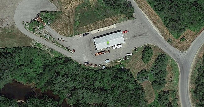
802 E Ricker Rd, Suncook, NH 03275

Property Detail
802 E Ricker Rd
PMBR-000256-000026-000002
MERRIMACK
Industrialgeneral
New Hampshire
C-1
2
B and X Area of moderate flood hazard, usually the area between the limits of the 100-year and 500-year floods.
35.40 AC
2025
Concord/New Hampshire North Area
2025
Other Market Areas
003202
Concord, NH
4,000 SF
NEARBY LISTINGS FOR SALE OR LEASE
-
-
View all Suncook listings for sale on LoopNet.com
DEMOGRAPHICS near 802 E Ricker Rd
1 mile
3 mile
5 mile
2025 Total Population
659
9,684
28,543
2030 Population
675
9,857
29,065
Pop Growth 2025-2030
+ 2.43%
+ 1.79%
+ 1.83%
Average Age
43
44
43
2025 Total Households
250
4,217
12,381
HH Growth 2025-2030
+ 2.40%
+ 1.73%
+ 1.87%
Median Household Inc
$125,676
$88,248
$81,891
Avg Household Size
2.60
2.30
2.20
2025 Avg HH Vehicles
2.00
2.00
2.00
Median Home Value
$393,835
$353,003
$349,227
Median Year Built
1986
1983
1976
Nearby Places
Map Layers
Map Styles
 Street
 Aerial
Layers
 Traffic
 Biking
Places
Listings with unknown addresses are not visible on the map
- Restaurants
- Banks
- Shops
- Fitness
- Groceries
PUBLIC TRANSPORTATION
AIRPORT
Manchester Boston Regional
Drive
Walk
Distance
Manchester Boston Regional
44 min
29.2 mi
Portsmouth International at Pease
Drive
Walk
Distance
Portsmouth International at Pease
64 min
38.8 mi
Nearby Properties
Address
Land Use
TOTAL SIZE
Lot Size
Zoning
Address
Land Use
TOTAL SIZE
Lot Size
Zoning
1,500 SF
RO
Address
Land Use
TOTAL SIZE
Lot Size
Zoning
65.25 AC
IN
Address
Land Use
TOTAL SIZE
Lot Size
Zoning
20 AC
RH
Address
Land Use
TOTAL SIZE
Lot Size
Zoning
41.49 AC
CG
Address
Land Use
TOTAL SIZE
Lot Size
Zoning
194,386 SF
33.30 AC
GWP
Address
Land Use
TOTAL SIZE
Lot Size
Zoning
10.85 AC
GWP
Address
Land Use
TOTAL SIZE
Lot Size
Zoning
13.23 AC
RH
Address
Land Use
TOTAL SIZE
Lot Size
Zoning
142,137 SF
10.23 AC
OFP
Address
Land Use
TOTAL SIZE
Lot Size
Zoning
21.45 AC
RH
Address
Land Use
TOTAL SIZE
Lot Size
Zoning
121,292 SF
10.69 AC
GWP
Address
Land Use
TOTAL SIZE
Lot Size
Zoning
7.48 AC
RM
Address
Land Use
TOTAL SIZE
Lot Size
Zoning
50.19 AC
GWP
Address
Land Use
TOTAL SIZE
Lot Size
Zoning
34.94 AC
RM
Address
Land Use
TOTAL SIZE
Lot Size
Zoning
135,161 SF
36.20 AC
GWP
Address
Land Use
TOTAL SIZE
Lot Size
Zoning
114,620 SF
12.89 AC
GWP
Address
Land Use
TOTAL SIZE
Lot Size
Zoning
65,868 SF
10.40 AC
GWP
Address
Land Use
TOTAL SIZE
Lot Size
Zoning
9,000 SF
49.90 AC
C-1D
Address
Land Use
TOTAL SIZE
Lot Size
Zoning
8.58 AC
GWP
Address
Land Use
TOTAL SIZE
Lot Size
Zoning
15.55 AC
IN
Address
Land Use
TOTAL SIZE
Lot Size
Zoning
Address
Land Use
TOTAL SIZE
Lot Size
Zoning
5.75 AC
CG
Address
Land Use
TOTAL SIZE
Lot Size
Zoning
44,809 SF
7.75 AC
OFP
Address
Land Use
TOTAL SIZE
Lot Size
Zoning
44,963 SF
16.29 AC
COMM V
Address
Land Use
TOTAL SIZE
Lot Size
Zoning
8.33 AC
GWP
Address
Land Use
TOTAL SIZE
Lot Size
Zoning
65,141 SF
35.70 AC
RM
Address
Land Use
TOTAL SIZE
Lot Size
Zoning
6.26 AC
RH
Address
Land Use
TOTAL SIZE
Lot Size
Zoning
86,346 SF
3.60 AC
IN
Address
Land Use
TOTAL SIZE
Lot Size
Zoning
59,844 SF
4.41 AC
OFP
Address
Land Use
TOTAL SIZE
Lot Size
Zoning
65,735 SF
7.93 AC
OFP
Address
Land Use
TOTAL SIZE
Lot Size
Zoning
3.47 AC
GWP
The World's #1 Commercial Real Estate Marketplace
Connect with us
© 2026 CoStar Group
The information above has been obtained from sources believed reliable. While we do not doubt its accuracy we have not verified it and make no guarantee, warranty or representation about it. It is your responsibility to independently confirm its accuracy and completeness. Any projections, opinions, assumptions, or estimates used are for example only and do not represent the current or future performance of the property. The value of this transaction to you depends on tax and other factors which should be evaluated by your tax, financial, and legal advisors. You and your advisors should conduct a careful, independent investigation of the property to determine to your satisfaction the suitability of the property for your needs.