Property Record
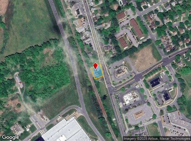
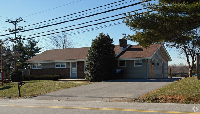
802 S Main St, Hampstead, MD 21074

NEARBY LISTINGS FOR SALE OR LEASE
-
-
View all Hampstead listings for sale on LoopNet.com
Property Detail
802 S Main St
08-002614
LT - 10271 SQ FT 802 S MAIN ST HAMPSTEAD
Officebuilding
Carroll
X
Maryland
2400100080G
0.24 AC
2025
Carroll County
2025
Baltimore
508200
Baltimore-Columbia-Towson, MD
1,652 SF
DEMOGRAPHICS near 802 S Main St
1 mile
3 mile
5 mile
2024 Total Population
5,782
12,797
24,677
2029 Population
5,952
13,089
25,053
Pop Growth 2024-2029
+ 2.94%
+ 2.28%
+ 1.52%
Average Age
40
41
42
2024 Total Households
2,307
4,922
9,274
HH Growth 2024-2029
+ 2.99%
+ 2.38%
+ 1.60%
Median Household Inc
$87,464
$92,177
$96,841
Avg Household Size
2.50
2.60
2.60
2024 Avg HH Vehicles
2.00
2.00
2.00
Median Home Value
$298,512
$339,787
$363,634
Median Year Built
1986
1984
1981
Nearby Places
Map Layers
Map Styles
 Street
 Aerial
Transit
 Traffic
 Biking
Places
Listings with unknown addresses are not visible on the map
- Restaurants
- Banks
- Shops
- Fitness
- Groceries
Nearby Properties
Address
Land Use
TOTAL SIZE
Lot Size
Zoning
Address
Land Use
TOTAL SIZE
Lot Size
Zoning
1,034,020 SF
51.58 AC
I-1
Address
Land Use
TOTAL SIZE
Lot Size
Zoning
842,295 SF
134.68 AC
RESTR
Address
Land Use
TOTAL SIZE
Lot Size
Zoning
223,105 SF
21.16 AC
RESTR
Address
Land Use
TOTAL SIZE
Lot Size
Zoning
115,358 SF
26.99 AC
PUBLI
Address
Land Use
TOTAL SIZE
Lot Size
Zoning
24,592 SF
1.17 AC
GLC3*
Address
Land Use
TOTAL SIZE
Lot Size
Zoning
58,095 SF
19.95 AC
Address
Land Use
TOTAL SIZE
Lot Size
Zoning
95,786 SF
10.11 AC
RESTR
Address
Land Use
TOTAL SIZE
Lot Size
Zoning
52,728 SF
13.88 AC
GENER
Address
Land Use
TOTAL SIZE
Lot Size
Zoning
210,288 SF
38.44 AC
RESTR
Address
Land Use
TOTAL SIZE
Lot Size
Zoning
229.22 AC
PUBLI
Address
Land Use
TOTAL SIZE
Lot Size
Zoning
39,992 SF
19.57 AC
PUBLI
Address
Land Use
TOTAL SIZE
Lot Size
Zoning
13,120 SF
3.15 AC
Address
Land Use
TOTAL SIZE
Lot Size
Zoning
3,000 SF
4.62 AC
I-1
Address
Land Use
TOTAL SIZE
Lot Size
Zoning
34,584 SF
6.02 AC
RESTR
Address
Land Use
TOTAL SIZE
Lot Size
Zoning
72,750 SF
7.09 AC
RESTR
Address
Land Use
TOTAL SIZE
Lot Size
Zoning
10,642 SF
2.30 AC
LOCAL
Address
Land Use
TOTAL SIZE
Lot Size
Zoning
52,108 SF
18.92 AC
AGRIC
Address
Land Use
TOTAL SIZE
Lot Size
Zoning
7,696 SF
2.84 AC
GENER
Address
Land Use
TOTAL SIZE
Lot Size
Zoning
702 SF
34.80 AC
RESTR
Address
Land Use
TOTAL SIZE
Lot Size
Zoning
20,705 SF
182.66 AC
RC2
Address
Land Use
TOTAL SIZE
Lot Size
Zoning
260,550 SF
49.38 AC
HISTO
Address
Land Use
TOTAL SIZE
Lot Size
Zoning
52,824 SF
9.74 AC
GENER
Address
Land Use
TOTAL SIZE
Lot Size
Zoning
11,860 SF
1.64 AC
LOCAL
Address
Land Use
TOTAL SIZE
Lot Size
Zoning
3,820 SF
103 AC
R-750
Address
Land Use
TOTAL SIZE
Lot Size
Zoning
39.19 AC
RESTR
Address
Land Use
TOTAL SIZE
Lot Size
Zoning
13,657 SF
4.05 AC
PRIVA
Address
Land Use
TOTAL SIZE
Lot Size
Zoning
33,350 SF
3.50 AC
HISTO
Address
Land Use
TOTAL SIZE
Lot Size
Zoning
3,864 SF
4.87 AC
C-2
Address
Land Use
TOTAL SIZE
Lot Size
Zoning
9,100 SF
0.85 AC
GENER
Address
Land Use
TOTAL SIZE
Lot Size
Zoning
2,120 SF
1.10 AC
RES O
The World's #1 Commercial Real Estate Marketplace
Connect with us
© 2026 CoStar Group
The information above has been obtained from sources believed reliable. While we do not doubt its accuracy we have not verified it and make no guarantee, warranty or representation about it. It is your responsibility to independently confirm its accuracy and completeness. Any projections, opinions, assumptions, or estimates used are for example only and do not represent the current or future performance of the property. The value of this transaction to you depends on tax and other factors which should be evaluated by your tax, financial, and legal advisors. You and your advisors should conduct a careful, independent investigation of the property to determine to your satisfaction the suitability of the property for your needs.