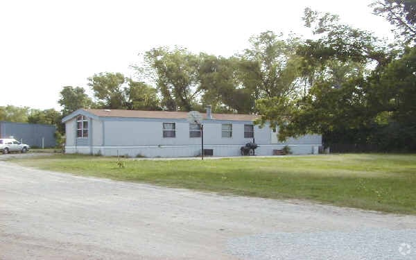
Property Record
802 W Oakdale Rd, Grand Prairie, TX 75050

NEARBY LISTINGS FOR SALE OR LEASE
-
-
View all Grand Prairie listings for sale on LoopNet.com
Property Detail
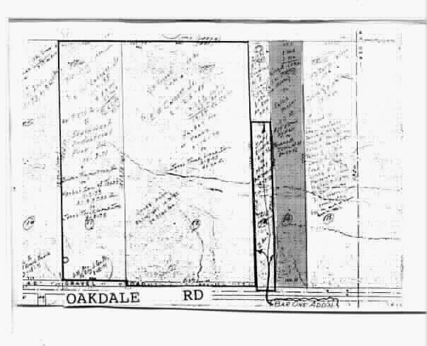
802 W Oakdale Rd
65020246010140000
B B B & C Rr Co
Warehouse
B B B & C RR CO ABST 202 PG 460 TR 14 ACS 3.08 INT201300357582 DD11192013 CO-DC 0202460101400 5CP02024601
X
Dallas
48439C0245L
Texas
2024
3.08 AC
2025
Grand Prairie
015304
Dallas/Ft Worth
5,685 SF
Dallas-Fort Worth-Arlington, TX
DEMOGRAPHICS near 802 W Oakdale Rd
1 Mile
3 Mile
5 Mile
2024 Total Population
2,561
72,479
250,285
2029 Population
2,528
72,219
251,612
Pop Growth 2024-2029
(1.29%)
(0.36%)
+ 0.53%
Average Age
33
36
35
2024 Total Households
757
26,447
91,424
HH Growth 2024-2029
(1.45%)
(0.22%)
+ 0.76%
Median Household Inc
$48,792
$59,603
$57,213
Avg Household Size
3.40
2.70
2.70
2024 Avg HH Vehicles
2.00
2.00
2.00
Median Home Value
$78,309
$229,528
$225,429
Median Year Built
1991
1982
1981
Nearby Places
Map Layers
Map Styles
 Street
 Aerial
- Restaurants
- Banks
- Shops
- Fitness
- Groceries
PUBLIC TRANSPORTATION
COMMUTER RAIL
DRIVE
WALK
Distance
5 min
2.1 mi
DRIVE
WALK
Distance
10 min
3.4 mi
AIRPORT
Dallas-Fort Worth International
DRIVE
WALK
Distance
Dallas-Fort Worth International
17 min
9.5 mi
Dallas Love Field
DRIVE
WALK
Distance
Dallas Love Field
26 min
15.7 mi
Nearby Properties
Address
Land Use
TOTAL SIZE
Lot Size
Zoning
Address
Land Use
TOTAL SIZE
Lot Size
Zoning
485,911 SF
54.76 AC
Address
Land Use
TOTAL SIZE
Lot Size
Zoning
522,294 SF
18.35 AC
Address
Land Use
TOTAL SIZE
Lot Size
Zoning
703,500 SF
47.38 AC
Z236
Address
Land Use
TOTAL SIZE
Lot Size
Zoning
496,283 SF
246.29 AC
Z236
Address
Land Use
TOTAL SIZE
Lot Size
Zoning
422,880 SF
20.06 AC
Z177
Address
Land Use
TOTAL SIZE
Lot Size
Zoning
738,276 SF
40.57 AC
Z243
Address
Land Use
TOTAL SIZE
Lot Size
Zoning
680,900 SF
32.25 AC
Z236
Address
Land Use
TOTAL SIZE
Lot Size
Zoning
683,300 SF
40.23 AC
Z01
Address
Land Use
TOTAL SIZE
Lot Size
Zoning
342,583 SF
23.87 AC
Address
Land Use
TOTAL SIZE
Lot Size
Zoning
334,057 SF
20.05 AC
Z312
Address
Land Use
TOTAL SIZE
Lot Size
Zoning
339,965 SF
15.59 AC
Address
Land Use
TOTAL SIZE
Lot Size
Zoning
576,000 SF
55.36 AC
Z123
Address
Land Use
TOTAL SIZE
Lot Size
Zoning
151,552 SF
16 AC
Z58
Address
Land Use
TOTAL SIZE
Lot Size
Zoning
413,524 SF
24.70 AC
Z198
Address
Land Use
TOTAL SIZE
Lot Size
Zoning
285,194 SF
15.91 AC
Address
Land Use
TOTAL SIZE
Lot Size
Zoning
531,072 SF
26.50 AC
Z236
Address
Land Use
TOTAL SIZE
Lot Size
Zoning
585,000 SF
27.06 AC
Z123
Address
Land Use
TOTAL SIZE
Lot Size
Zoning
520,000 SF
28.92 AC
Z123
Address
Land Use
TOTAL SIZE
Lot Size
Zoning
563,300 SF
27.40 AC
Z128
Address
Land Use
TOTAL SIZE
Lot Size
Zoning
264,010 SF
34.50 AC
Z190
Address
Land Use
TOTAL SIZE
Lot Size
Zoning
197,000 SF
25.51 AC
Z236
Address
Land Use
TOTAL SIZE
Lot Size
Zoning
500,256 SF
25.64 AC
Z123
Address
Land Use
TOTAL SIZE
Lot Size
Zoning
266,448 SF
17 AC
Z97
Address
Land Use
TOTAL SIZE
Lot Size
Zoning
304,636 SF
12.84 AC
Address
Land Use
TOTAL SIZE
Lot Size
Zoning
193,212 SF
9.68 AC
Z177
Address
Land Use
TOTAL SIZE
Lot Size
Zoning
309,386 SF
15.14 AC
Address
Land Use
TOTAL SIZE
Lot Size
Zoning
277,385 SF
14.33 AC
Address
Land Use
TOTAL SIZE
Lot Size
Zoning
257,409 SF
12.31 AC
Address
Land Use
TOTAL SIZE
Lot Size
Zoning
224,486 SF
18.11 AC
Z236
Address
Land Use
TOTAL SIZE
Lot Size
Zoning
241,780 SF
16.46 AC
RMR2
The World's #1 Commercial Real Estate Marketplace
Connect with us
© 2025 CoStar Group
The information above has been obtained from sources believed reliable. While we do not doubt its accuracy we have not verified it and make no guarantee, warranty or representation about it. It is your responsibility to independently confirm its accuracy and completeness. Any projections, opinions, assumptions, or estimates used are for example only and do not represent the current or future performance of the property. The value of this transaction to you depends on tax and other factors which should be evaluated by your tax, financial, and legal advisors. You and your advisors should conduct a careful, independent investigation of the property to determine to your satisfaction the suitability of the property for your needs.