Property Record
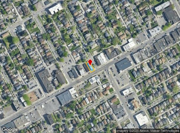
8020 W Vernor Hwy, Detroit, MI 48209


NEARBY LISTINGS FOR SALE OR LEASE
Property Detail
8020 W Vernor Hwy
20-004313
Harrahs Dix Ave
Storebuilding
N VERNOR HIGHWAY E 5 FT 10 9 HARRAHS DIX AVE SUB L17 P81 PLATS, W C R 20/194 40 X 100
X
Wayne
26163C0270F
Michigan
2024
0.09 AC
2025
Detroit W of Woodward
524101
Detroit
3,258 SF
Detroit-Warren-Dearborn, MI
DEMOGRAPHICS near 8020 W Vernor Hwy
1 Mile
3 Mile
5 Mile
2024 Total Population
18,018
91,141
275,850
2029 Population
17,516
89,346
271,699
Pop Growth 2024-2029
(2.79%)
(1.97%)
(1.50%)
Average Age
33
34
36
2024 Total Households
5,540
29,052
104,334
HH Growth 2024-2029
(2.82%)
(1.71%)
(1.15%)
Median Household Inc
$35,986
$35,069
$37,215
Avg Household Size
3.10
3.00
2.50
2024 Avg HH Vehicles
1.00
1.00
1.00
Median Home Value
$70,674
$86,633
$95,827
Median Year Built
1946
1947
1948
Nearby Places
Map Layers
Map Styles
 Street
 Aerial
- Restaurants
- Banks
- Shops
- Fitness
- Groceries
PUBLIC TRANSPORTATION
COMMUTER RAIL
Detroit (Wolverine - Amtrak)
DRIVE
WALK
Distance
Detroit (Wolverine - Amtrak)
13 min
6.4 mi
Dearborn (Wolverine - Amtrak)
DRIVE
WALK
Distance
Dearborn (Wolverine - Amtrak)
16 min
6.7 mi
AIRPORT
Windsor International
DRIVE
WALK
Distance
Windsor International
30 min
14.5 mi
Detroit Metro Wayne County
DRIVE
WALK
Distance
Detroit Metro Wayne County
27 min
18.5 mi
Freight Ports
Port of Toledo
DRIVE
WALK
Distance
Port of Toledo
69 min
56.3 mi
SALE & LEASE HISTORY
LISTING DATE
SALE/LEASE

Jan 03, 2019
For Sale
Nearby Properties
Address
Land Use
TOTAL SIZE
Lot Size
Zoning
Address
Land Use
TOTAL SIZE
Lot Size
Zoning
6,620 SF
9.43 AC
B6
Address
Land Use
TOTAL SIZE
Lot Size
Zoning
590,116 SF
388.80 AC
ID
Address
Land Use
TOTAL SIZE
Lot Size
Zoning
153,040 SF
2.13 AC
BC
Address
Land Use
TOTAL SIZE
Lot Size
Zoning
2,822,007 SF
75.54 AC
ID
Address
Land Use
TOTAL SIZE
Lot Size
Zoning
309,661 SF
8.81 AC
M4
Address
Land Use
TOTAL SIZE
Lot Size
Zoning
1,076,924 SF
125.54 AC
ID
Address
Land Use
TOTAL SIZE
Lot Size
Zoning
102,646 SF
77.55 AC
ID
Address
Land Use
TOTAL SIZE
Lot Size
Zoning
452,876 SF
Address
Land Use
TOTAL SIZE
Lot Size
Zoning
80,861 SF
1.17 AC
BC
Address
Land Use
TOTAL SIZE
Lot Size
Zoning
111,008 SF
26.62 AC
IB
Address
Land Use
TOTAL SIZE
Lot Size
Zoning
365,040 SF
382 AC
M4
Address
Land Use
TOTAL SIZE
Lot Size
Zoning
520,522 SF
51.78 AC
M4
Address
Land Use
TOTAL SIZE
Lot Size
Zoning
590,652 SF
21.79 AC
TM
Address
Land Use
TOTAL SIZE
Lot Size
Zoning
191,460 SF
Address
Land Use
TOTAL SIZE
Lot Size
Zoning
342,272 SF
16.48 AC
M4
Address
Land Use
TOTAL SIZE
Lot Size
Zoning
303,705 SF
17.28 AC
ID
Address
Land Use
TOTAL SIZE
Lot Size
Zoning
381,532 SF
M4
Address
Land Use
TOTAL SIZE
Lot Size
Zoning
196,801 SF
38.32 AC
M5
Address
Land Use
TOTAL SIZE
Lot Size
Zoning
83,552 SF
20.32 AC
IC
Address
Land Use
TOTAL SIZE
Lot Size
Zoning
735,435 SF
37.86 AC
ID
Address
Land Use
TOTAL SIZE
Lot Size
Zoning
147,942 SF
14 AC
IA
Address
Land Use
TOTAL SIZE
Lot Size
Zoning
193,155 SF
8.68 AC
R1 1 FA
Address
Land Use
TOTAL SIZE
Lot Size
Zoning
47,524 SF
Address
Land Use
TOTAL SIZE
Lot Size
Zoning
1,452 SF
19.24 AC
IC
Address
Land Use
TOTAL SIZE
Lot Size
Zoning
483,165 SF
22.98 AC
IB
Address
Land Use
TOTAL SIZE
Lot Size
Zoning
145,572 SF
58.41 AC
M4
Address
Land Use
TOTAL SIZE
Lot Size
Zoning
314,003 SF
26.32 AC
B6
Address
Land Use
TOTAL SIZE
Lot Size
Zoning
61,840 SF
M4
Address
Land Use
TOTAL SIZE
Lot Size
Zoning
336,958 SF
15.54 AC
IB
Address
Land Use
TOTAL SIZE
Lot Size
Zoning
193,114 SF
20.29 AC
M4
The World's #1 Commercial Real Estate Marketplace
Connect with us
© 2025 CoStar Group
The information above has been obtained from sources believed reliable. While we do not doubt its accuracy we have not verified it and make no guarantee, warranty or representation about it. It is your responsibility to independently confirm its accuracy and completeness. Any projections, opinions, assumptions, or estimates used are for example only and do not represent the current or future performance of the property. The value of this transaction to you depends on tax and other factors which should be evaluated by your tax, financial, and legal advisors. You and your advisors should conduct a careful, independent investigation of the property to determine to your satisfaction the suitability of the property for your needs.