Property Record
8025 Depot Rd, Ashtabula, OH 44004


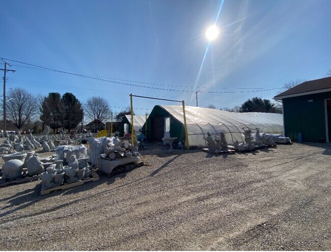
Property Detail
8025 Depot Rd
Cleveland-Elyria, OH
59
480190007600
Ashtabula
Commercialnec
Ohio
B and X Area of moderate flood hazard, usually the area between the limits of the 100-year and 500-year floods.
59
2025
1.16 AC
2025
Ashtabula County
000702
Cleveland
NEARBY LISTINGS FOR SALE OR LEASE
-
-
View all Ashtabula listings for sale on LoopNet.com
DEMOGRAPHICS near 8025 Depot Rd
1 mile
3 mile
5 mile
2025 Total Population
698
3,427
26,319
2030 Population
684
3,400
26,426
Pop Growth 2025-2030
(2.01%)
(0.79%)
+ 0.41%
Average Age
45
45
43
2025 Total Households
286
1,459
11,004
HH Growth 2025-2030
(2.10%)
(0.75%)
+ 0.50%
Median Household Inc
$72,691
$72,127
$58,157
Avg Household Size
2.40
2.30
2.30
2025 Avg HH Vehicles
2.00
2.00
2.00
Median Home Value
$160,280
$173,795
$167,420
Median Year Built
1957
1962
1962
Nearby Places
Map Layers
Map Styles
 Street
 Aerial
Layers
 Traffic
 Biking
Places
Listings with unknown addresses are not visible on the map
- Restaurants
- Banks
- Shops
- Fitness
- Groceries
SALE & LEASE HISTORY
LISTING DATE
SALE/LEASE

Sep 13, 2022
For Sale
Apr 06, 2022
For Sale
Nearby Properties
Address
Land Use
TOTAL SIZE
Lot Size
Zoning
Address
Land Use
TOTAL SIZE
Lot Size
Zoning
311,348 SF
128.96 AC
Address
Land Use
TOTAL SIZE
Lot Size
Zoning
15,826 SF
320.34 AC
Address
Land Use
TOTAL SIZE
Lot Size
Zoning
936,616 SF
32.04 AC
Address
Land Use
TOTAL SIZE
Lot Size
Zoning
400,734 SF
29.94 AC
Address
Land Use
TOTAL SIZE
Lot Size
Zoning
Address
Land Use
TOTAL SIZE
Lot Size
Zoning
231,332 SF
16.53 AC
Address
Land Use
TOTAL SIZE
Lot Size
Zoning
100,819 SF
6.16 AC
Address
Land Use
TOTAL SIZE
Lot Size
Zoning
Address
Land Use
TOTAL SIZE
Lot Size
Zoning
Address
Land Use
TOTAL SIZE
Lot Size
Zoning
55,948 SF
12.28 AC
Address
Land Use
TOTAL SIZE
Lot Size
Zoning
53,096 SF
20.34 AC
Address
Land Use
TOTAL SIZE
Lot Size
Zoning
12,897 SF
3.58 AC
Address
Land Use
TOTAL SIZE
Lot Size
Zoning
78,016 SF
7.70 AC
Address
Land Use
TOTAL SIZE
Lot Size
Zoning
30,826 SF
2.60 AC
Address
Land Use
TOTAL SIZE
Lot Size
Zoning
27,928 SF
18.98 AC
Address
Land Use
TOTAL SIZE
Lot Size
Zoning
40,782 SF
1.75 AC
Address
Land Use
TOTAL SIZE
Lot Size
Zoning
62,044 SF
9.21 AC
Address
Land Use
TOTAL SIZE
Lot Size
Zoning
380,401 SF
45.45 AC
Address
Land Use
TOTAL SIZE
Lot Size
Zoning
62,376 SF
5.93 AC
Address
Land Use
TOTAL SIZE
Lot Size
Zoning
12,670 SF
2.51 AC
Address
Land Use
TOTAL SIZE
Lot Size
Zoning
60,600 SF
11.91 AC
Address
Land Use
TOTAL SIZE
Lot Size
Zoning
21,138 SF
Address
Land Use
TOTAL SIZE
Lot Size
Zoning
3,344 SF
10.38 AC
Address
Land Use
TOTAL SIZE
Lot Size
Zoning
51,500 SF
5.11 AC
Address
Land Use
TOTAL SIZE
Lot Size
Zoning
62,044 SF
9.21 AC
Address
Land Use
TOTAL SIZE
Lot Size
Zoning
21,431 SF
6.44 AC
Address
Land Use
TOTAL SIZE
Lot Size
Zoning
7,592 SF
2.25 AC
Address
Land Use
TOTAL SIZE
Lot Size
Zoning
Address
Land Use
TOTAL SIZE
Lot Size
Zoning
43,312 SF
14.95 AC
Address
Land Use
TOTAL SIZE
Lot Size
Zoning
2,400 SF
249.94 AC
The World's #1 Commercial Real Estate Marketplace
Connect with us
© 2026 CoStar Group
The information above has been obtained from sources believed reliable. While we do not doubt its accuracy we have not verified it and make no guarantee, warranty or representation about it. It is your responsibility to independently confirm its accuracy and completeness. Any projections, opinions, assumptions, or estimates used are for example only and do not represent the current or future performance of the property. The value of this transaction to you depends on tax and other factors which should be evaluated by your tax, financial, and legal advisors. You and your advisors should conduct a careful, independent investigation of the property to determine to your satisfaction the suitability of the property for your needs.