Property Record
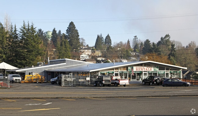
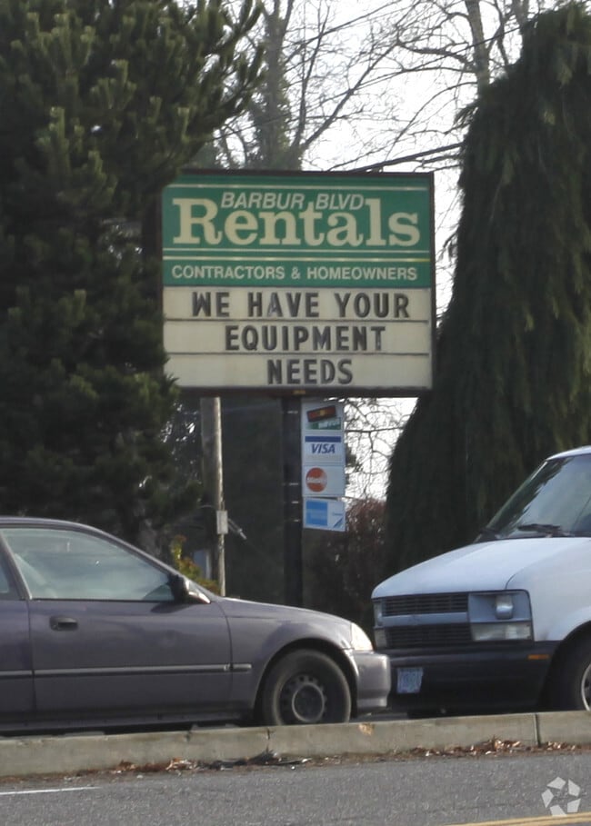
8025 Sw 19Th Ave, Portland, OR 97219

Property Detail
8025 Sw 19Th Ave
Portland-Vancouver-Hillsboro, OR-WA
SECTION 21 1S 1E, TL 3700 0.23 ACRES, POTENTIAL ADDITIONAL TAX
R330154
MULTNOMAH
Commercialnec
Oregon
CG
2
B and X Area of moderate flood hazard, usually the area between the limits of the 100-year and 500-year floods.
1.13 AC
2024
Barbur Blvd/Capitol Hwy
2025
Portland
006602
NEARBY LISTINGS FOR SALE OR LEASE
DEMOGRAPHICS near 8025 Sw 19Th Ave
1 mile
3 mile
5 mile
2025 Total Population
16,724
110,137
375,514
2030 Population
16,460
109,471
375,709
Pop Growth 2025-2030
(1.58%)
(0.60%)
+ 0.05%
Average Age
41
42
42
2025 Total Households
7,155
48,784
175,146
HH Growth 2025-2030
(1.89%)
(0.68%)
(0.01%)
Median Household Inc
$101,893
$111,246
$95,671
Avg Household Size
2.30
2.20
2.00
2025 Avg HH Vehicles
2.00
2.00
1.00
Median Home Value
$715,196
$742,241
$720,221
Median Year Built
1971
1975
1973
Nearby Places
Map Layers
Map Styles
 Street
 Aerial
Transit
 Traffic
 Biking
Places
Listings with unknown addresses are not visible on the map
- Restaurants
- Banks
- Shops
- Fitness
- Groceries
PUBLIC TRANSPORTATION
COMMUTER RAIL
Hall/Nimbus (Westside Express Service - Tri-County Metropolitan Transportation District of Oregon Rail (TriMet Rail))
Drive
Walk
Distance
Hall/Nimbus (Westside Express Service - Tri-County Metropolitan Transportation District of Oregon Rail (TriMet Rail))
12 min
5.0 mi
Tigard Transit Center (Westside Express Service - Tri-County Metropolitan Transportation District of Oregon Rail (TriMet Rail))
Drive
Walk
Distance
Tigard Transit Center (Westside Express Service - Tri-County Metropolitan Transportation District of Oregon Rail (TriMet Rail))
12 min
5.1 mi
AIRPORT
Portland International
Drive
Walk
Distance
Portland International
27 min
16.4 mi
Freight Ports
Port of Portland
Drive
Walk
Distance
Port of Portland
13 min
7.6 mi
Nearby Properties
Address
Land Use
TOTAL SIZE
Lot Size
Zoning
Address
Land Use
TOTAL SIZE
Lot Size
Zoning
27.58 AC
EX
Address
Land Use
TOTAL SIZE
Lot Size
Zoning
931,749 SF
85.50 AC
CI1
Address
Land Use
TOTAL SIZE
Lot Size
Zoning
828,566 SF
54.77 AC
CI2
Address
Land Use
TOTAL SIZE
Lot Size
Zoning
409,260 SF
7.41 AC
EX
Address
Land Use
TOTAL SIZE
Lot Size
Zoning
2.24 AC
CX
Address
Land Use
TOTAL SIZE
Lot Size
Zoning
251,293 SF
14.15 AC
IR
Address
Land Use
TOTAL SIZE
Lot Size
Zoning
175,880 SF
36.43 AC
OS
Address
Land Use
TOTAL SIZE
Lot Size
Zoning
138,295 SF
29.79 AC
CI1
Address
Land Use
TOTAL SIZE
Lot Size
Zoning
473,746 SF
1.68 AC
Address
Land Use
TOTAL SIZE
Lot Size
Zoning
79,646 SF
9.23 AC
R2R7
Address
Land Use
TOTAL SIZE
Lot Size
Zoning
147,334 SF
10.92 AC
IG1
Address
Land Use
TOTAL SIZE
Lot Size
Zoning
155,201 SF
4.04 AC
R7
Address
Land Use
TOTAL SIZE
Lot Size
Zoning
453,461 SF
1.16 AC
CX
Address
Land Use
TOTAL SIZE
Lot Size
Zoning
282,840 SF
1.46 AC
CX
Address
Land Use
TOTAL SIZE
Lot Size
Zoning
404,000 SF
0.92 AC
CXD
Address
Land Use
TOTAL SIZE
Lot Size
Zoning
285,650 SF
26.94 AC
INST
Address
Land Use
TOTAL SIZE
Lot Size
Zoning
279,607 SF
1.67 AC
CX
Address
Land Use
TOTAL SIZE
Lot Size
Zoning
5,724 SF
13.95 AC
NC/R-0
Address
Land Use
TOTAL SIZE
Lot Size
Zoning
198,988 SF
1.02 AC
CXD
Address
Land Use
TOTAL SIZE
Lot Size
Zoning
Address
Land Use
TOTAL SIZE
Lot Size
Zoning
220,655 SF
1.16 AC
CXDG
Address
Land Use
TOTAL SIZE
Lot Size
Zoning
238,629 SF
1.06 AC
CXD
Address
Land Use
TOTAL SIZE
Lot Size
Zoning
262,880 SF
0.95 AC
CX
Address
Land Use
TOTAL SIZE
Lot Size
Zoning
2.12 AC
OS
Address
Land Use
TOTAL SIZE
Lot Size
Zoning
184,285 SF
0.91 AC
CX
Address
Land Use
TOTAL SIZE
Lot Size
Zoning
176,428 SF
1.31 AC
CM2
Address
Land Use
TOTAL SIZE
Lot Size
Zoning
62,048 SF
8.58 AC
R20
Address
Land Use
TOTAL SIZE
Lot Size
Zoning
47,014 SF
35.23 AC
OS
Address
Land Use
TOTAL SIZE
Lot Size
Zoning
7,200 SF
7.96 AC
EX
Address
Land Use
TOTAL SIZE
Lot Size
Zoning
293,524 SF
0.96 AC
RM4
The World's #1 Commercial Real Estate Marketplace
Connect with us
© 2026 CoStar Group
The information above has been obtained from sources believed reliable. While we do not doubt its accuracy we have not verified it and make no guarantee, warranty or representation about it. It is your responsibility to independently confirm its accuracy and completeness. Any projections, opinions, assumptions, or estimates used are for example only and do not represent the current or future performance of the property. The value of this transaction to you depends on tax and other factors which should be evaluated by your tax, financial, and legal advisors. You and your advisors should conduct a careful, independent investigation of the property to determine to your satisfaction the suitability of the property for your needs.