Property Record
8026 State Highway 185 N, Port Lavaca, TX 77979
NEARBY LISTINGS FOR SALE OR LEASE
Property Detail
8026 State Highway 185 N
35692
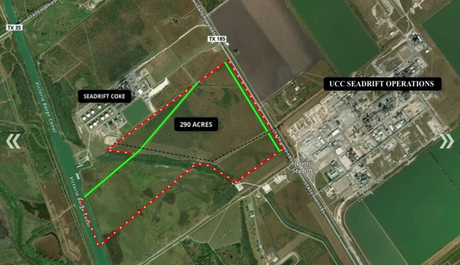
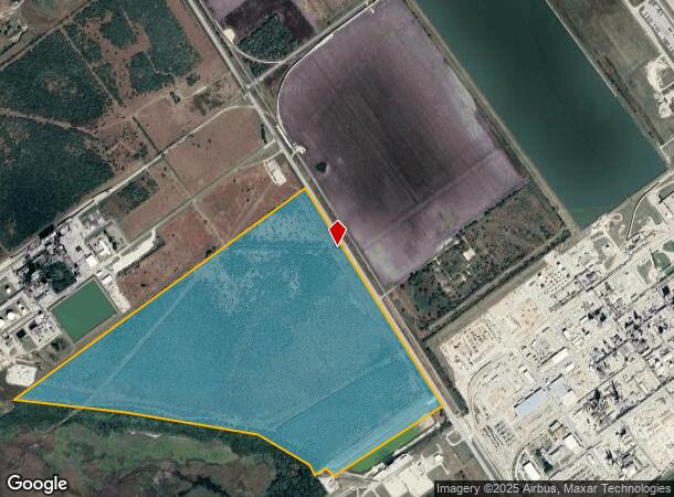
A0031 ENRIQUES RENDON, TRACT PT 2, ACRES 200.383
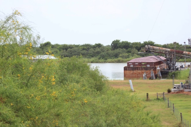
Agriculturalland
Calhoun
X
Texas
48469C0600H
200.38 AC
2025
Texas South Area
2025
Other Market Areas
000200
Port Lavaca, TX
DEMOGRAPHICS near 8026 State Highway 185 N
1 Mile
3 Mile
5 Mile
2024 Total Population
0
105
302
2029 Population
0
96
280
Pop Growth 2024-2029
0.00%
(8.57%)
(7.28%)
Average Age
0
43
44
2024 Total Households
0
41
118
HH Growth 2024-2029
0.00%
(9.76%)
(6.78%)
Median Household Inc
$0
$74,999
$74,422
Avg Household Size
.00
2.60
2.50
2024 Avg HH Vehicles
.00
2.00
2.00
Median Home Value
$0
$162,499
$163,953
Median Year Built
0
1997
1996
Nearby Places
Map Layers
Map Styles
 Street
 Aerial
- Restaurants
- Banks
- Shops
- Fitness
- Groceries
SALE & LEASE HISTORY
LISTING DATE
SALE/LEASE

Nov 11, 2019
For Sale
Nearby Properties
Address
Land Use
TOTAL SIZE
Lot Size
Zoning
Address
Land Use
TOTAL SIZE
Lot Size
Zoning
5 SF
351.81 AC
Address
Land Use
TOTAL SIZE
Lot Size
Zoning
Address
Land Use
TOTAL SIZE
Lot Size
Zoning
1 SF
351.82 AC
Address
Land Use
TOTAL SIZE
Lot Size
Zoning
Address
Land Use
TOTAL SIZE
Lot Size
Zoning
260.61 AC
Address
Land Use
TOTAL SIZE
Lot Size
Zoning
220.30 AC
Address
Land Use
TOTAL SIZE
Lot Size
Zoning
204.84 AC
Address
Land Use
TOTAL SIZE
Lot Size
Zoning
1,098 SF
210.03 AC
Address
Land Use
TOTAL SIZE
Lot Size
Zoning
195 AC
Address
Land Use
TOTAL SIZE
Lot Size
Zoning
167.96 AC
Address
Land Use
TOTAL SIZE
Lot Size
Zoning
Address
Land Use
TOTAL SIZE
Lot Size
Zoning
Address
Land Use
TOTAL SIZE
Lot Size
Zoning
1,320 SF
159.63 AC
Address
Land Use
TOTAL SIZE
Lot Size
Zoning
2,084 SF
172.88 AC
Address
Land Use
TOTAL SIZE
Lot Size
Zoning
Address
Land Use
TOTAL SIZE
Lot Size
Zoning
Address
Land Use
TOTAL SIZE
Lot Size
Zoning
2,820 SF
1.50 AC
Address
Land Use
TOTAL SIZE
Lot Size
Zoning
Address
Land Use
TOTAL SIZE
Lot Size
Zoning
Address
Land Use
TOTAL SIZE
Lot Size
Zoning
102.98 AC
Address
Land Use
TOTAL SIZE
Lot Size
Zoning
Address
Land Use
TOTAL SIZE
Lot Size
Zoning
93.96 AC
Address
Land Use
TOTAL SIZE
Lot Size
Zoning
3,575 SF
1.50 AC
Address
Land Use
TOTAL SIZE
Lot Size
Zoning
Address
Land Use
TOTAL SIZE
Lot Size
Zoning
9,240 SF
4 AC
Address
Land Use
TOTAL SIZE
Lot Size
Zoning
84.91 AC
Address
Land Use
TOTAL SIZE
Lot Size
Zoning
382.15 AC
Address
Land Use
TOTAL SIZE
Lot Size
Zoning
The World's #1 Commercial Real Estate Marketplace
Connect with us
© 2025 CoStar Group
The information above has been obtained from sources believed reliable. While we do not doubt its accuracy we have not verified it and make no guarantee, warranty or representation about it. It is your responsibility to independently confirm its accuracy and completeness. Any projections, opinions, assumptions, or estimates used are for example only and do not represent the current or future performance of the property. The value of this transaction to you depends on tax and other factors which should be evaluated by your tax, financial, and legal advisors. You and your advisors should conduct a careful, independent investigation of the property to determine to your satisfaction the suitability of the property for your needs.