No Photo
Property Record
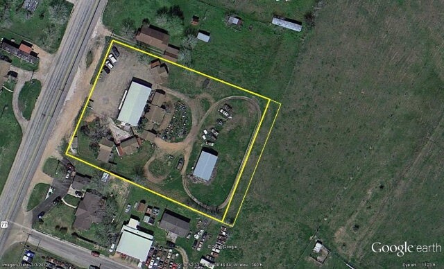
803 Us Highway 77A N, Yoakum, TX 77995

Property Detail
803 Us Highway 77A N
Commercialnec
ABS 44 PAT RYAN, ACRES 1.7752
B and X Area of moderate flood hazard, usually the area between the limits of the 100-year and 500-year floods.
Lavaca
2025
Texas
2025
1.78 AC
000600
Other Market Areas
4,988 SF
R31629
NEARBY LISTINGS FOR SALE OR LEASE
DEMOGRAPHICS near 803 Us Highway 77A N
1 mile
3 mile
5 mile
2025 Total Population
944
7,340
8,323
2030 Population
978
7,433
8,411
Pop Growth 2025-2030
+ 3.60%
+ 1.27%
+ 1.06%
Average Age
37
41
41
2025 Total Households
348
2,784
3,176
HH Growth 2025-2030
+ 3.74%
+ 1.29%
+ 1.07%
Median Household Inc
$34,238
$53,238
$53,856
Avg Household Size
2.70
2.60
2.50
2025 Avg HH Vehicles
1.00
2.00
2.00
Median Home Value
$185,293
$184,607
$188,975
Median Year Built
1985
1974
1975
Nearby Places
Map Layers
Map Styles
 Street
 Aerial
Layers
 Traffic
 Biking
Places
Listings with unknown addresses are not visible on the map
- Restaurants
- Banks
- Shops
- Fitness
- Groceries
SALE & LEASE HISTORY
LISTING DATE
SALE/LEASE

Sep 24, 2016
For Sale
Nearby Properties
Address
Land Use
TOTAL SIZE
Lot Size
Zoning
Address
Land Use
TOTAL SIZE
Lot Size
Zoning
233,811 SF
10 AC
Address
Land Use
TOTAL SIZE
Lot Size
Zoning
Address
Land Use
TOTAL SIZE
Lot Size
Zoning
36,057 SF
6.03 AC
Address
Land Use
TOTAL SIZE
Lot Size
Zoning
102,781 SF
8.37 AC
Address
Land Use
TOTAL SIZE
Lot Size
Zoning
57,003 SF
9.66 AC
Address
Land Use
TOTAL SIZE
Lot Size
Zoning
22,234 SF
6.44 AC
Address
Land Use
TOTAL SIZE
Lot Size
Zoning
32,364 SF
4 AC
Address
Land Use
TOTAL SIZE
Lot Size
Zoning
2,400 SF
286 AC
Address
Land Use
TOTAL SIZE
Lot Size
Zoning
99,021 SF
2.07 AC
Address
Land Use
TOTAL SIZE
Lot Size
Zoning
629 SF
215.40 AC
Address
Land Use
TOTAL SIZE
Lot Size
Zoning
13,325 SF
2.58 AC
Address
Land Use
TOTAL SIZE
Lot Size
Zoning
19,628 SF
1.92 AC
Address
Land Use
TOTAL SIZE
Lot Size
Zoning
2,592 SF
145.66 AC
Address
Land Use
TOTAL SIZE
Lot Size
Zoning
192.10 AC
Address
Land Use
TOTAL SIZE
Lot Size
Zoning
Address
Land Use
TOTAL SIZE
Lot Size
Zoning
584 SF
244.79 AC
Address
Land Use
TOTAL SIZE
Lot Size
Zoning
50,285 SF
4.88 AC
Address
Land Use
TOTAL SIZE
Lot Size
Zoning
36,617 SF
3.50 AC
Address
Land Use
TOTAL SIZE
Lot Size
Zoning
32,353 SF
0.85 AC
Address
Land Use
TOTAL SIZE
Lot Size
Zoning
30,468 SF
5 AC
Address
Land Use
TOTAL SIZE
Lot Size
Zoning
1,697 SF
145.12 AC
Address
Land Use
TOTAL SIZE
Lot Size
Zoning
960 SF
171.42 AC
Address
Land Use
TOTAL SIZE
Lot Size
Zoning
1,200 SF
165.95 AC
Address
Land Use
TOTAL SIZE
Lot Size
Zoning
27,032 SF
1.81 AC
Address
Land Use
TOTAL SIZE
Lot Size
Zoning
41,171 SF
1.99 AC
Address
Land Use
TOTAL SIZE
Lot Size
Zoning
1,584 SF
96.82 AC
Address
Land Use
TOTAL SIZE
Lot Size
Zoning
128.78 AC
Address
Land Use
TOTAL SIZE
Lot Size
Zoning
1,840 SF
82.05 AC
Address
Land Use
TOTAL SIZE
Lot Size
Zoning
1,274 SF
105.76 AC
Address
Land Use
TOTAL SIZE
Lot Size
Zoning
2,718 SF
23.03 AC
The World's #1 Commercial Real Estate Marketplace
Connect with us
© 2026 CoStar Group
The information above has been obtained from sources believed reliable. While we do not doubt its accuracy we have not verified it and make no guarantee, warranty or representation about it. It is your responsibility to independently confirm its accuracy and completeness. Any projections, opinions, assumptions, or estimates used are for example only and do not represent the current or future performance of the property. The value of this transaction to you depends on tax and other factors which should be evaluated by your tax, financial, and legal advisors. You and your advisors should conduct a careful, independent investigation of the property to determine to your satisfaction the suitability of the property for your needs.