Property Record
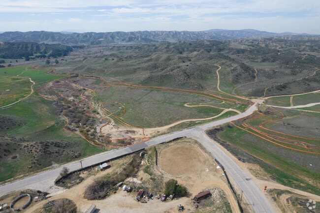
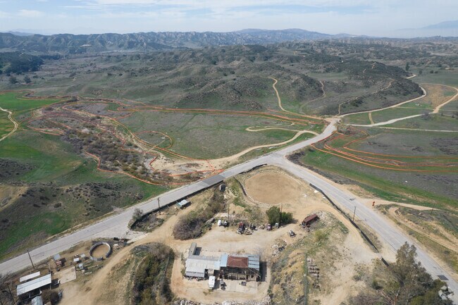
8035 Singleton Rd, Calimesa, CA 92320


Property Detail
8035 Singleton Rd
Riverside-San Bernardino-Ontario, CA
ACRES 22.82000000 ACREAGEQUALCODE ML LOTTYPE P PARCEL 2-P MAPPLATB 256 MAPPLATP 006 SUBDIVISIONNAME PM 37862
413-190-041
RIVERSIDE
Commercialacreage
California
2024
22.82 AC
2025
Beaumont/Hemet
043802
Inland Empire (California)
NEARBY LISTINGS FOR SALE OR LEASE
DEMOGRAPHICS near 8035 Singleton Rd
1 mile
3 mile
5 mile
2025 Total Population
2,781
34,052
89,042
2030 Population
2,898
35,217
91,429
Pop Growth 2025-2030
+ 4.21%
+ 3.42%
+ 2.68%
Average Age
38
40
40
2025 Total Households
873
11,505
30,645
HH Growth 2025-2030
+ 3.89%
+ 3.03%
+ 2.39%
Median Household Inc
$114,270
$98,046
$98,948
Avg Household Size
3.20
2.90
2.90
2025 Avg HH Vehicles
2.00
2.00
2.00
Median Home Value
$638,349
$552,966
$550,306
Median Year Built
2005
1998
1989
Nearby Places
Map Layers
Map Styles
 Street
 Aerial
Transit
 Traffic
 Biking
Places
Listings with unknown addresses are not visible on the map
- Restaurants
- Banks
- Shops
- Fitness
- Groceries
PUBLIC TRANSPORTATION
COMMUTER RAIL
Redlands - University Metrolink Station (Metrolink San Bernardino Line - Metrolink Trains)
Drive
Walk
Distance
Redlands - University Metrolink Station (Metrolink San Bernardino Line - Metrolink Trains)
15 min
10.0 mi
Freight Ports
Port of Long Beach
Drive
Walk
Distance
Port of Long Beach
103 min
80.9 mi
Nearby Properties
Address
Land Use
TOTAL SIZE
Lot Size
Zoning
Address
Land Use
TOTAL SIZE
Lot Size
Zoning
1,013,356 SF
135.79 AC
Address
Land Use
TOTAL SIZE
Lot Size
Zoning
810,962 SF
85.23 AC
Address
Land Use
TOTAL SIZE
Lot Size
Zoning
369,838 SF
19.32 AC
Address
Land Use
TOTAL SIZE
Lot Size
Zoning
82,694 SF
3.41 AC
Address
Land Use
TOTAL SIZE
Lot Size
Zoning
45,712 SF
4.87 AC
Address
Land Use
TOTAL SIZE
Lot Size
Zoning
56,491 SF
7.50 AC
Address
Land Use
TOTAL SIZE
Lot Size
Zoning
56,491 SF
3.39 AC
Address
Land Use
TOTAL SIZE
Lot Size
Zoning
22,308 SF
1.87 AC
Address
Land Use
TOTAL SIZE
Lot Size
Zoning
15,980 SF
1.56 AC
Address
Land Use
TOTAL SIZE
Lot Size
Zoning
33.42 AC
Address
Land Use
TOTAL SIZE
Lot Size
Zoning
41,005 SF
3.27 AC
MIX
Address
Land Use
TOTAL SIZE
Lot Size
Zoning
73,670 SF
4.49 AC
Address
Land Use
TOTAL SIZE
Lot Size
Zoning
18,800 SF
4.07 AC
CC
Address
Land Use
TOTAL SIZE
Lot Size
Zoning
14,738 SF
1.49 AC
C1
Address
Land Use
TOTAL SIZE
Lot Size
Zoning
50,936 SF
6.50 AC
936
Address
Land Use
TOTAL SIZE
Lot Size
Zoning
35,688 SF
3.03 AC
Address
Land Use
TOTAL SIZE
Lot Size
Zoning
15,211 SF
2.15 AC
Address
Land Use
TOTAL SIZE
Lot Size
Zoning
3,967 SF
0.64 AC
CP
Address
Land Use
TOTAL SIZE
Lot Size
Zoning
22.97 AC
Address
Land Use
TOTAL SIZE
Lot Size
Zoning
15,924 SF
4.13 AC
C1
Address
Land Use
TOTAL SIZE
Lot Size
Zoning
64,187 SF
9.45 AC
R1
Address
Land Use
TOTAL SIZE
Lot Size
Zoning
3,491 SF
31.32 AC
MIX
Address
Land Use
TOTAL SIZE
Lot Size
Zoning
21.88 AC
Address
Land Use
TOTAL SIZE
Lot Size
Zoning
24,266 SF
4.35 AC
R1
Address
Land Use
TOTAL SIZE
Lot Size
Zoning
25.94 AC
MIX
Address
Land Use
TOTAL SIZE
Lot Size
Zoning
46,313 SF
3.26 AC
The World's #1 Commercial Real Estate Marketplace
Connect with us
© 2026 CoStar Group
The information above has been obtained from sources believed reliable. While we do not doubt its accuracy we have not verified it and make no guarantee, warranty or representation about it. It is your responsibility to independently confirm its accuracy and completeness. Any projections, opinions, assumptions, or estimates used are for example only and do not represent the current or future performance of the property. The value of this transaction to you depends on tax and other factors which should be evaluated by your tax, financial, and legal advisors. You and your advisors should conduct a careful, independent investigation of the property to determine to your satisfaction the suitability of the property for your needs.