Property Record
804 Gladstell Rd, Conroe, TX 77304
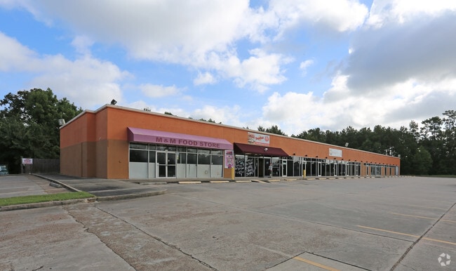

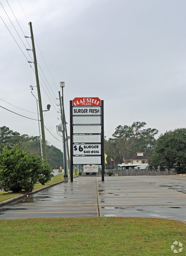
Property Detail
804 Gladstell Rd
0071-01-00220
A0071 BRICKER JOHN, TRACT 2-B, ACRES 1.372
Commercialnec
Montgomery
B and X Area of moderate flood hazard, usually the area between the limits of the 100-year and 500-year floods.
Texas
2024
1.37 AC
2025
Montgomery County
693302
Houston
15,460 SF
Houston-Pasadena-The Woodlands, TX
NEARBY LISTINGS FOR SALE OR LEASE
DEMOGRAPHICS near 804 Gladstell Rd
1 mile
3 mile
5 mile
2025 Total Population
11,072
57,579
119,848
2030 Population
12,973
67,501
141,383
Pop Growth 2025-2030
+ 17.17%
+ 17.23%
+ 17.97%
Average Age
35
37
37
2025 Total Households
4,389
20,743
43,710
HH Growth 2025-2030
+ 17.68%
+ 18.40%
+ 18.75%
Median Household Inc
$54,333
$69,631
$78,786
Avg Household Size
2.40
2.60
2.60
2025 Avg HH Vehicles
2.00
2.00
2.00
Median Home Value
$299,190
$284,009
$343,397
Median Year Built
1993
2000
2010
Nearby Places
Map Layers
Map Styles
 Street
 Aerial
Transit
 Traffic
 Biking
Places
Listings with unknown addresses are not visible on the map
- Restaurants
- Banks
- Shops
- Fitness
- Groceries
PUBLIC TRANSPORTATION
AIRPORT
George Bush Intcntl/Houston
Drive
Walk
Distance
George Bush Intcntl/Houston
37 min
30.2 mi
SALE & LEASE HISTORY
LISTING DATE
SALE/LEASE

Aug 16, 2017
For Lease
Nearby Properties
Address
Land Use
TOTAL SIZE
Lot Size
Zoning
Address
Land Use
TOTAL SIZE
Lot Size
Zoning
470,259 SF
27.98 AC
1
Address
Land Use
TOTAL SIZE
Lot Size
Zoning
619,770 SF
81.76 AC
Address
Land Use
TOTAL SIZE
Lot Size
Zoning
353,247 SF
14.38 AC
Address
Land Use
TOTAL SIZE
Lot Size
Zoning
292,274 SF
7.55 AC
Address
Land Use
TOTAL SIZE
Lot Size
Zoning
354,000 SF
13.81 AC
Address
Land Use
TOTAL SIZE
Lot Size
Zoning
441,092 SF
29.09 AC
Address
Land Use
TOTAL SIZE
Lot Size
Zoning
304,482 SF
12.15 AC
Address
Land Use
TOTAL SIZE
Lot Size
Zoning
274,494 SF
28.96 AC
Address
Land Use
TOTAL SIZE
Lot Size
Zoning
262,925 SF
12.16 AC
Address
Land Use
TOTAL SIZE
Lot Size
Zoning
284,451 SF
13.66 AC
1
Address
Land Use
TOTAL SIZE
Lot Size
Zoning
326,478 SF
20.22 AC
Address
Land Use
TOTAL SIZE
Lot Size
Zoning
204,716 SF
15.51 AC
Address
Land Use
TOTAL SIZE
Lot Size
Zoning
258,100 SF
12.04 AC
1
Address
Land Use
TOTAL SIZE
Lot Size
Zoning
159,144 SF
32.27 AC
Address
Land Use
TOTAL SIZE
Lot Size
Zoning
168,926 SF
9.12 AC
Address
Land Use
TOTAL SIZE
Lot Size
Zoning
195,956 SF
1.76 AC
1
Address
Land Use
TOTAL SIZE
Lot Size
Zoning
276,238 SF
21.48 AC
Address
Land Use
TOTAL SIZE
Lot Size
Zoning
134,935 SF
10.50 AC
1
Address
Land Use
TOTAL SIZE
Lot Size
Zoning
250,716 SF
11.17 AC
1
Address
Land Use
TOTAL SIZE
Lot Size
Zoning
211,275 SF
12.58 AC
Address
Land Use
TOTAL SIZE
Lot Size
Zoning
191,006 SF
9.19 AC
Address
Land Use
TOTAL SIZE
Lot Size
Zoning
142,800 SF
7.82 AC
Address
Land Use
TOTAL SIZE
Lot Size
Zoning
136,300 SF
9.08 AC
1
Address
Land Use
TOTAL SIZE
Lot Size
Zoning
89,298 SF
9.22 AC
Address
Land Use
TOTAL SIZE
Lot Size
Zoning
590,471 SF
32.21 AC
Address
Land Use
TOTAL SIZE
Lot Size
Zoning
197,533 SF
58.31 AC
Address
Land Use
TOTAL SIZE
Lot Size
Zoning
100,800 SF
8.60 AC
Address
Land Use
TOTAL SIZE
Lot Size
Zoning
85,560 SF
8.55 AC
Address
Land Use
TOTAL SIZE
Lot Size
Zoning
157,996 SF
9 AC
The World's #1 Commercial Real Estate Marketplace
Connect with us
© 2026 CoStar Group
The information above has been obtained from sources believed reliable. While we do not doubt its accuracy we have not verified it and make no guarantee, warranty or representation about it. It is your responsibility to independently confirm its accuracy and completeness. Any projections, opinions, assumptions, or estimates used are for example only and do not represent the current or future performance of the property. The value of this transaction to you depends on tax and other factors which should be evaluated by your tax, financial, and legal advisors. You and your advisors should conduct a careful, independent investigation of the property to determine to your satisfaction the suitability of the property for your needs.