Property Record
804 Hoosick Rd, Troy, NY 12180
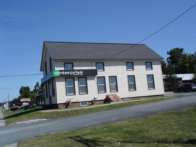

Property Detail
804 Hoosick Rd
Albany-Schenectady-Troy, NY
Rensselaer
2200-091-7-9
New York
Vehiclerentalsvehiclesales
9.000
2025
0.44 AC
2025
Outer Rensselaer County
052004
Albany/Schenectady/Troy
756 SF
NEARBY LISTINGS FOR SALE OR LEASE
DEMOGRAPHICS near 804 Hoosick Rd
1 mile
3 mile
5 mile
2025 Total Population
2,741
43,487
111,279
2030 Population
2,823
43,625
111,030
Pop Growth 2025-2030
+ 2.99%
+ 0.32%
(0.22%)
Average Age
43
39
40
2025 Total Households
1,293
18,041
48,323
HH Growth 2025-2030
+ 3.09%
+ 0.39%
(0.21%)
Median Household Inc
$95,600
$69,924
$69,891
Avg Household Size
2.10
2.10
2.10
2025 Avg HH Vehicles
2.00
1.00
1.00
Median Home Value
$278,957
$236,192
$228,518
Median Year Built
1987
1950
1952
Nearby Places
Map Layers
Map Styles
 Street
 Aerial
Layers
 Traffic
 Biking
Places
Listings with unknown addresses are not visible on the map
- Restaurants
- Banks
- Shops
- Fitness
- Groceries
PUBLIC TRANSPORTATION
AIRPORT
Albany International
Drive
Walk
Distance
Albany International
17 min
10.0 mi
Freight Ports
Albany, NY Port
Drive
Walk
Distance
Albany, NY Port
22 min
12.7 mi
SALE & LEASE HISTORY
LISTING DATE
SALE/LEASE

Apr 11, 2019
For Lease
Nearby Properties
Address
Land Use
TOTAL SIZE
Lot Size
Zoning
Address
Land Use
TOTAL SIZE
Lot Size
Zoning
34,971 SF
108.68 AC
CI
Address
Land Use
TOTAL SIZE
Lot Size
Zoning
313,907 SF
8.23 AC
CI
Address
Land Use
TOTAL SIZE
Lot Size
Zoning
9,643 SF
5.36 AC
CI
Address
Land Use
TOTAL SIZE
Lot Size
Zoning
Address
Land Use
TOTAL SIZE
Lot Size
Zoning
35,392 SF
73.57 AC
CI
Address
Land Use
TOTAL SIZE
Lot Size
Zoning
5,000 SF
48.44 AC
CR
Address
Land Use
TOTAL SIZE
Lot Size
Zoning
413,006 SF
37.94 AC
CI
Address
Land Use
TOTAL SIZE
Lot Size
Zoning
67,335 SF
65.54 AC
CI
Address
Land Use
TOTAL SIZE
Lot Size
Zoning
210,415 SF
1.69 AC
MF
Address
Land Use
TOTAL SIZE
Lot Size
Zoning
77,193 SF
28.41 AC
SF
Address
Land Use
TOTAL SIZE
Lot Size
Zoning
353,510 SF
2.94 AC
WMU
Address
Land Use
TOTAL SIZE
Lot Size
Zoning
10,271 SF
11.22 AC
05 - COMME
Address
Land Use
TOTAL SIZE
Lot Size
Zoning
Address
Land Use
TOTAL SIZE
Lot Size
Zoning
16,698 SF
46.45 AC
MF
Address
Land Use
TOTAL SIZE
Lot Size
Zoning
251,672 SF
16.18 AC
06 - INDUS
Address
Land Use
TOTAL SIZE
Lot Size
Zoning
113,400 SF
3.40 AC
CI
Address
Land Use
TOTAL SIZE
Lot Size
Zoning
77,928 SF
2.25 AC
WMU
Address
Land Use
TOTAL SIZE
Lot Size
Zoning
1,500 SF
7.01 AC
WMU
Address
Land Use
TOTAL SIZE
Lot Size
Zoning
154,587 SF
3.79 AC
CC
Address
Land Use
TOTAL SIZE
Lot Size
Zoning
155,900 SF
1.30 AC
DMU
Address
Land Use
TOTAL SIZE
Lot Size
Zoning
3,600 SF
17.54 AC
MF
Address
Land Use
TOTAL SIZE
Lot Size
Zoning
116,015 SF
2.32 AC
DMU
Address
Land Use
TOTAL SIZE
Lot Size
Zoning
63,828 SF
2.74 AC
CI
Address
Land Use
TOTAL SIZE
Lot Size
Zoning
3,202 SF
7.34 AC
CI
Address
Land Use
TOTAL SIZE
Lot Size
Zoning
Address
Land Use
TOTAL SIZE
Lot Size
Zoning
95,466 SF
7.64 AC
MF
Address
Land Use
TOTAL SIZE
Lot Size
Zoning
81,054 SF
3.12 AC
DMU
Address
Land Use
TOTAL SIZE
Lot Size
Zoning
Address
Land Use
TOTAL SIZE
Lot Size
Zoning
135,933 SF
12.17 AC
CC
Address
Land Use
TOTAL SIZE
Lot Size
Zoning
181,839 SF
3.42 AC
DMU
The World's #1 Commercial Real Estate Marketplace
Connect with us
© 2026 CoStar Group
The information above has been obtained from sources believed reliable. While we do not doubt its accuracy we have not verified it and make no guarantee, warranty or representation about it. It is your responsibility to independently confirm its accuracy and completeness. Any projections, opinions, assumptions, or estimates used are for example only and do not represent the current or future performance of the property. The value of this transaction to you depends on tax and other factors which should be evaluated by your tax, financial, and legal advisors. You and your advisors should conduct a careful, independent investigation of the property to determine to your satisfaction the suitability of the property for your needs.