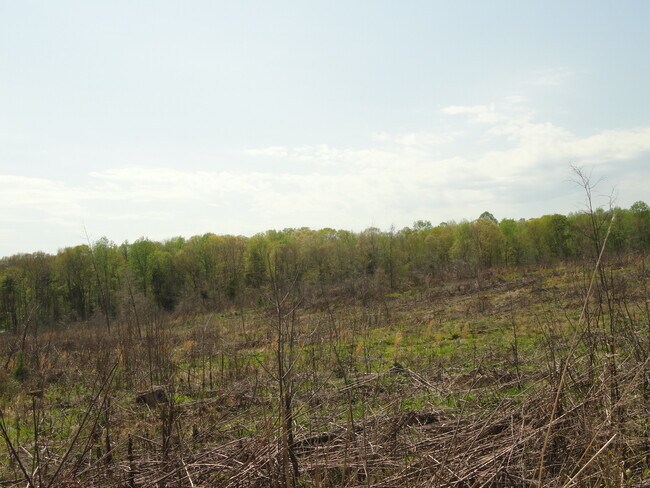
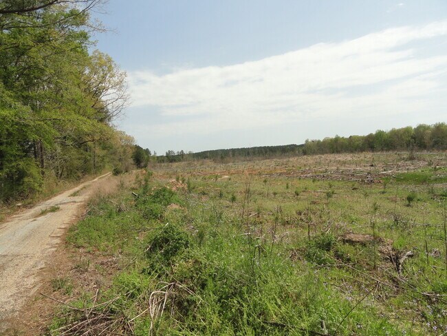
Property Record
804 Latimer Mill Rd, Honea Path, SC 29654

Property Detail
804 Latimer Mill Rd
Greenville-Anderson-Greer, SC
MAP 0572.01
0572.01-01-005.00
GREENVILLE
Residentialacreage
South Carolina
UNZONED
005.00
B and X Area of moderate flood hazard, usually the area between the limits of the 100-year and 500-year floods.
142 AC
2025
Western Greenville County
2025
Greenville/Spartanburg
003202
NEARBY LISTINGS FOR SALE OR LEASE
-
-
View all Honea Path listings for sale on LoopNet.com
DEMOGRAPHICS near 804 Latimer Mill Rd
1 mile
3 mile
5 mile
2025 Total Population
145
1,771
6,193
2030 Population
160
1,900
6,601
Pop Growth 2025-2030
+ 10.34%
+ 7.28%
+ 6.59%
Average Age
43
43
43
2025 Total Households
54
681
2,408
HH Growth 2025-2030
+ 11.11%
+ 7.49%
+ 6.77%
Median Household Inc
$69,999
$66,216
$63,156
Avg Household Size
2.50
2.50
2.50
2025 Avg HH Vehicles
2.00
2.00
2.00
Median Home Value
$257,142
$232,353
$224,401
Median Year Built
1993
1996
1994
Nearby Places
Map Layers
Map Styles
 Street
 Aerial
Transit
 Traffic
 Biking
Places
Listings with unknown addresses are not visible on the map
- Restaurants
- Banks
- Shops
- Fitness
- Groceries
PUBLIC TRANSPORTATION
AIRPORT
Greenville Spartanburg International
Drive
Walk
Distance
Greenville Spartanburg International
55 min
30.7 mi
Freight Ports
North Charleston Terminal
Drive
Walk
Distance
North Charleston Terminal
229 min
192.4 mi
SALE & LEASE HISTORY
LISTING DATE
SALE/LEASE

Apr 19, 2021
For Sale
Nearby Properties
Address
Land Use
TOTAL SIZE
Lot Size
Zoning
Address
Land Use
TOTAL SIZE
Lot Size
Zoning
Address
Land Use
TOTAL SIZE
Lot Size
Zoning
5.82 AC
UNZONED
Address
Land Use
TOTAL SIZE
Lot Size
Zoning
2.80 AC
UNZONED
Address
Land Use
TOTAL SIZE
Lot Size
Zoning
7.93 AC
UNZONED
Address
Land Use
TOTAL SIZE
Lot Size
Zoning
52.97 AC
Address
Land Use
TOTAL SIZE
Lot Size
Zoning
1.21 AC
Address
Land Use
TOTAL SIZE
Lot Size
Zoning
0.50 AC
UNZONED
Address
Land Use
TOTAL SIZE
Lot Size
Zoning
4.38 AC
Address
Land Use
TOTAL SIZE
Lot Size
Zoning
167.77 AC
Address
Land Use
TOTAL SIZE
Lot Size
Zoning
43.94 AC
Address
Land Use
TOTAL SIZE
Lot Size
Zoning
3.56 AC
UNZONED
Address
Land Use
TOTAL SIZE
Lot Size
Zoning
1,064 SF
Address
Land Use
TOTAL SIZE
Lot Size
Zoning
4,158 SF
17.80 AC
UNZONED
Address
Land Use
TOTAL SIZE
Lot Size
Zoning
15.67 AC
Address
Land Use
TOTAL SIZE
Lot Size
Zoning
2,374 SF
23.95 AC
RS
Address
Land Use
TOTAL SIZE
Lot Size
Zoning
16.28 AC
Address
Land Use
TOTAL SIZE
Lot Size
Zoning
2,425 SF
10 AC
UNZONED
Address
Land Use
TOTAL SIZE
Lot Size
Zoning
2,398 SF
7.01 AC
UNZONED
Address
Land Use
TOTAL SIZE
Lot Size
Zoning
2,004 SF
10 AC
RS
Address
Land Use
TOTAL SIZE
Lot Size
Zoning
2,690 SF
42 AC
RS
Address
Land Use
TOTAL SIZE
Lot Size
Zoning
2,298 SF
10.05 AC
UNZONED
Address
Land Use
TOTAL SIZE
Lot Size
Zoning
1.48 AC
Address
Land Use
TOTAL SIZE
Lot Size
Zoning
1,762 SF
6.32 AC
RS
Address
Land Use
TOTAL SIZE
Lot Size
Zoning
1.30 AC
Address
Land Use
TOTAL SIZE
Lot Size
Zoning
1,536 SF
10 AC
UNZONED
Address
Land Use
TOTAL SIZE
Lot Size
Zoning
1,820 SF
10 AC
RS
Address
Land Use
TOTAL SIZE
Lot Size
Zoning
Address
Land Use
TOTAL SIZE
Lot Size
Zoning
Address
Land Use
TOTAL SIZE
Lot Size
Zoning
11.20 AC
UNZONED
Address
Land Use
TOTAL SIZE
Lot Size
Zoning
2,110 SF
12.55 AC
RS
The World's #1 Commercial Real Estate Marketplace
Connect with us
© 2026 CoStar Group
The information above has been obtained from sources believed reliable. While we do not doubt its accuracy we have not verified it and make no guarantee, warranty or representation about it. It is your responsibility to independently confirm its accuracy and completeness. Any projections, opinions, assumptions, or estimates used are for example only and do not represent the current or future performance of the property. The value of this transaction to you depends on tax and other factors which should be evaluated by your tax, financial, and legal advisors. You and your advisors should conduct a careful, independent investigation of the property to determine to your satisfaction the suitability of the property for your needs.