Property Record
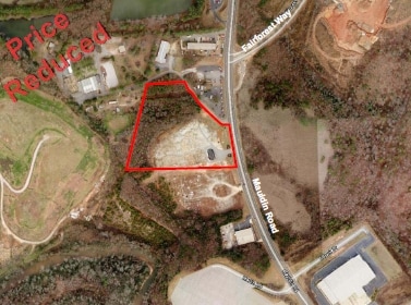
804 Mauldin Rd, Greenville, SC 29607


Property Detail
804 Mauldin Rd
Greenville-Anderson-Greer, SC
MAP M014.01
M014.01-01-008.02
Greenville
Privateschool
South Carolina
S1
008.02
B and X Area of moderate flood hazard, usually the area between the limits of the 100-year and 500-year floods.
16.70 AC
2025
Mauldin/Fountain
2025
Greenville/Spartanburg
002901
NEARBY LISTINGS FOR SALE OR LEASE
DEMOGRAPHICS near 804 Mauldin Rd
1 mile
3 mile
5 mile
2024 Total Population
3,313
42,852
120,496
2029 Population
3,630
46,370
131,171
Pop Growth 2024-2029
+ 9.57%
+ 8.21%
+ 8.86%
Average Age
36
39
39
2024 Total Households
1,479
17,754
51,623
HH Growth 2024-2029
+ 9.94%
+ 8.38%
+ 9.07%
Median Household Inc
$59,191
$68,163
$74,113
Avg Household Size
2.20
2.40
2.30
2024 Avg HH Vehicles
1.00
2.00
2.00
Median Home Value
$171,005
$275,051
$316,270
Median Year Built
1996
1989
1991
Nearby Places
Map Layers
Map Styles
 Street
 Aerial
Transit
 Traffic
 Biking
Places
Listings with unknown addresses are not visible on the map
- Restaurants
- Banks
- Shops
- Fitness
- Groceries
PUBLIC TRANSPORTATION
COMMUTER RAIL
Greenville Amtrak Station (Crescent - Amtrak)
Drive
Walk
Distance
Greenville Amtrak Station (Crescent - Amtrak)
17 min
7.2 mi
AIRPORT
Greenville Spartanburg International
Drive
Walk
Distance
Greenville Spartanburg International
21 min
12.4 mi
Freight Ports
North Charleston Terminal
Drive
Walk
Distance
North Charleston Terminal
222 min
196.9 mi
Nearby Properties
Address
Land Use
TOTAL SIZE
Lot Size
Zoning
Address
Land Use
TOTAL SIZE
Lot Size
Zoning
333.78 AC
S-1,I-1
Address
Land Use
TOTAL SIZE
Lot Size
Zoning
15.82 AC
RM
Address
Land Use
TOTAL SIZE
Lot Size
Zoning
54.35 AC
I-1
Address
Land Use
TOTAL SIZE
Lot Size
Zoning
10.07 AC
S1
Address
Land Use
TOTAL SIZE
Lot Size
Zoning
15.20 AC
RM2
Address
Land Use
TOTAL SIZE
Lot Size
Zoning
10.29 AC
S1
Address
Land Use
TOTAL SIZE
Lot Size
Zoning
12.95 AC
RM3
Address
Land Use
TOTAL SIZE
Lot Size
Zoning
387.84 AC
S1
Address
Land Use
TOTAL SIZE
Lot Size
Zoning
3.38 AC
S1
Address
Land Use
TOTAL SIZE
Lot Size
Zoning
20.30 AC
I1
Address
Land Use
TOTAL SIZE
Lot Size
Zoning
5.83 AC
S1
Address
Land Use
TOTAL SIZE
Lot Size
Zoning
31.81 AC
R6
Address
Land Use
TOTAL SIZE
Lot Size
Zoning
Address
Land Use
TOTAL SIZE
Lot Size
Zoning
10.36 AC
R12
Address
Land Use
TOTAL SIZE
Lot Size
Zoning
3.24 AC
S1
Address
Land Use
TOTAL SIZE
Lot Size
Zoning
12.03 AC
RM2
Address
Land Use
TOTAL SIZE
Lot Size
Zoning
15.14 AC
I1
Address
Land Use
TOTAL SIZE
Lot Size
Zoning
19.49 AC
0D
Address
Land Use
TOTAL SIZE
Lot Size
Zoning
21.33 AC
Address
Land Use
TOTAL SIZE
Lot Size
Zoning
108.12 AC
I1
Address
Land Use
TOTAL SIZE
Lot Size
Zoning
19.33 AC
S1
Address
Land Use
TOTAL SIZE
Lot Size
Zoning
40.92 AC
S1
Address
Land Use
TOTAL SIZE
Lot Size
Zoning
11.17 AC
C2
Address
Land Use
TOTAL SIZE
Lot Size
Zoning
12.80 AC
S1
Address
Land Use
TOTAL SIZE
Lot Size
Zoning
5 AC
R12
Address
Land Use
TOTAL SIZE
Lot Size
Zoning
25.70 AC
I1
Address
Land Use
TOTAL SIZE
Lot Size
Zoning
6.30 AC
S1
Address
Land Use
TOTAL SIZE
Lot Size
Zoning
8.51 AC
S1
Address
Land Use
TOTAL SIZE
Lot Size
Zoning
1.84 AC
0D
Address
Land Use
TOTAL SIZE
Lot Size
Zoning
23.10 AC
S1
The World's #1 Commercial Real Estate Marketplace
Connect with us
© 2026 CoStar Group
The information above has been obtained from sources believed reliable. While we do not doubt its accuracy we have not verified it and make no guarantee, warranty or representation about it. It is your responsibility to independently confirm its accuracy and completeness. Any projections, opinions, assumptions, or estimates used are for example only and do not represent the current or future performance of the property. The value of this transaction to you depends on tax and other factors which should be evaluated by your tax, financial, and legal advisors. You and your advisors should conduct a careful, independent investigation of the property to determine to your satisfaction the suitability of the property for your needs.