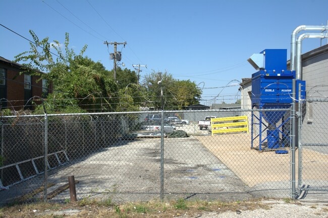
Property Record
804 S Sheridan Rd, Tulsa, OK 74112
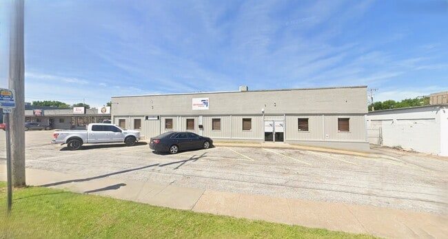
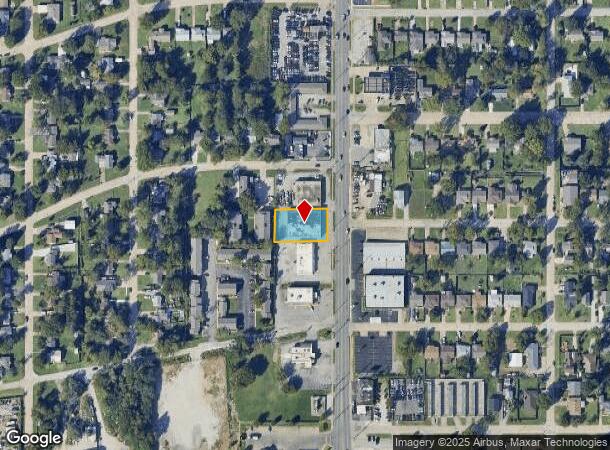
This Property Is For Sale
NEARBY LISTINGS FOR SALE OR LEASE
Property Detail
804 S Sheridan Rd
16300-93-03-03400
Glenhaven
Warehouse
S 100 OF N 200 OF E 180 LESS E 15 BLK 59
AE
Tulsa
40143C0244L
Oklahoma
2023
0.38 AC
2024
North Central Tulsa
001700
Tulsa
9,030 SF
Tulsa, OK
DEMOGRAPHICS near 804 S Sheridan Rd
1 Mile
3 Mile
5 Mile
2024 Total Population
8,946
93,997
211,855
2029 Population
9,239
97,613
219,971
Pop Growth 2024-2029
+ 3.28%
+ 3.85%
+ 3.83%
Average Age
38
37
37
2024 Total Households
3,806
38,356
86,303
HH Growth 2024-2029
+ 3.34%
+ 3.96%
+ 4.00%
Median Household Inc
$46,162
$46,754
$48,663
Avg Household Size
2.30
2.30
2.30
2024 Avg HH Vehicles
2.00
2.00
2.00
Median Home Value
$105,392
$128,540
$148,948
Median Year Built
1954
1957
1963
Nearby Places
- Restaurants
- Banks
- Shops
- Fitness
- Groceries
PUBLIC TRANSPORTATION
AIRPORT
Tulsa International
DRIVE
WALK
Distance
Tulsa International
11 min
5.4 mi
Freight Ports
Tulsa Port Of Catoosa
DRIVE
WALK
Distance
Tulsa Port Of Catoosa
19 min
13.7 mi
Nearby Properties
Address
Land Use
TOTAL SIZE
Lot Size
Zoning
Address
Land Use
TOTAL SIZE
Lot Size
Zoning
1,604,892 SF
208.96 AC
AG
Address
Land Use
TOTAL SIZE
Lot Size
Zoning
1,673,798 SF
90.26 AC
NCU
Address
Land Use
TOTAL SIZE
Lot Size
Zoning
429,506 SF
39.02 AC
RM2
Address
Land Use
TOTAL SIZE
Lot Size
Zoning
350,741 SF
28.01 AC
CS
Address
Land Use
TOTAL SIZE
Lot Size
Zoning
175,176 SF
1.57 AC
RM2
Address
Land Use
TOTAL SIZE
Lot Size
Zoning
230,620 SF
16.72 AC
RM2
Address
Land Use
TOTAL SIZE
Lot Size
Zoning
146,538 SF
2.56 AC
CS
Address
Land Use
TOTAL SIZE
Lot Size
Zoning
66,541 SF
6.05 AC
CN
Address
Land Use
TOTAL SIZE
Lot Size
Zoning
46,859 SF
5.80 AC
CH
Address
Land Use
TOTAL SIZE
Lot Size
Zoning
118,824 SF
38.79 AC
IM
Address
Land Use
TOTAL SIZE
Lot Size
Zoning
180,642 SF
5.14 AC
CS
Address
Land Use
TOTAL SIZE
Lot Size
Zoning
90,638 SF
8.59 AC
RS3
Address
Land Use
TOTAL SIZE
Lot Size
Zoning
163,321 SF
10.74 AC
RS3
Address
Land Use
TOTAL SIZE
Lot Size
Zoning
194,615 SF
18.68 AC
RS3
Address
Land Use
TOTAL SIZE
Lot Size
Zoning
51,539 SF
0.96 AC
RM2
Address
Land Use
TOTAL SIZE
Lot Size
Zoning
62,968 SF
2.32 AC
NCU
Address
Land Use
TOTAL SIZE
Lot Size
Zoning
36,962 SF
1.23 AC
CH
Address
Land Use
TOTAL SIZE
Lot Size
Zoning
103,248 SF
8.87 AC
IL
Address
Land Use
TOTAL SIZE
Lot Size
Zoning
106,898 SF
5.25 AC
RM2
Address
Land Use
TOTAL SIZE
Lot Size
Zoning
25,604 SF
25.15 AC
IL
Address
Land Use
TOTAL SIZE
Lot Size
Zoning
97.68 AC
CH
Address
Land Use
TOTAL SIZE
Lot Size
Zoning
78,096 SF
3.20 AC
RM2
Address
Land Use
TOTAL SIZE
Lot Size
Zoning
50,088 SF
2.08 AC
RM2
Address
Land Use
TOTAL SIZE
Lot Size
Zoning
117,204 SF
9.79 AC
IM
Address
Land Use
TOTAL SIZE
Lot Size
Zoning
34,356 SF
35.67 AC
RS3
Address
Land Use
TOTAL SIZE
Lot Size
Zoning
29,158 SF
2.78 AC
IL
Address
Land Use
TOTAL SIZE
Lot Size
Zoning
60,913 SF
3.18 AC
RM2
Address
Land Use
TOTAL SIZE
Lot Size
Zoning
31,248 SF
2.05 AC
CS
Address
Land Use
TOTAL SIZE
Lot Size
Zoning
60,690 SF
3.69 AC
RS3
Address
Land Use
TOTAL SIZE
Lot Size
Zoning
101,090 SF
1.70 AC
RS2
The World's #1 Commercial Real Estate Marketplace
Connect with us
© 2025 CoStar Group
The information above has been obtained from sources believed reliable. While we do not doubt its accuracy we have not verified it and make no guarantee, warranty or representation about it. It is your responsibility to independently confirm its accuracy and completeness. Any projections, opinions, assumptions, or estimates used are for example only and do not represent the current or future performance of the property. The value of this transaction to you depends on tax and other factors which should be evaluated by your tax, financial, and legal advisors. You and your advisors should conduct a careful, independent investigation of the property to determine to your satisfaction the suitability of the property for your needs.